
My goal is not to supply answers, but to provide questions.The purchase of a satellite-mapping device is far more complex and multi-layered than the purchase of a recreational GPS.Do your homework, ask around, and by all means, test drive a variety of units.
Why GPS for the GIS?
No matter what the resolution, background
imagery cannot keep up with the changing world that needs to be reflected
in your GIS.Even with supplemental resources such as parcel surveys, utility
data, and tax assessment records, you are confronted with a unique list
of specific needs, including data collection as well as infrastructure
inventories and update.However, the most important aspect of on-the-spot
GIS is the ability to get up-close information that cannot be attained
on large-scale capture.
Choosing the right GPS
When making a GPS purchase, you
have other things to consider beside the receiver's ability to provide
a location.A consumer GPS can cost as little as $100, whereas a survey
grade with all the bells and whistles can quickly approach $20,000 per
unit.Obviously some price justification exists between these extremes.
When comparing prices, note the capabilities and refer to the "Fundamentals
of GPS" column if necessary.
Before jumping in head first, outline an assessment of your needs, budget, and resources available:
- First, determine the accuracy needs of your GIS including the budget for the project.The price and accuracy will quickly help determine the type of GPS unit necessary.However, beware of the accuracy claims of recreational GPS, and by all means ask for supporting documentation.
- If higher accuracy is required, are real-time corrections necessary or is office post-processing an option? Make sure the GPS is capable of accepting real-time differential corrections and that raw satellite data can be saved for office processing.
- Consider the costs incurred beyond the initial purchase.The out-of-box price may pale in comparison to the cost of successfully collecting your first data.Time to proficiency (via training or tinkering), time of occupation to achieve a desired accuracy, and time in the office post processing and formatting data for import into a GIS should be considered an indirect cost in your GPS purchase.You may want to calculate the necessary project man-hours and add training and support before finalizing your GPS budget.
- Understand the conditions you will encounter during the project.Dense foliage and urban and natural canyons provides a serious impediment to most GPS units; extreme conditions may render GPS ineffective.
- Keep in mind possibilities for expandability. External antennas, serial, USB and wireless interface, and the ability to upgrade can allow your receiver to grow with your needs and your budget.
GIS Data Collection vs.Mobile
GIS
When comparing different GPS/GIS
devices, make sure you are comparing apples to apples.Although data collection
and a mobile GIS are not mutually exclusive, the requirements may be vastly
different.Consider the operator, the environmental conditions, and the
needs of the application before making your purchase.Collecting data for
a GIS via GPS and connecting a GIS into a GPS are often confused in the
market.
Know thy project, know thy needs and know thyself.
The purpose of a GIS data collector is to populate a GIS with both geographic and database attribution.Assess the ease and functionality of both geographic elements as well as the attribution, and keep in mind that the operator collecting the data will often not be an accomplished GIS user.Ease of use may be more important than GIS functionality when collecting data.
When choosing a GPS data collector or mobile GIS, follow these guidelines:
1.Consider the geography.Does the collection only require points? If linear and polygon features are necessary, how will that data be translated from the field to the GIS?
-
Some advanced capabilities of feature
collection may include capture based on the quality of data.What is the
confidence in the quality or accuracy of collection and how can that be
queried, reported and translated into metadata?
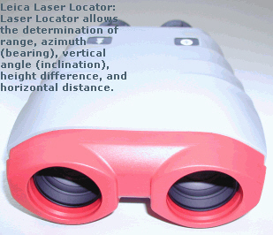
- Look to the ease of feature collection, but be aware of the benefits of advanced features.Support of offset devices such as laser rangefinders, and linear collection abilities such as nesting (the ability to collect a feature inside of a feature), and the mixing of streamed "moving" and noded "vertex" data can enhance both the appearance and efficiency of the data collected.
- Data Management capabilities that allow for the data to be appended or edited in the field, not only save time, but allows for the operator to visually inspect the data as it is collected.
Think outside the box
Don't make the mistake of purchasing
based on features instead of benefits.A color display, sound effects and
a Windows interface can be attractive selling features, but make sure you
understand how that translates into productivity.If you are uneasy with
the purchase, look into leasing or renting a unit to assess its usability
in actual production.
Greg Pendleton is a Licensed Land Surveyor and Product Manager for the GPS/GIS product area of the GIS & Mapping Division of Leica Geosystems, which specializes in creating hardware and software solutions for the acquisition and update of geographic database data via satellite positioning.