This past weekend several efforts came to fruition for me. I gave my very first “lightning talk” at Ignite Spatial: Boston 3, and then I made a presentation at this year’s Teaching and Learning with Technology Symposium (TLT) at Penn State. Perhaps because of the tight time frame, the two events have blended in my mind, yielding these takeaways.
The Right Tool for the Job
In 2011, we have many tools and options to “get the job done.” If you want to share information at a conference, there are different formats available: panels, poster sessions, roundtable discussions at lunch... If you want to teach English or science or geography, there are of all kinds of technologies available; many are low cost or even free. I think there are enough options and tools out there that presenters and educators should get the perfect fit. But, that doesn’t always happen.
I saw my first lightning talk at a Mapserver User Group Meeting, back before it was rebranded as FOSS4G. Schuyler Erle gave the talk, and what I remember is how much energy he packed into the five minutes. I decided that was the key to these bite-sized communication opportunities. Over the years, even though I’ve hoped to see other talks with that much energy and focus, I’ve not found too many. Instead, I’ve seen far too many 20- or 45-minute presentations squeezed into the short period. I’ve also seen demos presented in slide form. And, I’ve seen sales pitches. The reality is, I think, that this five-minute format is not appropriate for everything. In short, it’s not always the right tool for the job. I was reminded of that at Ignite Spatial: Boston 3.
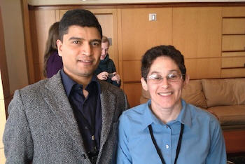
That phrase, “not the right tool for the job,” popped up again at the TLT Symposium at Penn State, in response to a question my colleague, Khusro Kidwai, and I received following our presentation. We had illustrated how we used a cloud technology in my distance learning GIS course, titled “Trends in Geospatial Technology.” The technology, VoiceThread, enables group voice, video and text communications (hosted in the cloud) via a very simple Web interface. A faculty member who teaches English as a second language asked if the service would be valuable for her students to use for voice diaries. Khusro, who has a Ph.D. in instructional systems, was quick to point out that it was possible, but that perhaps there was something more appropriate, a better tool for that job.
 |
The Power of Three
I tapped into some of my students’ interests to put together my Ignite Spatial presentation. In the course, we tackle emerging trends and often the first step is forming a useful definition. What are location-based services? What is a user interface? What is a tablet computer? For the course, we aimed to find accepted, somewhat formal definitions. In our work and daily lives those definitions may not be the most practical or useful. If your supervisor or the CEO asks what cloud computing is, would you use a technical definition as a starting point? Maybe. Or maybe you’d start with something more accessible, something more familiar. I wanted to share those more accessible types of definitions in my lightning talk. In my five minutes I defined three terms in a handy and practical way: NoSQL, cloud computing and certification. Interestingly, they are not terms directly associated with geospatial, but they are (or will be) important in our conversations.
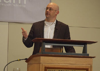
I was very pleased to hear Clay Shirky (bio), in his 45-minute keynote at TLT, arrange his remarks around three dilemmas we are facing in education. These all relate to creating a better educational environment. The first dilemma is the challenge of educating the individual student, even as we focus on group work. The second relates to gaps in participation, which he illustrated by the small number of people who contribute most of the edits to Wikipedia. The same gap frequently exists in a large classroom. How then do we minimize the likelihood of that gap happening? One possible solution involves arranging learning around small groups, “where no one can hide.” The third dilemma he raised highlights the preconceptions about academia and how it’s organized. Why can’t crowdsourced efforts be published in respectable journals or be valued when looking at tenure? Why should the Library of Congress (LOC) keep its images hidden away? What could happen if they appeared on Flickr? One answer came after the LOC uploaded a series of images to the photo sharing site for crowdsourced tagging and use. An image of a fish was added to a scientific database and that same image was even reproduced on a purse! Clearly we need to reexamine our thinking about educational environments as we head into the coming years and decades.
 |
Technology Plays Second Fiddle to a Greater Purpose
While there were many notable presentations at Ignite Spatial: Boston 3 (and I only saw half of them as I had to prep for my trip to Penn State), my favorite was called, “Where Not to Walk in Cambridge: One Citizen Journalist's Journey Through Snow, Bureaucracy and Google Fusion Table Maps,” by Saul Tannenbaum. He used maps and technology to highlight unshoveled sidewalks. Then, after gaining access to data on complaints, he got the city to make the data available, if not on a map, at least in a spreadsheet. What I really liked about this presentation was that the technology really was second fiddle to a bigger idea and goal; it enabled a greater good.
One of the themes of our presentation and several others at TLT was the idea that when at its best, technology enables learning but doesn’t get in the way. My colleague Khurso uses the term “transparency.” The technology (software and hardware) becomes, once the students use it a few times, virtually invisible. I pondered the possibility of such transparency while attending sessions on learning management systems (LMSs), most of which are not thought of as transparent. The question may also apply to the use of the iPads in the classroom (which right now have such a halo about them, it’s hard to imagine them being transparent).
Engagement
Ignite Spatial and other lightning events are popping up at many face-to-face geospatial events to try to engage or maybe re-engage the community. I applaud any effort to invigorate groups, but let’s find a variety of ways to do it and not all focus on the same one. Who will try something new? Or, offer a few different techniques of engagement within a single event?
I met two instructors from Penn State’s Hazelton Campus (Penn State has 19 campuses not including the one at which I teach, The World Campus) at TLT who explained that they were looking for new ways to engage their students. One taught communications, the other, economics, which she admitted was “dry.” Their goal for the day seemed to be to seek out and evaluate possible tools of engagement. Their commitment was clear; they spent an entire Saturday driving to State College and attending the event. I pondered if it was possible to permanently remove full- and half-day “death by Powerpoint” workshops and courses from our geospatial conference agendas. (I might even have some expertise and time to offer now that I’ve completed my service at Penn State and want to take what I’ve learned to new communities.)
Conclusion
I’ll wrap up with something Clay Shirky shared when asked to predict what the classroom of the future will look like. He responded, in part, by commenting on why we bother to predict the future. We do so, he said, not to be proven correct in our forecasting, but rather to remind ourselves that the current situation is changing fast.
Postscript: Geography is Alive and Well
I, along with other members of the geography faculty, attended a session at TLT titled, “Enhancing Geographic and Digital Literacy with a Student-Generated Course Portfolio and 'Amazing Race' in Google Earth.” The earth science course (EARTH 400 Earth Sciences Seminar) is aimed at non-majors and uses Google Earth as a portfolio platform for creating stories around public lands and other topics. Students use personal audio recorders and digital still and video tools to build these portfolios. I thought that was a great use of technology to engage the students, who built several different KMZs with embedded audio and video to explore different topics during the course.
The “Amazing Race” is a Google Earth-based tool to quiz students on the location of states and countries on the globe. The developers had some challenges using the platform since all the boundaries and labels are on a single layer. In the end, they actually used CIA data for the boundaries (which sent a hoot through the attendees, but not the geography faculty in the session). The tool was used twice in the class, once at the beginning of the course and once at the end, and focused on areas studied in class. Scores (percent correct) improved. I suspect the speed of finding the locations in the 3D environment, which was also measured, dropped. I was disappointed to hear the developers, who presented alongside the instructor, state several times how Google Earth is open source (it is not). The instructor noted how one student showed off her Google Earth-based portfolio in an internship interview and how that might not have been possible if the course used commercial software. (Google Earth is commercial software, so far as I know, though it is free to use for many purposes.)