The tornado that hit Greensburg, Kansas on May 5th has been rated a "5" on the Enhanced Fujita scale.The devastation is hard to imagine from news reports until you see pictures of the tornado that was estimated to be two miles (see doppler radar imagery) in width by NOAA's National Weather Service and essentially reduced the entire town to ruble.
MJ Harden, a GeoEye company, captured the following aerial images on May 12th at various resolutions.
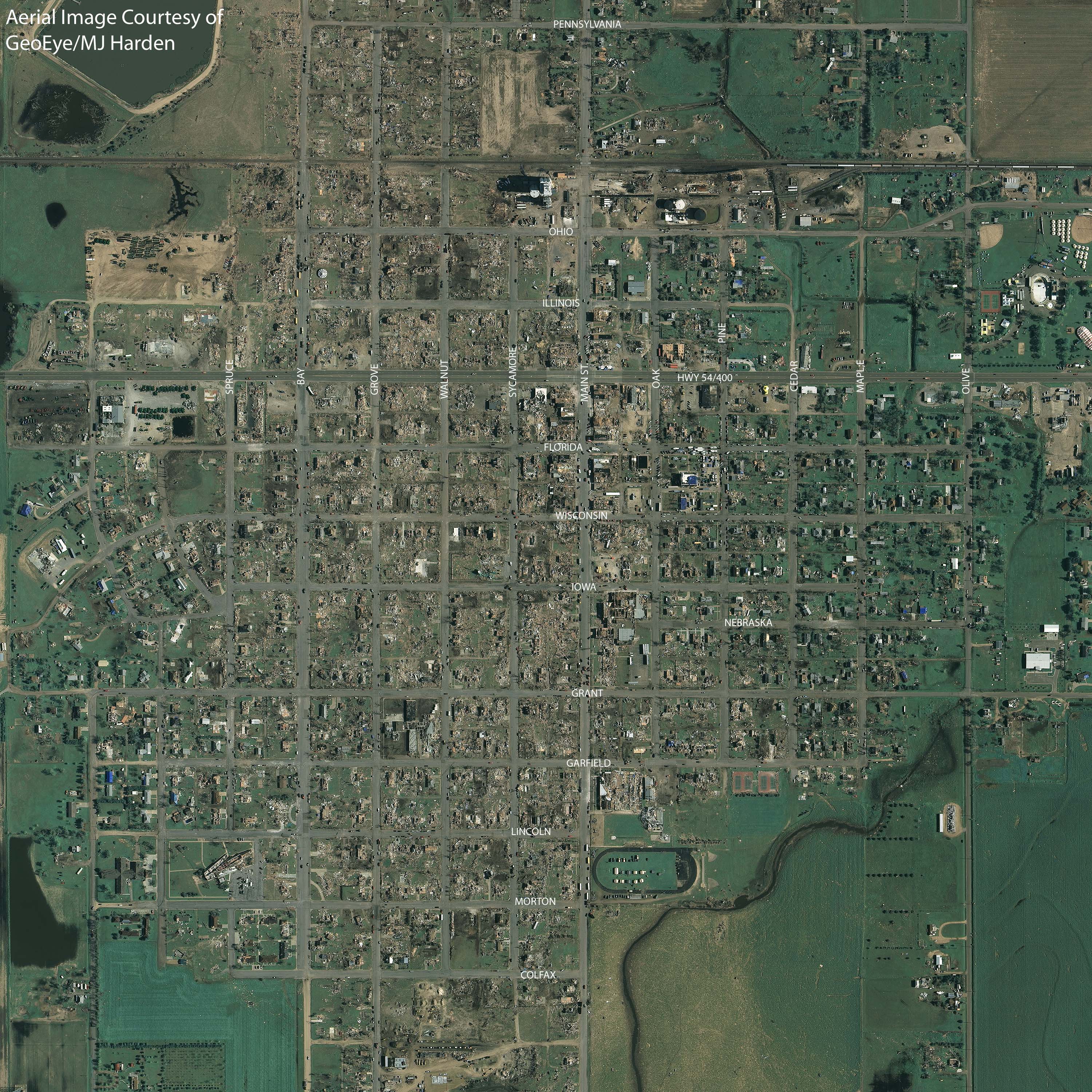
Two feet (Click on image to see full resolution)
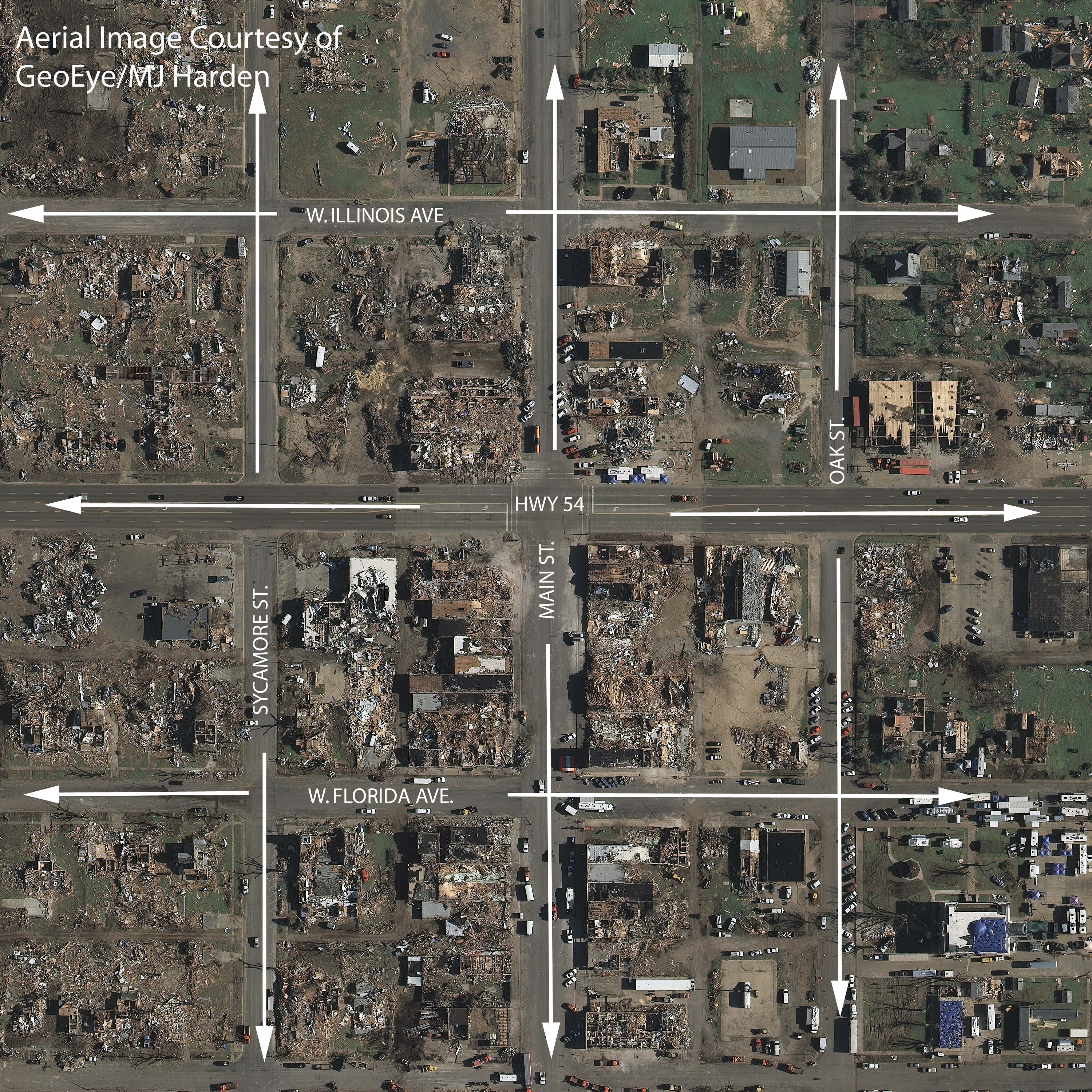
Six inches (Click on image to see full resolution)
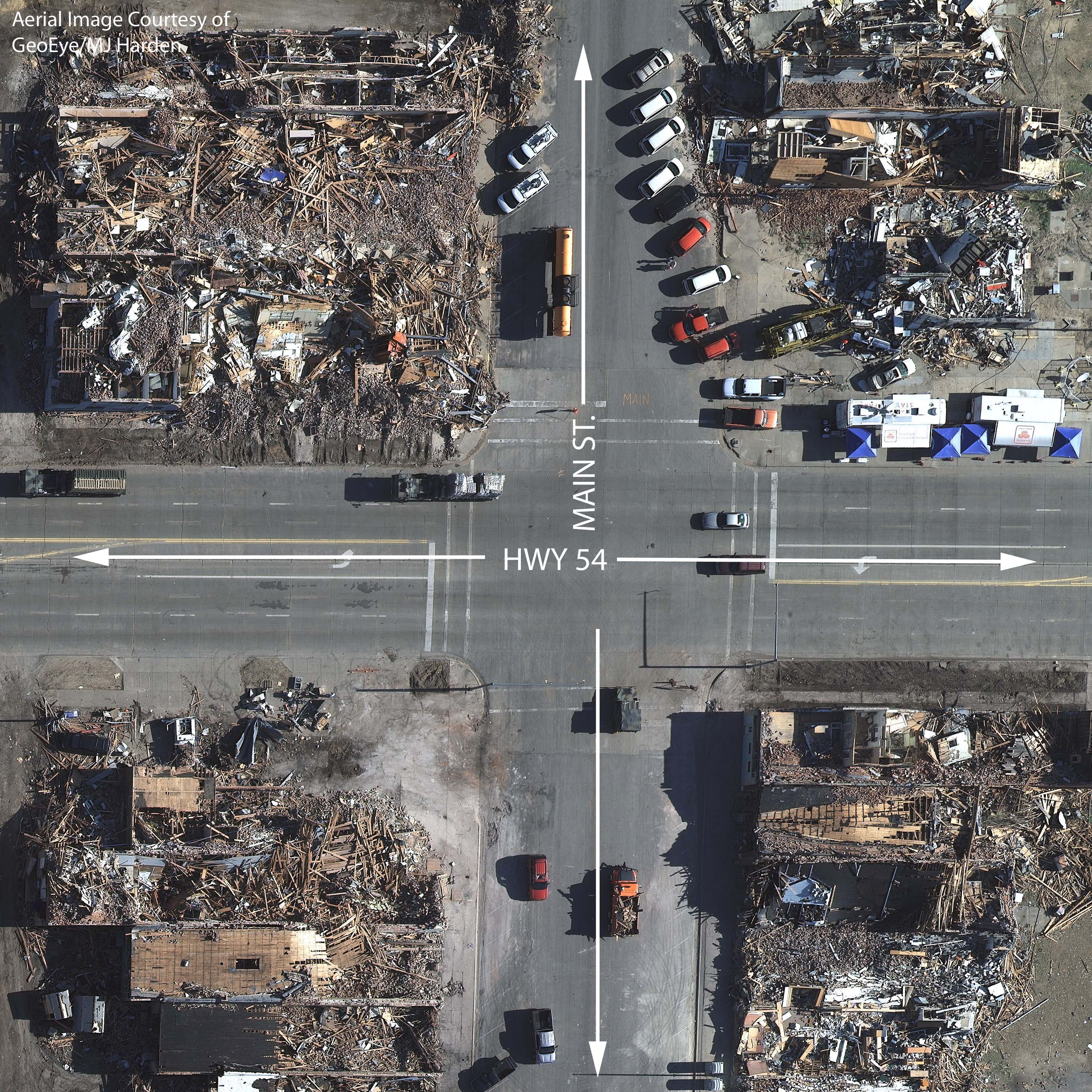
Tenth foot (Click on image to see full resolution)
Photos courtesy of GeoEye/MJ Harden
From Our Homepage
Saying Farewell to an Amazing Journey
Communicating with Maps
Is There a GIS Career Ladder?
What does it mean to be geospatially smart? Series
Ways Real Estate and Property Developers Utilize Melissa GeoData for Data-Driven Decisions
Unlocking Value From Daily Satellite Imagery and Insights
Maximizing the Value of Your Address Data with Geo Addressing
How Indoor Mapping Enhances the Security of Smart Buildings
Look Ahead: AI, Location Intelligence and Efficiency
Collaboration Takes on Sea Level Rise & Dynamic Technology Environments
Brownies for Brownfields
Has Everything Been Mapped Already?
How Is Data Literacy Changing in an Artificial Intelligence Landscape
Portfolios for GIS Professionals: More Than Just Maps
How to Create a Distance Matrix in QGIS - A Step-by-Step Guide
7 Ideas for Bringing GIS into the K-12 Classroom
The Geography of Movement