My
mom was a librarian. She explicitly told me that if I thought there
should be a book about something, there probably was. I proved that to
myself in my final year of high school. I explained to the reference
librarian at the Winchester Public Library that there should be a book
with all the words of Shakespeare that listed in what plays they were
used. She laughed and showed me the concordance of Shakespeare and
similar tomes for the Bible and the stories of Star Trek.
That experience prompts me to tell today's "younger generation" that if they think there should be a Web application for something, there probably is. Mostly, of course, I'm thinking about apps related to mapping. My experience is that many of these do in fact exist. I don't think much about why that's true, but I suspect it's a mix of available free APIs, datasets and the developer's passion for the subject or a hope of making a profit (someday).
My favorite tech gurus on C|net's Buzz Out Loud podcast made quite a bit of fun of a recent announcement of an app store for netbooks. They chided: "They have a store for that, it's called the Internet" and reminded listeners that "before these apps were called apps, they were known as applications." I do see their point, but I'd argue "app" means something different than "application." What is it that differentiates the 2009 "app" from the 2005 (and earlier) "application"? For one, apps are written for lightweight OSs or browsers. For two, apps are different than widgets, those small applications meant to be embedded on web pages or blogs or on your TV screen. Finally, the term "app" suggests a quick install, single focus, no or low fee (compared with an application), and ease of use.
What, then, does this plethora of apps on the Web and mobile platforms like the Blackberry OS, iPhone OS, Android and others mean for traditional packaged software? I think it's another factor pushing generic horizontal desktop and Web mapping/GIS out of widespread use. When I started in this business in 1989 my then boss explained that for most computer users in our space (we were building ArcCAD) AutoCAD was their "operating system." They lived in it 40 hours a week and never really "got out of it." Some used it out of the box, but many more used third-party applications to tune it for civil engineering, architecture or perhaps, mapping. In the intervening years the core CAD software providers (I'm thinking of Autodesk and Bentley in particular) bought up the leading third-party players and encouraged users to leave generic CAD behind and step up to a vertical application. That's pushed many small, independent third-party developers out of business.
Compare that history with the explosion of third-party apps (free and fee-based) now available for consumers and business people who at one time lived in specialized desktop software and data (perhaps these were their operating system?). Here are a few I've written about just this year that offer B2B/B2C "apps for that."
Want some core data to market your small business? There's an app for that.
Growing Jobs in Small Businesses: Bringing Business Analyst Online to the Little Guy
Do you own a landscaping business that needs a quick way to make estimates? There's an app for that.
Go iLawn: Geospatial SaaS for Lawn and Landscape Companies
Need iPhone access to the geology of California? There's an app for that.
GIS iPhone app
While we are not yet to a point where there's an app for all the possible B2B GIS opportunities, I think we are heading that way. The idea of starting from scratch with a generic desktop or Web mapping app is less and less attractive, especially as these services (and the underlying developer-friendly tools) begin to make a name for themselves. That's happening even as many public datasets are available to developers.
 Just
as generic desktop GIS is lessening its grip on users, so too are
generic Web mapping sites. While many still go to Google Maps or
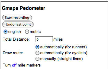
MapQuest to get directions or find a hotel or bar, specialized,
vertical apps are gaining traction and buzz: these are the foursquares, Yelps, or in my case GMapsPedometers
for laying out running routes. Having said that, Google is working hard
to make Google Maps serve more and more users by adding real estate
listing searches and other layers. Still, it's those vertical types of
consumer apps, I'd argue, that professionals will expect in their work
environments.
Just
as generic desktop GIS is lessening its grip on users, so too are
generic Web mapping sites. While many still go to Google Maps or
MapQuest to get directions or find a hotel or bar, specialized,
vertical apps are gaining traction and buzz: these are the foursquares, Yelps, or in my case GMapsPedometers
for laying out running routes. Having said that, Google is working hard
to make Google Maps serve more and more users by adding real estate
listing searches and other layers. Still, it's those vertical types of
consumer apps, I'd argue, that professionals will expect in their work
environments.
I know I'd like ready-to-use, relatively inexpensive (or free) apps, with data already ingested, that I can "tap into" for work, just as I would for my personal life. Is it realistic to think that's possible? Can we have "GIS apps stores" for electric, gas, local government, forestry and other professional areas that use GIS? It's hard to say at this point, as there are some definite challenges.
Consumer facing applications can tolerate "good enough" data. If the street data are a bit off, it's not a life or death issue. If the restaurant review is the average of those from all who visited, that's "good enough." Professional apps (say, for surveyors or engineers) demand high data standards, clear data sourcing and in some cases, authoritative signatures. Those are all possible to gather and make available on the Web or a mobile phone app, but they are more expensive to collect and maintain than data out of Wikipedia. Would such requirements price the professional apps out of reach?
Consumer facing apps can offer limited functionality and serve up a "one size fits all" interface. Business workflows need to be more tailored and broader ranging. Could that requirement take away the "quick and easy and immediately useful" feel of most popular Web and phone apps?
I can't say exactly what may come down the line as "professional apps" for geospatial. But I do expect more than one organization to test the waters in the coming weeks and months.
That experience prompts me to tell today's "younger generation" that if they think there should be a Web application for something, there probably is. Mostly, of course, I'm thinking about apps related to mapping. My experience is that many of these do in fact exist. I don't think much about why that's true, but I suspect it's a mix of available free APIs, datasets and the developer's passion for the subject or a hope of making a profit (someday).
My favorite tech gurus on C|net's Buzz Out Loud podcast made quite a bit of fun of a recent announcement of an app store for netbooks. They chided: "They have a store for that, it's called the Internet" and reminded listeners that "before these apps were called apps, they were known as applications." I do see their point, but I'd argue "app" means something different than "application." What is it that differentiates the 2009 "app" from the 2005 (and earlier) "application"? For one, apps are written for lightweight OSs or browsers. For two, apps are different than widgets, those small applications meant to be embedded on web pages or blogs or on your TV screen. Finally, the term "app" suggests a quick install, single focus, no or low fee (compared with an application), and ease of use.
What, then, does this plethora of apps on the Web and mobile platforms like the Blackberry OS, iPhone OS, Android and others mean for traditional packaged software? I think it's another factor pushing generic horizontal desktop and Web mapping/GIS out of widespread use. When I started in this business in 1989 my then boss explained that for most computer users in our space (we were building ArcCAD) AutoCAD was their "operating system." They lived in it 40 hours a week and never really "got out of it." Some used it out of the box, but many more used third-party applications to tune it for civil engineering, architecture or perhaps, mapping. In the intervening years the core CAD software providers (I'm thinking of Autodesk and Bentley in particular) bought up the leading third-party players and encouraged users to leave generic CAD behind and step up to a vertical application. That's pushed many small, independent third-party developers out of business.
Compare that history with the explosion of third-party apps (free and fee-based) now available for consumers and business people who at one time lived in specialized desktop software and data (perhaps these were their operating system?). Here are a few I've written about just this year that offer B2B/B2C "apps for that."
Want some core data to market your small business? There's an app for that.
Growing Jobs in Small Businesses: Bringing Business Analyst Online to the Little Guy
Do you own a landscaping business that needs a quick way to make estimates? There's an app for that.
Go iLawn: Geospatial SaaS for Lawn and Landscape Companies
Need iPhone access to the geology of California? There's an app for that.
GIS iPhone app
While we are not yet to a point where there's an app for all the possible B2B GIS opportunities, I think we are heading that way. The idea of starting from scratch with a generic desktop or Web mapping app is less and less attractive, especially as these services (and the underlying developer-friendly tools) begin to make a name for themselves. That's happening even as many public datasets are available to developers.
Just
as generic desktop GIS is lessening its grip on users, so too are
generic Web mapping sites. While many still go to Google Maps or
MapQuest to get directions or find a hotel or bar, specialized,
vertical apps are gaining traction and buzz: these are the foursquares, Yelps, or in my case GMapsPedometers
for laying out running routes. Having said that, Google is working hard
to make Google Maps serve more and more users by adding real estate
listing searches and other layers. Still, it's those vertical types of
consumer apps, I'd argue, that professionals will expect in their work
environments.I know I'd like ready-to-use, relatively inexpensive (or free) apps, with data already ingested, that I can "tap into" for work, just as I would for my personal life. Is it realistic to think that's possible? Can we have "GIS apps stores" for electric, gas, local government, forestry and other professional areas that use GIS? It's hard to say at this point, as there are some definite challenges.
Consumer facing applications can tolerate "good enough" data. If the street data are a bit off, it's not a life or death issue. If the restaurant review is the average of those from all who visited, that's "good enough." Professional apps (say, for surveyors or engineers) demand high data standards, clear data sourcing and in some cases, authoritative signatures. Those are all possible to gather and make available on the Web or a mobile phone app, but they are more expensive to collect and maintain than data out of Wikipedia. Would such requirements price the professional apps out of reach?
Consumer facing apps can offer limited functionality and serve up a "one size fits all" interface. Business workflows need to be more tailored and broader ranging. Could that requirement take away the "quick and easy and immediately useful" feel of most popular Web and phone apps?
I can't say exactly what may come down the line as "professional apps" for geospatial. But I do expect more than one organization to test the waters in the coming weeks and months.
From Our Homepage
Saying Farewell to an Amazing Journey
Communicating with Maps
Is There a GIS Career Ladder?
What does it mean to be geospatially smart? Series
Ways Real Estate and Property Developers Utilize Melissa GeoData for Data-Driven Decisions
Unlocking Value From Daily Satellite Imagery and Insights
Maximizing the Value of Your Address Data with Geo Addressing
How Indoor Mapping Enhances the Security of Smart Buildings
Look Ahead: AI, Location Intelligence and Efficiency
Collaboration Takes on Sea Level Rise & Dynamic Technology Environments
Brownies for Brownfields
Has Everything Been Mapped Already?
How Is Data Literacy Changing in an Artificial Intelligence Landscape
Portfolios for GIS Professionals: More Than Just Maps
How to Create a Distance Matrix in QGIS - A Step-by-Step Guide
7 Ideas for Bringing GIS into the K-12 Classroom
The Geography of Movement