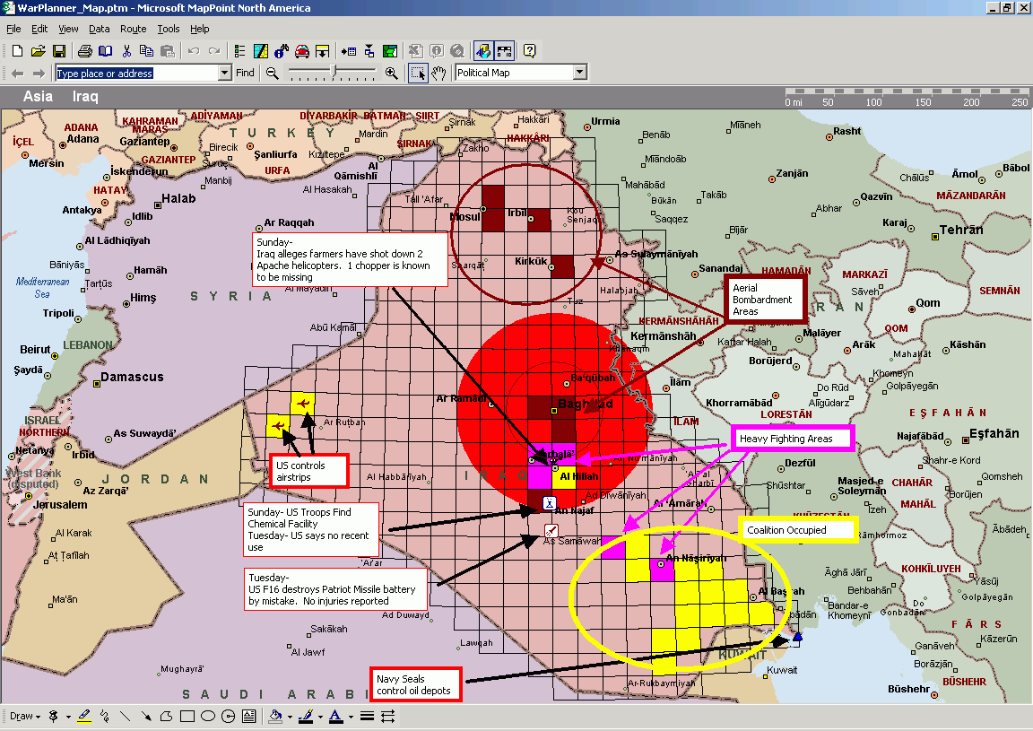
Maps from the Iraqi War Theater
Click for larger Image
Click for larger Image
The maroon grids are areas that are receiving aerial bombardment, Red
is heavy fighting areas, and Yellow is areas taken over, but still some
skirmishes.The blue pushpins in the lower right are oil platforms under
the control of Navy Seals.Most of the scattered blocks in the west and
north are Iraqi bases, the west is air bases under Coalition control, the
north is ground bases being bombed.
Directions Magazine obtained the first publicly available
satellite images of the Iraqi war theater.
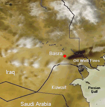
The image above was taken by ORBIMAGE's OrbView-2 "SeaWiFS" satellite
at 1 km resolution on Friday, March 21st.this image clearly shows thick
black smoke from burning oil well fires near Basra in Southern Iraq.
Directions will continue to update this page as more imagery and maps
become available.
Images courtesy of ORBIMAGE