De Beers, the worlds largest diamond supplier, has an eye on an enterprisewide GIS.De Beers' multifaceted business entails global operations in exploration and mining, including marine mining sales and marketing.The company has assets on six continents and employs 22,000 people.During the 1990's, management put in place a five-year plan reflecting its need for "improving operational efficiency and effectiveness" starting in the latter part of the decade.
GIS at De Beers
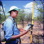
De Beers has employed GIS for over twelve years where it functions
primarily in their exploration division.The first installation of GIS
was in their exploration group where it now has over 200 users and has
expanded to De Beers Marine.Group Exploration now has over 200 users with
additional users in other divisions like De Beers Marine and Mining, and
Mineral Resources Management.Group Exploration is in the process of standardizing
its operational systems, including prospecting, laboratories and document
management system.GIS will be directly linked to the Prospecting Information
System and will play an important role in the integration.
To manage the process, De Beers has enlisted the help of a local consulting
company, GIMS (Pty.) Limited in South Africa, and has signed a Multi National
Enterprise (MNE) agreement.As major contractor on the project, GIMS will
have responsibility for the ESRI products of an enterprisewide spatial
database that will employ Microsoft SQL Server.One of the main goals of
the project will ensure that all ventures in De Beers Group Exploration
will have the same spatial database structure, in order to facilitate information
sharing and access to spatial data.
Technical Clarity
The foundation of the spatial database will use ESRI's ArcSDE to manage
spatial data dissemination.The enterprise application being designed for
initial implementation is the Prospecting Information Management System
which will be responsible for providing prospecting information trough
and generating a Personal Geodatabase for field usage and analysis.This
Geodatabase will send and receive data in a secure and automated way.In
addition, it will provide some additional functionality such as Spatial
Audit Trails and Access Control, according to De Beers.
 De
Beers intends to standardize spatial applications on ESRI technology.According
to Marcelo Braghin of De Beers, "De Beers Group Exploration not only has standards
in the technology, using ArcGIS, ArcSDE and ArcIMS we are also developing
standards for symbology, metadata and the geodatabase schema.At the moment,
we are developing specific applications to integrate the spatial data and
prospecting data to the field operations.These applications will be used
in all countries in which our Group Exploration is working, currently on
five continents." Mr.Braghin continued by saying that, "De Beers Group
Exploration will use SQL Server; De Beers Brazil has already installed
ArcSDE/SQLServer and put in production; De Beers Canada Exploration is
quite close to finalizing the conversion."
De
Beers intends to standardize spatial applications on ESRI technology.According
to Marcelo Braghin of De Beers, "De Beers Group Exploration not only has standards
in the technology, using ArcGIS, ArcSDE and ArcIMS we are also developing
standards for symbology, metadata and the geodatabase schema.At the moment,
we are developing specific applications to integrate the spatial data and
prospecting data to the field operations.These applications will be used
in all countries in which our Group Exploration is working, currently on
five continents." Mr.Braghin continued by saying that, "De Beers Group
Exploration will use SQL Server; De Beers Brazil has already installed
ArcSDE/SQLServer and put in production; De Beers Canada Exploration is
quite close to finalizing the conversion."
De Beers Marine also uses GIS where they are deploying ArcPAD, ArcIMS and ArcSDE to manage the production of the vessels on line.
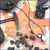
Diamond Hunters
According to Bill McKecnnie, Global Exploration Manager, diamond prospecting
takes a long-term commitment."The company's projects cover the full exploration
'pipeline' i.e.early stage exploration which includes desktop appraisal
of potentially prospective areas and grassroots reconnaissance work to
discover new kimberlites as well as advanced exploration projects to establish
the economic viability of diamondiferous kimberlites.Acquisitions and
joint ventures, where appropriate, complement De Beers' own exploration
efforts.