Source
code for ECW JPEG 2000 SDK released by ER Mapper
While others in IT are open sourcing patents and code (Sun and IBM among them), this is a new idea in the geospatial industry for commercial product vendors to turn code open source.The only situation I can think of off the top of my head is Autodesk's release of DWF code, though that's not specifically a geospatial code base.I was surprised when Joe Francica called for Intergraph to open source GeoMedia, but perhaps he was just ahead of his time? In any case, Earth Resource Mapping (ERM) has done so.I asked ERM president Stuart Nixon to explain the logic.
"Our recent source code release for the ECW JPEG 2000 Software Development Kit (SDK) is a natural progression of our commitment to the industry.
"Imagery has become an essential part of geospatial desktop, Web and enterprise solutions.Geospatial images are very large - TB (1,000GB) images are now common - so it is essential that all users have easy access to imagery.
"Releasing our source code under simple licensing agreements enables unified and standard access to imagery.This is especially important to help nurture the new ISO JPEG 2000 standard.ER Mapper strongly endorses both the new JPEG 2000 standard and our popular ECW format.
"Perhaps more importantly, releasing the source code for our SDK signals - in the strongest possible way - our commitment to wide spread industry imagery use.
"ER Mapper continues to expand support for the Open Source community, through funding support for important Geospatial Open Source projects as well as planned release of more source code."
Those interesting in the SDK should read the license with care; it's a GNU Public License-like license, which allows its use in open source products.Commercial vendors can use one of two other licensing options (one is free).And, do be aware, there are other JPG 2000 open source libraries out there include Frank Warmerdam's and OpenJPEG.
Yahoo Sends Directions to Phones; Google Offers New Toolbar
While it's not exactly getting real time directions or even getting navigation information while you are on the road, if you plan ahead you can take Yahoo directions with you.The idea is simple: (1) use Yahoo! Maps on your computer to create a set of directions, (2) click the "send to mobile phone" link on the screen (3) fill out phone number.I suppose there are going to be quite a number of these sorts of "free" solutions that will compete with actual navigation services and in-car offerings.It'll be interesting to see how they fare.My gut feeling is that while this is nice, it requires too much planning ahead for most of us!
Google's Toolbar (of which I've been a fan for years) has been updated. ToolBar 3.0 Beta includes tools for translating foreign words and spell checking input to web forms.Also, it includes AutoLink, a tool that searches for text on a page that it can make more valuable with a link.

For example, an ISBN number will link to information about a book, a Fedex Tracking number will link to its information.For geospatial folks, it will turn a US address into a link to, that's right, Google Maps.It's basically passing information to Google Maps, but avoiding the extra pasting step is nice.Interestingly, it works only on full US street addresses, so just Somerville is not linked but 100 Main St, Somerville MA, is.Also interesting, Google Local results still send users to MapQuest for maps and directions.Anything Autolinked goes to Google Maps.

Maps.com Introduces the Industry's First Unlimited Location Mapping Service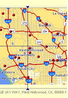
What, I though could that possibly mean? What is means is that a new service offer multipoint geocoding (right) and tackles the "traveling salesman problem." It's not free and as a higher end offering, it should not be.Users can make up to 18 stops and track up to 8 routes for traffic problems (in 69 metro areas).Updated routes to avoid traffic can be sent via e-mail.There are weekly, monthly and annual rates.Online mapping services are getting more sophisticated!
USGIF Looking for Accreditation Panel (pdf)
While no press release was issued, I thought this news needed a bit more exposure.The USGIF Geospatial Intelligence Academy develops and promotes curriculum guidelines and a voluntary accreditation process by which educational institutions demonstrate the effectiveness of their courses and programs in helping students achieve recommended learning objectives.The Academy confers the USGIF's seal upon courses and certificate programs that fulfill the Academy's accreditation standards.Those who wish to participate on an accreditation panel are invited to submit an application by March 1.(The original deadline was January 10.)
Remote Sensing Technologies at DEMO
DEMO, which to the best of my knowledge does not stand for anything, is an innovation show where but 73 companies were given the privilege of showing off their new technology.Two are spatial and worth note. Pacific Northwest National Laboratory and the Department of Energy developed technology to detect nonmetallic weapons.The scanning technology is now being used to scan people, creating 200,000 point models, so that Macy's and Lane Bryant can better fit their clothing needs.NASA's Mars Rover project gave rise to an imaging tool from Canada-based MDA called Instant Scene Modeler.By taking hundreds of photos of say a crime scene, the system builds, in seconds not minutes, a three-dimensional model, complete with measurements.I've never been to DEMO but I love the idea that presenters each have but six minutes to tell their story!
New ESRI Live Training Seminar Delves Into ArcIMS Capabilities
ESRI Launches Developer Network Program
ESRI is looking more and more like Microsoft these days.And, I don't mean that in a negative way, rather in a customer service sort of way. ESRI is offering more and more educational tools via the Web including an array of free live intro sessions such as Introduction to ArcIMS. While aimed at existing users, this sort of presentation is also a marketing tool for potential buyers.For the developer community, this week saw the official announcement of ESRI's EDN, its developer network build along the same lines as Microsoft's.
While others in IT are open sourcing patents and code (Sun and IBM among them), this is a new idea in the geospatial industry for commercial product vendors to turn code open source.The only situation I can think of off the top of my head is Autodesk's release of DWF code, though that's not specifically a geospatial code base.I was surprised when Joe Francica called for Intergraph to open source GeoMedia, but perhaps he was just ahead of his time? In any case, Earth Resource Mapping (ERM) has done so.I asked ERM president Stuart Nixon to explain the logic.
"Our recent source code release for the ECW JPEG 2000 Software Development Kit (SDK) is a natural progression of our commitment to the industry.
"Imagery has become an essential part of geospatial desktop, Web and enterprise solutions.Geospatial images are very large - TB (1,000GB) images are now common - so it is essential that all users have easy access to imagery.
"Releasing our source code under simple licensing agreements enables unified and standard access to imagery.This is especially important to help nurture the new ISO JPEG 2000 standard.ER Mapper strongly endorses both the new JPEG 2000 standard and our popular ECW format.
"Perhaps more importantly, releasing the source code for our SDK signals - in the strongest possible way - our commitment to wide spread industry imagery use.
"ER Mapper continues to expand support for the Open Source community, through funding support for important Geospatial Open Source projects as well as planned release of more source code."
Those interesting in the SDK should read the license with care; it's a GNU Public License-like license, which allows its use in open source products.Commercial vendors can use one of two other licensing options (one is free).And, do be aware, there are other JPG 2000 open source libraries out there include Frank Warmerdam's and OpenJPEG.
Yahoo Sends Directions to Phones; Google Offers New Toolbar
While it's not exactly getting real time directions or even getting navigation information while you are on the road, if you plan ahead you can take Yahoo directions with you.The idea is simple: (1) use Yahoo! Maps on your computer to create a set of directions, (2) click the "send to mobile phone" link on the screen (3) fill out phone number.I suppose there are going to be quite a number of these sorts of "free" solutions that will compete with actual navigation services and in-car offerings.It'll be interesting to see how they fare.My gut feeling is that while this is nice, it requires too much planning ahead for most of us!
Google's Toolbar (of which I've been a fan for years) has been updated. ToolBar 3.0 Beta includes tools for translating foreign words and spell checking input to web forms.Also, it includes AutoLink, a tool that searches for text on a page that it can make more valuable with a link.
For example, an ISBN number will link to information about a book, a Fedex Tracking number will link to its information.For geospatial folks, it will turn a US address into a link to, that's right, Google Maps.It's basically passing information to Google Maps, but avoiding the extra pasting step is nice.Interestingly, it works only on full US street addresses, so just Somerville is not linked but 100 Main St, Somerville MA, is.Also interesting, Google Local results still send users to MapQuest for maps and directions.Anything Autolinked goes to Google Maps.
Maps.com Introduces the Industry's First Unlimited Location Mapping Service
What, I though could that possibly mean? What is means is that a new service offer multipoint geocoding (right) and tackles the "traveling salesman problem." It's not free and as a higher end offering, it should not be.Users can make up to 18 stops and track up to 8 routes for traffic problems (in 69 metro areas).Updated routes to avoid traffic can be sent via e-mail.There are weekly, monthly and annual rates.Online mapping services are getting more sophisticated!
USGIF Looking for Accreditation Panel (pdf)
While no press release was issued, I thought this news needed a bit more exposure.The USGIF Geospatial Intelligence Academy develops and promotes curriculum guidelines and a voluntary accreditation process by which educational institutions demonstrate the effectiveness of their courses and programs in helping students achieve recommended learning objectives.The Academy confers the USGIF's seal upon courses and certificate programs that fulfill the Academy's accreditation standards.Those who wish to participate on an accreditation panel are invited to submit an application by March 1.(The original deadline was January 10.)
Remote Sensing Technologies at DEMO
DEMO, which to the best of my knowledge does not stand for anything, is an innovation show where but 73 companies were given the privilege of showing off their new technology.Two are spatial and worth note. Pacific Northwest National Laboratory and the Department of Energy developed technology to detect nonmetallic weapons.The scanning technology is now being used to scan people, creating 200,000 point models, so that Macy's and Lane Bryant can better fit their clothing needs.NASA's Mars Rover project gave rise to an imaging tool from Canada-based MDA called Instant Scene Modeler.By taking hundreds of photos of say a crime scene, the system builds, in seconds not minutes, a three-dimensional model, complete with measurements.I've never been to DEMO but I love the idea that presenters each have but six minutes to tell their story!
New ESRI Live Training Seminar Delves Into ArcIMS Capabilities
ESRI Launches Developer Network Program
ESRI is looking more and more like Microsoft these days.And, I don't mean that in a negative way, rather in a customer service sort of way. ESRI is offering more and more educational tools via the Web including an array of free live intro sessions such as Introduction to ArcIMS. While aimed at existing users, this sort of presentation is also a marketing tool for potential buyers.For the developer community, this week saw the official announcement of ESRI's EDN, its developer network build along the same lines as Microsoft's.
From Our Homepage
Saying Farewell to an Amazing Journey
Communicating with Maps
Is There a GIS Career Ladder?
What does it mean to be geospatially smart? Series
Ways Real Estate and Property Developers Utilize Melissa GeoData for Data-Driven Decisions
Unlocking Value From Daily Satellite Imagery and Insights
Maximizing the Value of Your Address Data with Geo Addressing
How Indoor Mapping Enhances the Security of Smart Buildings
Look Ahead: AI, Location Intelligence and Efficiency
Collaboration Takes on Sea Level Rise & Dynamic Technology Environments
Brownies for Brownfields
Has Everything Been Mapped Already?
How Is Data Literacy Changing in an Artificial Intelligence Landscape
Portfolios for GIS Professionals: More Than Just Maps
How to Create a Distance Matrix in QGIS - A Step-by-Step Guide
7 Ideas for Bringing GIS into the K-12 Classroom
The Geography of Movement