Directions Magazine (DM): Tele Atlas Kalyani India is the first company to receive approval to distribute digital data of India under the new National Map Policy. Does that mean that until now, shared digital data were basically "not legal"?
 |
Arnout Desmet (AD): First, let me start by saying that we are excited to be making this announcement and to collaborate with the Survey of India to meet the growing market demand for navigation, map and location-based services and technologies. Tele Atlas Kalyani India is indeed the first mapping company to sign a Value-Added Reseller Agreement with the Survey of India, authorizing us to incorporate the topographic maps and other map materials of the Survey of India in our products. We add value to these maps by combining them with additional content such as advanced navigable attributes and enhanced display features, as well as landmarks and address information, thus enabling the most demanding navigation applications and location-based services. We are aware that the topographic maps of the Survey of India are used by several other mapping companies as a basis for their products without such a legal agreement in place.
In order to address the security concerns of the Republic of India, the Survey of India is also responsible for overseeing the distribution of maps in the public domain to ensure territorial integrity and avoid display of sensitive places in map representation. The current release of navigable maps created by Tele Atlas Kalyani India is the first ever to be screened and approved for public release by the SOI, in full compliance with the regulations of the government of India and the provisions of the National Mapping Policy.
DM: What process did Tele Atlas' digital data go through to gain the Survey of India's approval for distribution? Did anything in the data need to be changed?
AD: This was a stepwise process where the digital data were provided in a readable form to the Survey of India for detailed screening. Indeed, some modifications were requested but we were glad to note that this entire process could be completed within a reasonable period of time, thanks to the good cooperation between the Survey of India and Tele Atlas Kalyani India.
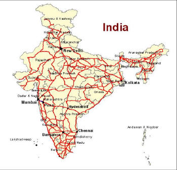
DM: The first offering of data for India includes all major metropolitan areas and full coverage of the national and state highway networks of India, with more data to come including points of interest (POIs). Is the data collection process for India different from that in the U.S. and Europe?
AD: In order to be successful in India, Tele Atlas is committed to working with our industry partners to help localize applications, products, solutions and services to the Indian context, in order to address the specifics of the country's unique road network and road user behavior. Our digital map offering for India leverages innovative map production technology and approaches that fulfill these complex requirements. Our products will help ensure that our partners can meet the rising market demand for navigation, map and location-based services and technologies, which at their core all rely on the coverage of their maps for success.
As you know, Tele Atlas' process for building and maintaining the digital map database is pretty complicated and involves updating a database that contains 17 million miles of roads around the world. Because road information can change 10-15% every year, and even more in busy urban areas, this is a constant process. In fact, Tele Atlas works to collect a vast range of information, including millions of POIs, 3D landmarks, traffic alert information, street and building signage, lane information, precise address locations, road slope and curvature measurements, and much more. Tele Atlas has been creating and updating digital maps for more than 20 years, and has a tried and true system to detect just where changes are, and where they're planned. The company gathers and validates changes, and updates its maps every day. In India, we leverage this process, as well – from coordinating with local and national organizations to leveraging available satellite imagery and secondary source materials. However, in the case of India, we are building the database, complete with road network details and city center information, and we still rely heavily on in-field capturing methods as well. We do mobilize very substantial field surveys to collect road network data, landmark data and address information to ensure that our data are the freshest and most complete for all our coverage areas. This field data collection work has its own challenges from a logistical and organizational point of view in the India context. We did, for example, adapt our local modes of transport, such as the "three-wheeler," and also use other field survey equipment adapted to the Indian context.
 |
DM: Are there any other countries where "state approval" is required in order to be in compliance with the law?
AD: Yes, there are other countries, for example China and Russia, where state approval is required.
DM: Which arena is likely to be most active in the Indian marketplace: mobile, Internet, automotive, personal navigation system or enterprise markets? Why?
AD: As India is the fastest growing mobile market worldwide, it is obvious that the mobile market is expected to be the most important market for Tele Atlas in India in the mid- to long-term. However, we do also expect the automotive and PND markets to be quite substantial, provided that the solutions are localized and offered at the appropriate price points. Considering the sheer size of the Indian subcontinent and the challenges for logistics companies, we do see a very bright future, as well, for adapted and localized fleet management and asset tracking solutions. In the enterprise market, geospatial solutions for urban planning, utility management and geomarketing will also have substantial potential.