There is no question that the world is agog over Google
Maps. Programmers and users laud the application programming interface
(API), the speed, the intuitive interface, the extensive data and more.
But for many, all of these goodies are unavailable due to Google's
licensing. Currently, if you want to use Google Maps in an intranet
environment, you are out of luck. If you need more than a limited
number of transactions, you are out of luck. If you need to have the
app branded with your, and not Google's name, you are out of luck. If
you don't want to see ads on your maps, you are out of luck. If you
need support beyond the basic documents and a bulleting board, you are
out of luck.
Enter Placebase and its Pushpin LE and Pushpin CX services.
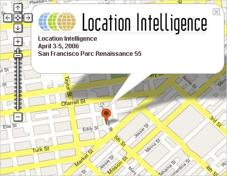
The hosted
systems, to be launched next week at the Location
Intelligence
Conference in San Francisco, offer a Google Maps-like API and
interface
and limited but growing data offerings, without restriction. The
Pushpin LE service goes beyond Google's offering by providing access to
helpdesk support and a geocoding API, things Google does not yet offer.
Pushpin CX offers LE's tools plus the ability to add custom data sets,
control things like road symbolization, create thematic maps and more.
At rollout, Placebase will offer Pushpin LE with TIGER data for a starting price of $1,600 for 150,000 transactions/month; enhanced data from NAVTEQ cost a bit more. Imagery and other datasets are on tap for future releases, along with enhanced functionality, as demanded by customers. The data, in pre-rendered tiles, are held in PlaceBase's server farm. The raw data are stored in shape files, ArcSDE or PostGIS environments.
I asked Jaron Waldman, CEO of Placebase, how close the Pushpin LE API is to Google Maps’. "They are not exactly the same, but a few tweaks of an existing application will have it up and running on Pushpin LE in a very short time." That plays into one segment of the market Placebase seeks to serve: those who have built "hobbyist" sorts of applications that they want to offer for commercial use. The other early adopter group is likely to be corporate users who want intranet applications with the look and feel of Google Maps, their own corporate branding and no distracting advertising. It’s worth noting that this week Google is again testing ads on Google Local, leading many to speculate that such ads are coming to the Google Maps API very soon. Google has from the start reserved the right to add advertisement to its mapping environment at any point.
Placebase may be new to many who work in the geospatial arena, but the company is not new to Web mapping. The consulting organization traces its roots in Web mapping back to 2001, when it first worked on integrating mapping into its clients' websites. Placebase learned quite a lot from its work with the Fannie Mae Foundation, on DataPlace, which I lauded when I first saw it last year. "At some point," says Waldman, "that sort of advanced functionality will be in the API of Pushpin."
Placebase is offering a unique set of services. The challenge it faces is in keeping up with high expectations that Google Maps has set regarding data availability, data updates, uptime and ease of use for both developers and end-users.
 |
At rollout, Placebase will offer Pushpin LE with TIGER data for a starting price of $1,600 for 150,000 transactions/month; enhanced data from NAVTEQ cost a bit more. Imagery and other datasets are on tap for future releases, along with enhanced functionality, as demanded by customers. The data, in pre-rendered tiles, are held in PlaceBase's server farm. The raw data are stored in shape files, ArcSDE or PostGIS environments.
I asked Jaron Waldman, CEO of Placebase, how close the Pushpin LE API is to Google Maps’. "They are not exactly the same, but a few tweaks of an existing application will have it up and running on Pushpin LE in a very short time." That plays into one segment of the market Placebase seeks to serve: those who have built "hobbyist" sorts of applications that they want to offer for commercial use. The other early adopter group is likely to be corporate users who want intranet applications with the look and feel of Google Maps, their own corporate branding and no distracting advertising. It’s worth noting that this week Google is again testing ads on Google Local, leading many to speculate that such ads are coming to the Google Maps API very soon. Google has from the start reserved the right to add advertisement to its mapping environment at any point.
Placebase may be new to many who work in the geospatial arena, but the company is not new to Web mapping. The consulting organization traces its roots in Web mapping back to 2001, when it first worked on integrating mapping into its clients' websites. Placebase learned quite a lot from its work with the Fannie Mae Foundation, on DataPlace, which I lauded when I first saw it last year. "At some point," says Waldman, "that sort of advanced functionality will be in the API of Pushpin."
Placebase is offering a unique set of services. The challenge it faces is in keeping up with high expectations that Google Maps has set regarding data availability, data updates, uptime and ease of use for both developers and end-users.
From Our Homepage
Saying Farewell to an Amazing Journey
Communicating with Maps
Is There a GIS Career Ladder?
What does it mean to be geospatially smart? Series
Ways Real Estate and Property Developers Utilize Melissa GeoData for Data-Driven Decisions
Unlocking Value From Daily Satellite Imagery and Insights
Maximizing the Value of Your Address Data with Geo Addressing
How Indoor Mapping Enhances the Security of Smart Buildings
Look Ahead: AI, Location Intelligence and Efficiency
Collaboration Takes on Sea Level Rise & Dynamic Technology Environments
Brownies for Brownfields
Has Everything Been Mapped Already?
How Is Data Literacy Changing in an Artificial Intelligence Landscape
Portfolios for GIS Professionals: More Than Just Maps
How to Create a Distance Matrix in QGIS - A Step-by-Step Guide
7 Ideas for Bringing GIS into the K-12 Classroom
The Geography of Movement