On April 12, 2003, the Associated Press (AP) moved an in-depth story about the attack on Saddam and his sons on the first night of the Iraqi war.(see the AP story by John Lumpkin).The wire service also showed an IKONOS satellite image of the Dora (Daura) farm complex where the attack took place.The reporter used Space Imaging imagery to help build his story.
Below is the side by side (before & after) IKONOS image of the Dora
farm area in Baghdad where coalition forces struck on March 19, 2003.This
is the farming compound where the CIA thought Saddam and his two sons may
have been seeking shelter in a bunker complex under the orchard.Specific
and discrete targets were attacked within the farm/orchard grove.The grove
is surrounded by a perimeter fence on all sides with the Tigris River along
the northern end.
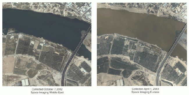
Above image on left courtesy of Space Imaging Middle
East; image on right courtesy of Space Imaging Eurasia - Click above
for full scale image (800K)
The 'before' image was taken by the IKONOS satellite on Oct.7, 2002
from 423 miles in space as the satellite moved over the Middle East.The
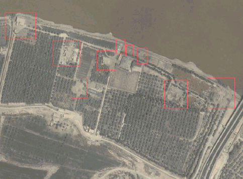
'after' image was taken by IKONOS on April 1, 2003.The image below is
an annotation that helps the eye see what has most probably changed on
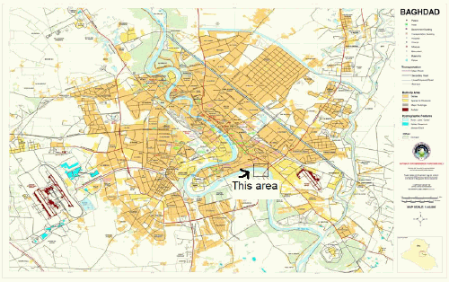
the ground.See also the map below showing where this facility is located
within the Baghdad area.