Last week Directions Media hosted its fifth Location
Intelligence (LI) Conference in Santa Clara, California. The first one,
Joe Francica noted in his introduction to the opening plenary, was
called the "Directions on Business Intelligence and Location Technology
Executive Seminar." The unwieldy name was dropped. The expected
inevitable and quick merging of business intelligence and location
technologies didn't happen. But, Francica concluded, things have come
full circle a full five years later: now Oracle, IBM and Microsoft are
acquiring and pushing forward both location and business intelligence,
finally enabling a vision for more unified solutions.
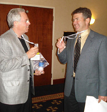
After four iterations, Directions Media and conference attendees determined that Location Intelligence is a networking event, first and foremost. So this year, the opening session tackled networking, but with a location-based twist, and a bit of technical experimentation.
Indoor Positioning and Networking
The day before the event kickoff, staffers from Ubisense and Fish Software took a database
of attendees, linked it to serial numbered RFID tags, and placed
sensors (antennas on tripods spaced about every 20 feet and extending
approximately 10 feet above the floor) in the plenary room and exhibit
areas. The idea was to illustrate indoor location tracking and suggest
how it might enable location-based marketing at a very large scale (in
a very small area). Russ Chandler of Ubisense introduced the equipment,
which uses ultrawideband (UWB), a radio
technology that enables short, low power data bursts. The company's
tags put out a signal every second which is received by one or more
sensors in the area. That's how a person's or asset's location is
determined. To show how it worked, Chandler had a staffer "beep" those
who answered a pre-conference questionnaire with a particular response
("Why are you here?"). Attendees at each table noted those in proximity
whose answers matched their own. Then, Chandler showed a distribution
map of those in the room with a particular answer.
Mike Gilvar of Fish Software shared a few case studies of organizations using the technology in marketing projects. Fish provides marketing services to the U.S. Army for its recruiting events, which are basically huge indoor, hands-on tradeshows where attendees get to "play" Army. Fish provides information to recruiters gleaned from registration details as well as what career areas of the venue a visitor explores. The recruiter uses a hand-held device to "detect" a "high value target" (yes, that's the term for a visitor with a high likelihood of being recruited) when the person is near. The device then offers up specific appropriate "messaging" to spark a conversation.
If a visitor has noted an interest in flying planes, the recruiter might mention that there are more planes to fly in the Army than in the Air Force. Other information, including a photo and others with whom the visitor has interacted, is also available. Part of the spookiness of these interactions, I think, comes from the fact that the information is used in close to real-time, in contrast to other such information that's used more passively and at a later date (such as information from your grocery store affinity card). The immediacy of this sort of marketing, and the fact that it's directed at 17-24 year-old candidates, can seem startling. Not surprisingly, recruiters love it, and per Gilvar, few if any attendees balk at wearing the tags.
Gilvar offered a less disturbing example of indoor location-based marketing integrated into a homebuilders show at McCormick Place in Chicago. When an attendee passed electronic signage, it provided ads and information targeted to attendee interest noted at registration. The kiosk also displayed a thematic map noting booth locations that offer, for example, roofing and siding solutions. The trick to making money on such systems, which are paid for by exhibitors, Gilvar explained, is to offer them valuable information. Who came to my booth? How much time did they spend? Which part of the booth drew their interest? Who didn't come to my booth? End-users also need to get something in return for wearing the tags - the map to what interests them and electronic information sent to their e-mail or a microsite (custom website just for them).
Attendees at the opening session had many questions on the details, and practiced exchanging contact information by pressing a red button when in proximity to another wearer. They were also able to click a green button, while in or near a booth in the exhibit area, to receive information from that vendor. While there were some technical glitches (Ubisense and Fish had limited time to set up and tune the system, and the sensors had to be moved as booths were installed), all attendees appreciated the proof of concept. They also noted enjoying "touching" some technology they'd only read about.
Panels and Sessions
The panel which followed the opening session focused on social networking, local search and location-based advertising. What I took away was the fact that such technologies are really "honing in" to better serve end-users. Anne Bezancon of 1020 Placecast provided a great example. She noted the importance of putting the right ad/information in the right place at the right time. She explained that if she wanted to market to us at the LI Conference, she could take into account that we were at the Santa Clara Hyatt, the date and time, the type of event, the nature of the event and, if available, our ages, gender and incomes, thereby identifying a relevant opportunity. In this specific case, the relevant opportunity is that Mother's Day is coming and the majority of the audience was male! Thus, her system might offer up an AT&T ad, noting there are just 12 days to Mother's Day and providing directions to the nearest AT&T store. Mike Lawless, from Yahoo, highlighted that company's new search tool which allows users to draw a boundary for search, and to limit it visually. That's another way of "honing in" with "better answers" for the end-user. Vincent Tao from Microsoft noted that company is honing in on how people are looking for information that's indexed by location. No surprise, Web/PC is on top (71%), print second (21%), but what came next? Voice at 5%, phone 5% and in-vehicle at .7% now but growing fast.
The Location Intelligence sessions included presentations by a number of "Distinguished Speakers" - high-level executives invited specifically to outline how their enterprise used location intelligence to provide return on investment. Ceri Carlill, a director at BP, caught everyone's attention.
BP is really large; it employees 100,000 people to do exploration, refining, fuel marketing, and to explore and develop alternative energy, lubricants and chemicals. Each year the company picks "a game changing technology" that ideally will deliver a significant return on the investment (think millions of dollars). For 2007/8 that technology was location intelligence (LI). Carlill noted three themes that drove the selection of LI: lots of consumer visualization tools (GE, VE, etc.), many sources of geospatial data (GPS, geocoding, RFID, etc.), and wireless tech for deliverability. Here are some of the projects he noted.
GIS
I noted, and several attendees made the point to me, how few times, if any, we heard the term GIS at this year’s event. GIS was there, often underlying applications and solutions, but it was not "front and center." I recall seeing just one "GIS" demo (it was part of a BI dashboard and included creating a buffer). As many predicted some years ago, GIS technology is becoming invisible.
Limitations and Barriers
People. It's been said before and will be said again, fewer and fewer of the limitations facing enterprise and non-enterprise implementations have to do with geospatial technology. The biggest barrier is people: people bound up in politics, tied to previous processes, and unwilling to look ahead and take chances.
How Many Tiers?
The workshop with the highest attendance was hosted by Microsoft. It explored, rather technically, the new spatially enabled SQL Server and the now well-established Microsoft Virtual Earth. What I understood from those who attended and others who stopped in to the Microsoft booth was that the three-tiered solutions seem far too complex for many implementations. The idea of having one or more middleware layers is sounding, to use one attendee’s words, "rather dated and closed." Blogger Sean Gorman of FortiusOne wrote about his takeaway from the Google workshop.
Viva La Consumer Interface!
While at one time the end-user interfaces of mapping portals seemed "too simple" for business applications, that sentiment seems to be gone. In fact, those exact interfaces are now required. Anything that looks too "GIS-y" is unacceptable. Players like Microsoft and Google are leveraging that preference in their enterprise solutions. What was the biggest difference between those two organizations, based on comments from attendees? One of those organizations is available to answer the phone and discuss options, while the other is less available.
Consolidation and Partnering
Airlines and tech companies are anxious to link up to do better business and make more money. Geospatial and tech companies are doing the same dance. While we all wait for Microsoft/Yahoo, TomTom/Tele Atlas and Nokia/NAVTEQ to play out, partnerships and connections between smaller geospatial players are on the rise. It seems that as much as companies are looking for more customers and more ways to serve them, they are also looking for new partners. Two small consultancies, well represented at the meeting, are key to implementations of players MapQuest and Microsoft: Seisan and IDV, respectively. It seemed that all the geospatial provider organizations at LI, large, small or otherwise, are looking for new partners. Further, these relationships seem more solid, more business focused than the long list of "strategic relationships" that peppered press releases in the first half of this decade.
After four iterations, Directions Media and conference attendees determined that Location Intelligence is a networking event, first and foremost. So this year, the opening session tackled networking, but with a location-based twist, and a bit of technical experimentation.
Indoor Positioning and Networking
 |
Mike Gilvar of Fish Software shared a few case studies of organizations using the technology in marketing projects. Fish provides marketing services to the U.S. Army for its recruiting events, which are basically huge indoor, hands-on tradeshows where attendees get to "play" Army. Fish provides information to recruiters gleaned from registration details as well as what career areas of the venue a visitor explores. The recruiter uses a hand-held device to "detect" a "high value target" (yes, that's the term for a visitor with a high likelihood of being recruited) when the person is near. The device then offers up specific appropriate "messaging" to spark a conversation.
If a visitor has noted an interest in flying planes, the recruiter might mention that there are more planes to fly in the Army than in the Air Force. Other information, including a photo and others with whom the visitor has interacted, is also available. Part of the spookiness of these interactions, I think, comes from the fact that the information is used in close to real-time, in contrast to other such information that's used more passively and at a later date (such as information from your grocery store affinity card). The immediacy of this sort of marketing, and the fact that it's directed at 17-24 year-old candidates, can seem startling. Not surprisingly, recruiters love it, and per Gilvar, few if any attendees balk at wearing the tags.
Gilvar offered a less disturbing example of indoor location-based marketing integrated into a homebuilders show at McCormick Place in Chicago. When an attendee passed electronic signage, it provided ads and information targeted to attendee interest noted at registration. The kiosk also displayed a thematic map noting booth locations that offer, for example, roofing and siding solutions. The trick to making money on such systems, which are paid for by exhibitors, Gilvar explained, is to offer them valuable information. Who came to my booth? How much time did they spend? Which part of the booth drew their interest? Who didn't come to my booth? End-users also need to get something in return for wearing the tags - the map to what interests them and electronic information sent to their e-mail or a microsite (custom website just for them).
Attendees at the opening session had many questions on the details, and practiced exchanging contact information by pressing a red button when in proximity to another wearer. They were also able to click a green button, while in or near a booth in the exhibit area, to receive information from that vendor. While there were some technical glitches (Ubisense and Fish had limited time to set up and tune the system, and the sensors had to be moved as booths were installed), all attendees appreciated the proof of concept. They also noted enjoying "touching" some technology they'd only read about.
Panels and Sessions
The panel which followed the opening session focused on social networking, local search and location-based advertising. What I took away was the fact that such technologies are really "honing in" to better serve end-users. Anne Bezancon of 1020 Placecast provided a great example. She noted the importance of putting the right ad/information in the right place at the right time. She explained that if she wanted to market to us at the LI Conference, she could take into account that we were at the Santa Clara Hyatt, the date and time, the type of event, the nature of the event and, if available, our ages, gender and incomes, thereby identifying a relevant opportunity. In this specific case, the relevant opportunity is that Mother's Day is coming and the majority of the audience was male! Thus, her system might offer up an AT&T ad, noting there are just 12 days to Mother's Day and providing directions to the nearest AT&T store. Mike Lawless, from Yahoo, highlighted that company's new search tool which allows users to draw a boundary for search, and to limit it visually. That's another way of "honing in" with "better answers" for the end-user. Vincent Tao from Microsoft noted that company is honing in on how people are looking for information that's indexed by location. No surprise, Web/PC is on top (71%), print second (21%), but what came next? Voice at 5%, phone 5% and in-vehicle at .7% now but growing fast.
The Location Intelligence sessions included presentations by a number of "Distinguished Speakers" - high-level executives invited specifically to outline how their enterprise used location intelligence to provide return on investment. Ceri Carlill, a director at BP, caught everyone's attention.
BP is really large; it employees 100,000 people to do exploration, refining, fuel marketing, and to explore and develop alternative energy, lubricants and chemicals. Each year the company picks "a game changing technology" that ideally will deliver a significant return on the investment (think millions of dollars). For 2007/8 that technology was location intelligence (LI). Carlill noted three themes that drove the selection of LI: lots of consumer visualization tools (GE, VE, etc.), many sources of geospatial data (GPS, geocoding, RFID, etc.), and wireless tech for deliverability. Here are some of the projects he noted.
- LASS (Location Aware Safety System), a tool to remove employees from dangerous places. It uses the UWB tags inside employee badges. An enhancement under consideration may include A-GPS on hand-helds to locate personnel outdoors.
- A spare parts storage area, basically a huge warehouse with lots of large parts and forklifts and the like, in Houma, LA held the potential for many accidents and/or fatalities. BP wanted to prevent such potential accidents and again selected UWB tags. This time the tags are on people and machines. Rules provide alerts. For example, a forklift has an invisible bubble of several meters. If that bubble intersects with a person’s bubble, they are alerted to move. That same technology also keeps visitors with escorts (within 5 meters).
- The company tracks gas trucks via GPS.
- Aircraft surveying for breaks along pipelines are also tracked using GPS. Besides knowing where the aircraft are, PB can prove it did the inspections, which are required by law every two weeks.
- PB is looking at UAVs, or unmanned aerial vehicles, (in partnership with NASA and others) as an alternative to manned flights. The unmanned aircraft could fly more often, and increase safety while decreasing costs. Further automation might include geocoded video and automated data processing along with the ability to survey the pipelines at night.
- The company is trying to limit pipeline inspections on residential properties by using satellite imagery to look for any leaks.
- There are also thoughts of "mirror worlds," to think through, plan and train for the construction of pipelines, ice roads, and to do virtual hazard mapping.
GIS
I noted, and several attendees made the point to me, how few times, if any, we heard the term GIS at this year’s event. GIS was there, often underlying applications and solutions, but it was not "front and center." I recall seeing just one "GIS" demo (it was part of a BI dashboard and included creating a buffer). As many predicted some years ago, GIS technology is becoming invisible.
Limitations and Barriers
People. It's been said before and will be said again, fewer and fewer of the limitations facing enterprise and non-enterprise implementations have to do with geospatial technology. The biggest barrier is people: people bound up in politics, tied to previous processes, and unwilling to look ahead and take chances.
How Many Tiers?
The workshop with the highest attendance was hosted by Microsoft. It explored, rather technically, the new spatially enabled SQL Server and the now well-established Microsoft Virtual Earth. What I understood from those who attended and others who stopped in to the Microsoft booth was that the three-tiered solutions seem far too complex for many implementations. The idea of having one or more middleware layers is sounding, to use one attendee’s words, "rather dated and closed." Blogger Sean Gorman of FortiusOne wrote about his takeaway from the Google workshop.
Viva La Consumer Interface!
While at one time the end-user interfaces of mapping portals seemed "too simple" for business applications, that sentiment seems to be gone. In fact, those exact interfaces are now required. Anything that looks too "GIS-y" is unacceptable. Players like Microsoft and Google are leveraging that preference in their enterprise solutions. What was the biggest difference between those two organizations, based on comments from attendees? One of those organizations is available to answer the phone and discuss options, while the other is less available.
Consolidation and Partnering
Airlines and tech companies are anxious to link up to do better business and make more money. Geospatial and tech companies are doing the same dance. While we all wait for Microsoft/Yahoo, TomTom/Tele Atlas and Nokia/NAVTEQ to play out, partnerships and connections between smaller geospatial players are on the rise. It seems that as much as companies are looking for more customers and more ways to serve them, they are also looking for new partners. Two small consultancies, well represented at the meeting, are key to implementations of players MapQuest and Microsoft: Seisan and IDV, respectively. It seemed that all the geospatial provider organizations at LI, large, small or otherwise, are looking for new partners. Further, these relationships seem more solid, more business focused than the long list of "strategic relationships" that peppered press releases in the first half of this decade.
From Our Homepage
Saying Farewell to an Amazing Journey
Communicating with Maps
Is There a GIS Career Ladder?
What does it mean to be geospatially smart? Series
Ways Real Estate and Property Developers Utilize Melissa GeoData for Data-Driven Decisions
Unlocking Value From Daily Satellite Imagery and Insights
Maximizing the Value of Your Address Data with Geo Addressing
How Indoor Mapping Enhances the Security of Smart Buildings
Look Ahead: AI, Location Intelligence and Efficiency
Collaboration Takes on Sea Level Rise & Dynamic Technology Environments
Brownies for Brownfields
Has Everything Been Mapped Already?
How Is Data Literacy Changing in an Artificial Intelligence Landscape
Portfolios for GIS Professionals: More Than Just Maps
How to Create a Distance Matrix in QGIS - A Step-by-Step Guide
7 Ideas for Bringing GIS into the K-12 Classroom
The Geography of Movement