MapInfo Professional (MiPro) Version 8 (or a later version) allows
users to download a utility that will allow them to map images such as
the contents of a thematic map, Map Objects such as custom territory
boundaries or a path of a hurricane to Google Earth. This is a one way
translation only
between the two products. However, if you've convinced yourself (or
your management has convinced you) that you really want the
visualization tools of Google Earth, this is exactly what you need.
MapInfo Professional Google Earth Link Utility can be downloaded from the MapInfo website.The site also provides instructions on how to download a 20 day evaluation of MIPro v8.0 for customers that do not have MapInfo Professional.
Either vector or raster data within an MiPro map window can be exported (See Figure 1 below; click for larger image). The extents of the window can be exported as raster and it will comprise the viewable area that will be seen using Google Earth. Map data can also be exported as vector data. In this mode, the Link utility will also export associated tabular data.MapInfo developed the utility using KML (Keyhole Markup Language) and exports the data to KML for vector and KMZ for raster files.When executed, the file will launch Google Earth.According to MapInfo's documentation:
"When you want to export a map selection, you have can export it as a vector map into .KML format.If you try to export a selected map object as a raster, the utility ignores the selection and exports the current map view instead.You can export your map selection as a vector map using the Google Maps .kml format.When you use this format, you preserve all of the data associated with those objects and can access that metadata in Google Maps.KML is an object description language similar to GML or XML."
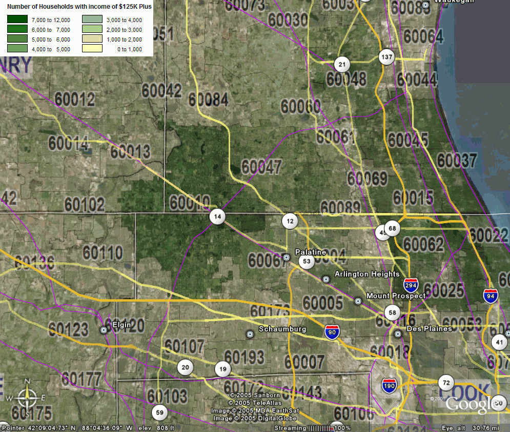
Figure 1
Prism or three dimensional maps can also be displayed (See Figures 2 & 3 below; click each for larger images). So, for example, if the map is a representation of income by zip code, the higher income, the higher the relative elevation of the thematic variable. It is helpful that the MapInfo utility also automatically exports the thematic legend information (See Figure 4 below; click for larger image).Rotate the view in Google Earth and you can see all sides of the 3D thematic. Standard functions within MiPro and other desktop mapping tools have been able to create 3D views in the past but never this quick and not with the same amount of underlying data.
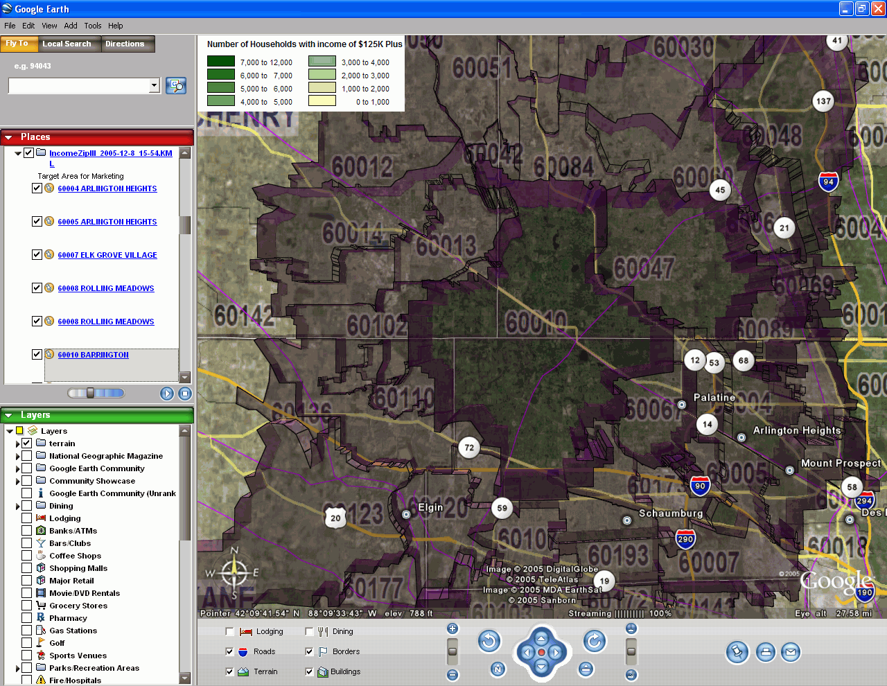
Figure 2
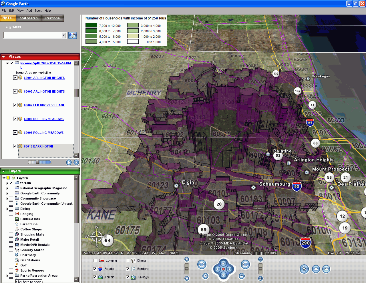
Figure 3

Figure 4
Whatever your motivation, whether you like the viewing tools for Google Earth, or the fact that satellite and topographic data are already integrated, you will find this a useful utility. The quirks of this workflow are such that you will need to remember that you may have to adjust the translucency of the thematic if you want to see some of the surficial data. And the size of your fonts in the MiPro window will carry over as a raster graphic so they will look pixilated on zooming in too close.But these are minor issues compared to the ability to take advantage of the Google Earth features.
[Note .KMZ files provided by MapInfo]