Directions Magazine (DM): Can you give a brief overview of SQL Server
in the context of managing spatial data?
Mitch Gatchalian (MG): With SQL Server customers have the ability
to implement spatial solutions with leading spatial applications such as
ESRI, MapInfo, etc. In our next version of SQL Server, code named
"Yukon", we will provide new features such as User Defined Datatypes (UDTs)
that will add additional support for customers, developers and spatial
application vendors to build spatial solutions.Customer examples of spatial
application solutions implemented on SQL Server include US Department of
Agriculture and the North Carolina Flood Control project (see below).
DM: Oracle has obviously garnered mindshare for spatial data management.
What are the strengths of the SQL Server product suite?
MG: SQL Server provides a robust and versatile platform that
is easy to use (both for developers and DBAs), at a low acquisition and
implementation price point, and offers a rich set of tools to help customers
efficiently implement and manage the solution.
DM: Currently, SQL Server handles spatial data as BLOBS? What plans,
if any, do you have to use specific database structures to manage spatial
data?
MG: User Defined Datatypes will be one of the new features in
Yukon that will improve BLOB support for customers.We are also including
support for the .NET Framework as an integral part of SQL Server to provide
developers with a better framework to tackle complex programming challenges.
With these enhancements, Customers and ISVs can boost their innovation
on top of SQL Server in bringing out better, more cost-efficient spatial
solutions to market.
DM: Microsoft has seemed to position SQL Server for smaller implementations
of GIS; Oracle for enterprise implementations.Will your marketing strategy
expand to encompass the enterprise systems in land management, ERP, or
CRM?
MG: SQL Server covers a wide range of spatial implementations
that are successfully put into operation by our partners like ESRI, MapInfo,
Autodesk, and Intergraph. SQL Server will scale to both ends of the
customer spectrum, whether you are implementing an extremely large spatial
solution or if you are simply doing a small geo project.Whether the solution
is big or small, our customers will consistently experience the value of
SQL Server in lower total cost of ownership, ease of management, and time
to implement.
DM: How will SQL Server be integrated with MapPoint Web Services?
MG: There are no plans to integrate the MapPoint Web Service
with SQL Server at this time.
DM: Is the management of spatial information recognized as being
a major potential market for Microsoft?
MG: Microsoft continues to work with our customers and spatial
ISV partners to better understand how to enhance the value of the SQL Server
platform as a part of an integrated spatial solution. Our customers
can expect better integrated solutions from Microsoft and the leading spatial
ISVs to help solve their business and geo-spatial application challenges.
DM: How will Microsoft address the mobile wireless market to manage
location information and data? Explain where Mobile Location Server fits
into this strategy?
MG: The Microsoft Location Server, a component of next version
of the MapPoint Web Service and will offer the ability to pull real-time
location into mobile applications.
DM: What can we expect from Microsoft in terms of advancing the support
of the Open GIS Consortium's initiatives in Simple Features Specifications,
OpenLS, Critical Infrastructure Protection Initiative (CIPI), and Web Services?
MG: Microsoft plays an active role in the key spatial consortiums
trying to understand more about what our customers and partners need from
our platform. As much as we can, Microsoft seeks to contribute and
possibly influence specific initiatives and technology areas within these
consortiums in the interest of our customers and partners.
SQL Server/Spatial Case Studies
FEMA, Space Shuttle Recovery
http://www.esri.com/news/arcnews/summer03articles/space-shuttle.html
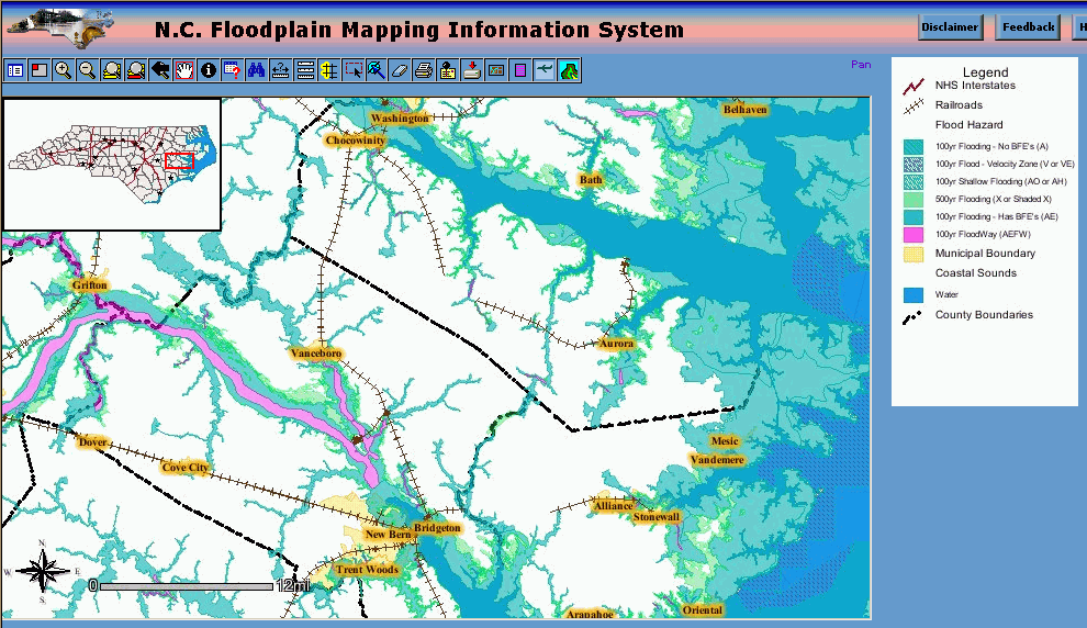
North Carolina Floodplain Project (see image below - click for larger image)
http://www.ncfloodmaps.com
http://www.esri.com/news/arcnews/spring02articles/nc-flood.html
City of Portland, OR
http://www.esri.com/library/fliers/pdfs/city-of-portland.pdf
http://www.esri.com/news/arcnews/fall00articles/cityofportland.html
http://www.sqlmag.com/Innovators/HertsChen.pdfSee also:
http://www.esri.com/partners/alliances/microsoft/ms_case_studies.html
MapMarker and SpatialWare® on SQL Server
http://www.mapinfo.com/press/index.cfm?fuseaction=view.pressrelease&id=618
http://www.mapinfo.com/products/Architecture.cfm?ProductID=1141
MapInfo Case Studies:
Cumberland County
http://www.mapinfo.com/press/index.cfm?fuseaction=view.pressrelease&id=1012
http://www.mapinfo.com/common/library/cumberland_casestudy.pdfAT&T
http://www.mapinfo.com/common/library/att_casestudy.pdf