Developing a Transportation GIS
From its headquarters in Harrisburg, PENNDOT is directly responsible
for 40,000 miles of state highways and bridges.Through its Geographic
Information Division and its Cartographic Services group, PENNDOT has digitally
mapped and stored more than 800 attributes for this entire network of highways
and bridges now included in the transportation GIS.Another 80,000 miles
of local highways have been mapped for future inclusion.
Evolution of transportation GIS in Pennsylvania began more than 12 years ago with Intergraph's MGE product, chosen for its dynamic segmentation capabilities that made it possible to link attributes to small sections of long roadways.Highway safety was one of the driving applications behind development of the GIS.
"PENNDOT saw the mapping and analysis technology as an excellent way to map crash sites, determine their causes and make the roadways safer," said Frank DeSendi, Cartographic Services Manager in PENNDOT's Bureau of Planning and Research.
Developed well in advance of the GIS were centrally located mainframe databases containing information relating to highway maintenance, project management, road safety and bridges.The Geographic Information Division built GIS applications to acquire, store, view and analyze the data in these databases.At the start, data was only available to users with specific mainframe system log-on capabilities.
As the benefits of GIS became more evident in the headquarters, PENNDOT decided to expand the technology to its 11 District Offices.The Districts embraced GIS and have succeeded in extending the technology to 20 of PENNDOT's county maintenance offices.This proliferation occurred just as Harrisburg was migrating from MGE to Intergraph's GeoMedia line of products in the late 1990s.As a result, district and county offices now use both MGE and GeoMedia software.
By 1997, the Geographic Information Division had developed a variety of business related GIS applications that could be used by personnel in many divisions within PENNDOT.Eyeing the value and potential of enterprise-wide access, PENNDOT quickly realized that maintaining GIS software on individual desktop computers was cost prohibitive, and the decision was made to adopt Intergraph's GeoMedia WebMap software for online access.
Not only did web-based GIS provide state personnel with access to the system through an existing wide area network, it also enabled PENNDOT to extend data and applications directly to the district and county offices, which also have intranet links.Looking back, this implementation opened the door to a nearly free-flow of valuable information that has made transportation planning and highway maintenance faster and more effective processes in Pennsylvania.
Putting GIS on the Web
In Pennsylvania, transportation planning and highway maintenance involve
multiple organizations.The Harrisburg headquarters of PENNDOT generally
participates only at the very highest levels of planning by determining
funding availability, developing long-term programs, approving plans and
consolidating projects, if needed.Planning of actual projects to build
or enhance state highways is carried out among the district offices and
state planning partner agencies.
These partners are generally regional and county planning commissions
located throughout the state.They are responsible for developing transportation
plans that fairly weigh the needs of all areas that will ultimately be
impacted by the implementation of a transportation project.
An objective of the web-based GIS is to serve relevant data that originated
in PENNDOT mainframe databases to all of these offices and partners for
use in planning, engineering and design (See Figure 1).PENNDOT
established an Oracle spatial database to manage this data and to run under
its GIS.On daily and weekly schedules, the GIS communicates with the mainframe
and retrieves information on crashes, maintenance, traffic, and other activities
and programs to update the attribute tables.
"Web-based GIS is ideal for Pennsylvania's situation because we can
support the planners and engineers with both information and applications,"
said Dwight McClain, System Administrator in the Bureau of Planning and
Research."Some of the district offices and partners are sophisticated
GIS users, so they primarily need access to our data through the online
system, but other offices have no GIS and rely on us to extend spatial
query and analysis functionality to them through the intranet."
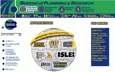
Figure 1: PENNDOT's Bureau of Planning and Research intranet
homepage - Performance in many PENNDOT business areas is enhanced by accessing
the bureau's package of spatial query and analysis tools on the department's
intranet.
Applying GIS to Planning
PENNDOT has focused most of its application development on the intranet
for access by department personnel.The flagship application is the Interactive
Web Query, which enables users to view one of 33 commonly requested maps
using USGS topographic maps or aerial photography as backgrounds.
District and county office maintenance managers have emerged as the most regular users of the system.Prior to nearly every repaving, road repair or widening project they plan, the district and county personnel can refer to the GIS to download maps and other details of the project area.County managers can also create maps showing the scheduled maintenance they plan to perform and later compare plans with actual performance.
"GIS is a great communications tool during the planning process," said
DeSendi."As projects are completed, district managers can log directly
into the mainframe database through a non-GIS connection and update information
as necessary." (See Figure 2)
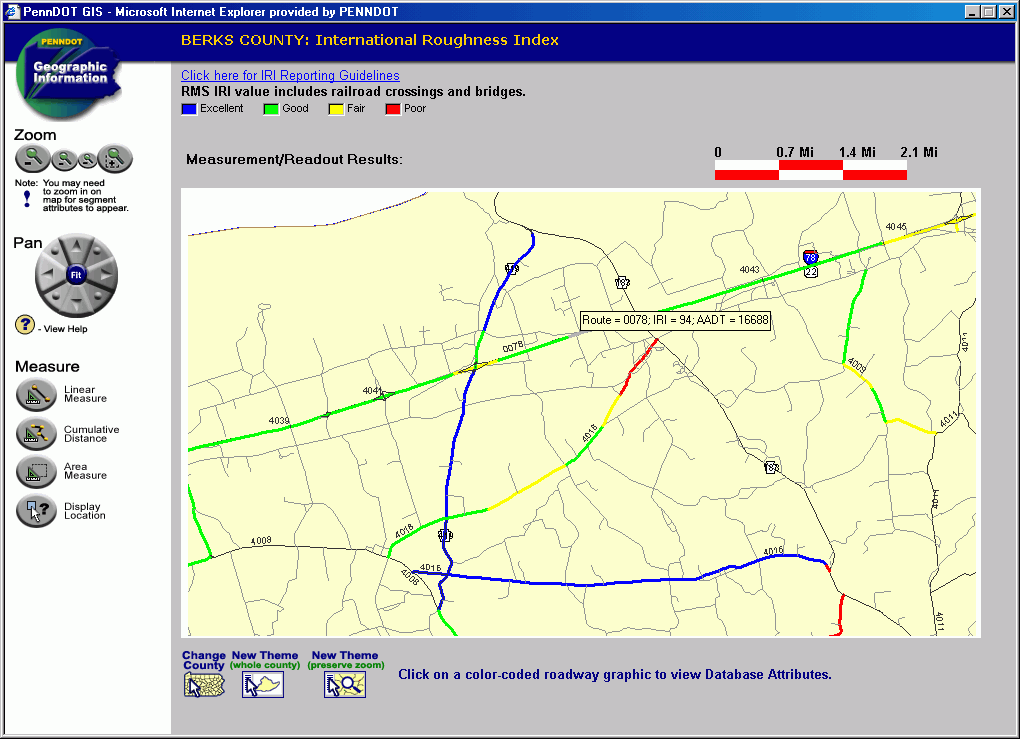
Figure 2: A sample GIS query of the International Roughness
Index for Berks County.The tool tip shows the route, IRI value and the
annual average daily traffic for Route 0078 (click image for larger view).
Because many of the district and county offices also maintain their own databases of projects and road conditions, the Geographic Information Division developed an application called GIS 2000.It allows any PENNDOT user to upload data with location coordinates from a desktop spreadsheet or database program and map it spatially on the GIS.
A favorite online application of the maintenance people (and numerous
other PENNDOT employees) is the Videolog Application (See Figure 3).
It contains street-level video of the entire state highway system that
is rarely more than two years old.The Videolog provides an online motion
picture of the highway.Simply by clicking on a highway segment, users
can view the video for that stretch and see pavement conditions, signage
locations, and crash sites.Often the county personnel can spot potential
problems or respond to queries or complaints from the public, and take
care of the situation before a crash occurs.
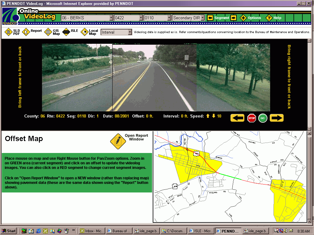
Figure 3: The Videolog provides an online motion picture
of the highway.Simply by clicking on a highway segment, users can view
the video for that stretch and see pavement conditions, signage locations,
and crash sites (click image for larger view).
In terms of time and money savings, one of the most valuable intranet applications is the system that displays cultural resources.Its development arose from the mandate to study all cultural, archaeological and historic sites that may be disturbed during the construction of a highway project. Unfortunately, the Pennsylvania Historic and Museum Commission (PHMC), which oversees cultural resources data, did not have the resources to keep pace with the demand for these studies.
"Some important safety-related projects were being held up as a result of the bottleneck in cultural studies," said DeSendi.
The Geographic Information Division teamed with the PHMC to create a web application and to digitize all of the files and maps relevant to historic and cultural sites.This data has been geocoded and loaded into the Oracle database.Now these locations can be analyzed online through GeoMedia WebMap. PENNDOT has given the PHMC access to the intranet so its personnel can keep the files updated.
"Personnel in the central office and out in the districts, and contractors, can now query a geographic area in the early phases of a planning project to see if there are any cultural sites that will have to be reviewed and budgeted for in advance," said DeSendi."People no longer have to waste a day coming to Harrisburg to search for a museum file...we estimate that once this application is extended to the Internet, it will save PENNDOT $300,000 per year on staff time, consultant costs, and duplicated studies."
For access by planning partners without access to the departmental intranet, PENNDOT, with the help of GeoDecisions and Cyber, Inc., has created an Internet application called Multimodal Project Management System - Maps (MPMSMaps).This password-protected site allows participants to view and create maps of programmed and candidate highway projects.In addition, they can download details on traffic, safety, maintenance and other activities in the affected areas from an FTP site established to serve selected attributes stored in the Oracle database.
"Most planning commissions have their own GIS capabilities now, so they use MPMSMaps to see where projects are spatially and to download our data into their own applications," said McClain.
Also accessible through the Internet is a Crash Reporting System (CRS). This GIS-enabled interface gives law enforcement officials an interactive mapping environment where they can verify crash locations.Relatively new and still catching on among police officers, the CRS makes the safety database the most up-to-date resources available to planners and safety engineers.
Looking Down the Road
The Geographic Information Division believes one of the next major
system developments will involve taking GIS on the road.It recently purchased
IntelliWhere OnDemand, a mobile GIS software from Intergraph's IntelliWhere
group.As a pilot project, PENNDOT plans to load the software onto a handheld,
GPS-based data collection device so that district field personnel can take
digital map data with them into the field and update the map or add new
attributes through a simple point-and-click interface.Through a web connection,
they could immediately upload roadway centerlines to PENNDOT's Cartographic
Services.
By early next year, PENNDOT also expects to further leverage its Internet-based GIS capability.It has already purchased a new server that will extend the Cultural Resources System to outside transportation consultants.Plans are also in the works to make the Videolog and some traffic count information available to the public via the Internet.
Even further down the road, PENNDOT hopes to add railroad, airport and shipping information to the GIS so that true intermodal transportation planning in Pennsylvania can be facilitated and carried out online.