Just before the holidays, news dribbled out that Twitter, the very popular 140 character messaging company, had acquired Mixer Labs, a company with a platform for Location-based Services (LBS). I was already aware of the Town.me site and its TownMe GeoAPI (APB post). I had not realized it was part of Mixer Labs until I learned of the acquisition.
What Twitter acquired is some basic Location-based Services needed to build a "check in" game like foursquare or a "find the treasure game" like capture the virtual flag. The Mixer Labs API is called GeoAPI, and it powers - and is the same one offered via - Town.me. Initially (October 2009) that API offered:
- A reverse geocoder - locates a point within a census tract, neighborhood, city, MSA and state
- A find near tool - finds POIs (including 16 million "scrubbed" businesses "based on three data licenses and other open data sets" per GigaOm) close to the point
- A write to server capability - the ability to write data with location information to Mixer Labs' server (information like the check-ins and virtual flags from the above mentioned games)
Currently the updated GeoAPI adds a few more features including access to "media layers" such as Twitter, Flickr, Foursquare, YouTube videos and weather from Weatherbug. Access is via those applications' APIs. Also added recently: an iPhone SDK.
At launch GeoAPI pricing was: "20,000 queries per day for free, 100,000 more for $3 a day." Further, the API "promises super speedy response times (sub-50 milliseconds)." The business model was a bit fuzzy for Mixer Labs, as it is for Twitter.
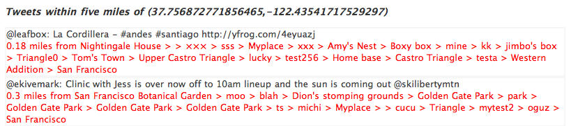
I'm guessing that what caught the Twitter folks' attention was an early demo built to use GeoAPI against the then-not-officially-spatially-tagged Twitter data, part of a list of demos. The "official statement" from Twitter about the acquisition is this (Twitter blog):
We will be looking at how to integrate the work Mixer Labs has done with the Twitter API in useful ways that give developers behind geo-enabled apps like Birdfeed, Seesmic Web, Foursquare, Gowalla, Twidroid, Twittelator Pro and others powerful new possibilities.
 |
I think the most valuable thing I can do to illuminate this acquisition is to make some observations.
First, I think it's noteworthy that Mixer Labs was not on the geocommunity's radar before the acquisition. I could find no coverage beyond GigaOm (see the short video interview with CEO and co-founder Elad Gil below) and TechCrunch, and I only noted the company via VentureBeat's coverage of its consumer site, TownMe.
Second, it's worth noting that Mixer Labs, in fact, started life as TownMe. First launched in July 2009 (TownMe blog post), it was a wiki-style, "find and share and comment on cool locations" app. Comments on a TechCrunch article vacillated between "nothing special" and "I've never seen anything like it" to "its database is out of date." TownMe doesn't seem to have exploded onto the very crowded space of interactive local search, but clearly the team decided what was special was the underlying tech. The TownMe API (not so-named but apparently the same as GeoAPI) came out in October in Alpha (TownMe blog post) and Twitter made the acquisition in December. That timeline raises an interesting question regarding the new Web marketplace: do you put out an app first, then open the API (worked for Google Maps) or do you put out the API first (as SimpleGeo has done)?
Third, I want to make a point about separating services and the data on which they run. Twitter is really two things in one: it's a communication tool, but it's also a real-time updated content database. One of the big tech stories of 2009 was Bing and Google indexing and searching Tweets (TechCrunch). If Google acquires/had acquired Twitter, it'd be in it for the Tweets, the content, as much as the platform. That would make total sense to me. I'm not sure that looking at Twitter as a content provider buying into an API makes as much sense, but maybe that's because I can't think of any good examples in our space.
Finally, in the few mentions of GeoAPI I did find before the acquisition (TechCrunch, for example, writing about the Google Maps Data API), it was often paired with newcomer SimpleGeo. SimpleGeo was just making a name for itself in late fall 2009 via the normal channels for tech companies: TechCrunch, C|net, and Rocky Radar. Oh, and All Points Blog. I wonder if the notoriety and acquisition of Mixer Labs will catapult SimpleGeo or make it an also-ran.
These observations are only the tip of the iceberg regarding what may happen with this Twitter/GeoAPI marriage. I'll wrap up with the ones spinning in my head:
- Will Twitter drop its existing API and force developers to GeoAPI?
- How will Twitter monetize GeoAPI? Its POI dataset?
- Will TownMe continue?
- Will Twitter be even more "important" with a stronger spatial API in front of it?
- Does the acquisition make Twitter an even better buyout target for 2010 or must the company "do something" with it first?
- Does this API make connections between "more serious" professional geospatial apps and Twitter more likely?