Gary Napier of Space Imaging shared some of what's gone on at the company in responding to Katrina.
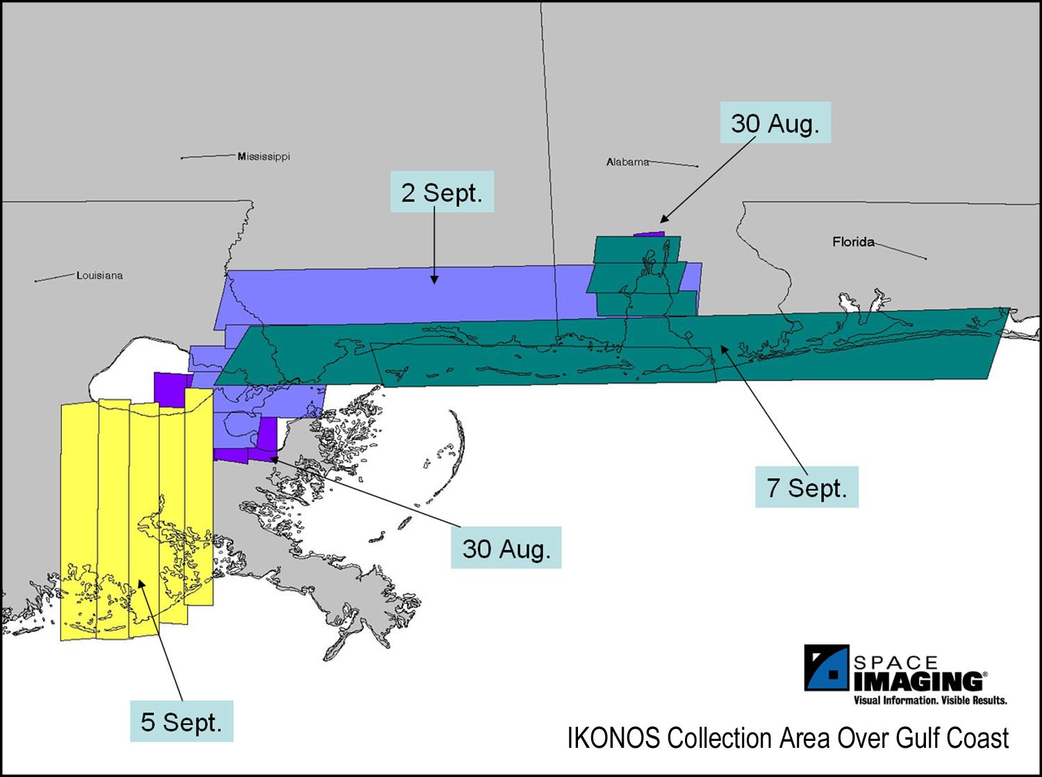 |
The company essentially cleared its IKONOS satellite collection schedule each time it passed over the impacted area.The first images were shot Tuesday, Aug.30.Unfortunately, the only cloud-free image was over Mobile, Ala.When the orbital path put IKONOS back in range Friday, Sept.2, Space Imaging executed a collection plan to shoot large swaths of imagery from Mobile to New Orleans in a single pass.That pass covered 12,500 square kilometers.As of the 8th, Thursday, the satellite imaged more than 35,000 sq km of the Gulf Coast.
Space Imaging worked closely with the National Geospatial-Intelligence Agency (NGA) to prioritize the areas that needed to be collected.Same day turnaround was possible.
The licensing agreement with the NGA meant that other agencies could also use the images.Data was shared with Federal Emergency Management Agency, Department of Homeland Security, US Geological Survey, Northern Command, US Army Space Command and Army Corps of Engineers.Space Imaging also established a high-bandwidth internet site to host gigabytes of imagery data for direct download by users authorized by the NGA.
To share imagery with the impacted residents, Space imaging offered many before-and-after images of New Orleans, Gulf Port, Biloxi, Mobile and Pascagoula via a web-based viewer.That imagery was also widely used by the media.
From Our Homepage
Saying Farewell to an Amazing Journey
Communicating with Maps
Is There a GIS Career Ladder?
What does it mean to be geospatially smart? Series
Ways Real Estate and Property Developers Utilize Melissa GeoData for Data-Driven Decisions
Unlocking Value From Daily Satellite Imagery and Insights
Maximizing the Value of Your Address Data with Geo Addressing
How Indoor Mapping Enhances the Security of Smart Buildings
Look Ahead: AI, Location Intelligence and Efficiency
Collaboration Takes on Sea Level Rise & Dynamic Technology Environments
Brownies for Brownfields
Has Everything Been Mapped Already?
How Is Data Literacy Changing in an Artificial Intelligence Landscape
Portfolios for GIS Professionals: More Than Just Maps
How to Create a Distance Matrix in QGIS - A Step-by-Step Guide
7 Ideas for Bringing GIS into the K-12 Classroom
The Geography of Movement