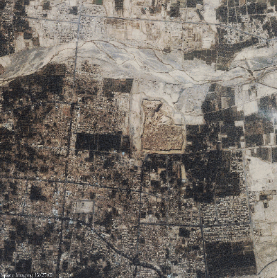
Dec.29, 2003 - This one-meter resolution satellite image of
Bam, Iran was taken by Space Imaging's IKONOS satellite on Dec.27, 2003,
just one day after a catastrophic earthquake struck the historic city.
The image shows widespread destruction as a result of the 6.7 magnitude
earthquake that leveled 70 percent of the buildings according to news reports.
Click for Larger Image
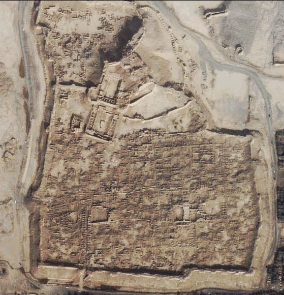
Clearly seen in the center of the image is the 2,000-year-old citadel (See at right), considered the world's largest mud fortress.According to news reports, much of the medieval fortress crumbled like a sand castle when the quake hit. The citadel was a popular tourist attraction and is on the register of the U.N.Educational, Scientific and Cultural Organization and has been a World Heritage site.
Bam is located about 1,000 km (620 miles) southeast of Tehran.
Download the full resolution image here.
IMAGES COURTESY OF SPACE IMAGING