Geography's metaphor of communication is a map.
Scientific achievements in both the physical and social disciplines of
geography have used mapping as the way to express results and
communicate ideas. Today's technology, whether it is a Web viewer like
Google Earth, an analysis platform like ArcGIS, or a geo-social network
like that created by Platial, is a profound expression of the "long
tail of mapping."
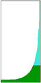
The "long tail" is a term used in statistics to define the extremes of
a bell curve, perhaps starting with two or more standard deviations
from the norm (See Figure 1). In more recent parlance, the "long tail
of the Internet" expresses the phenomenon created by a multitude of
linked pages through interconnected world of information as well as the
emergence of viable businesses based solely on electronic storefronts
and media, like Amazon.com or this publication, for example. In other
words, the Internet facilitates more than just storing pages of
information on a server. It has become a research, communication, and
entertainment medium, sometimes to the chagrin of parents.
For the mapping industry, the evidence of "the long tail" is
everywhere. There are maps in cars, maps on phones, maps on the Web,
maps on your wrist watch for running maps from the Weather Channel,
maps for showing traffic congestion, maps to find your pet, your lost
grandmother or your stolen car. What we are seeing is a pervasive
extension of mapping technology fueled by consumer demand and a more
competitive business environment. And if you turn the long tail 90
degrees counterclockwise, it looks like the classic "hockey stick"
graph used to describe an exponentially growing market sector (See
figure 2). Mapping technology is now on this same path.
Much of the more recent enthusiasm for mapping technology has been focused on consumer mapping portals for driving directions and unique visualization using satellite imagery and 3D viewing. Somewhat lost in this trend is the technological underpinnings that we seem to take for granted. Google can protest all it wants that it is not a GIS company but at the core of Google Maps is a geospatial processing system (supplied by deCarta, formerly Telcontar-also "not a GIS" system) that is interpreting and integrating location-based information. It geocodes, it integrates points, lines and areas, and displays raster imagery. Will Google Maps eventually be coupled with more advanced geographic search and query so that it looks, feels and acts like a GIS? If it walks, talks, and acts like a duck, then ArcGIS Explorer, in its beta form, already is the closest thing to "GIS on the Web." Along with Google Earth, the pair of products, and others like them, are creating a paradigm that moves the mapping industry closer to a standard way of using location technology as a platform for other business ideas and successful business models. Some companies, like Platial, use the technology solely as a platform to launch social location networking. We can expect to see other companies do likewise using the technology in applications that are yet to be defined. This paradigm shift parallels how Amazon transformed the retail sector. With all the glitz removed, Amazon is essentially a good search engine and database, fueled by effective marketing. Likewise, the next generation of these Web mapping platforms will transform a $2 billion software industry into one that could see an order of magnitude greater in revenue potential.
Data. Streets, signs, bridge heights, on ramps, restaurants, coffee shops, historical markers, my friends - my friends on the move, biohazard sensors, seismic recording geophones, tsunami warning devices, heart rate monitors (see a Garmin 301 GPS coupled with a heart monitor). We will both monitor and possibly become geo-sensors (should we choose to share our personal location data). We will broadcast geospatial data to different devices and geospatial servers that will assimilate these data to be re-broadcast to mapping portals like on-board vehicle navigation systems that might platoon your car within a traffic corridor or reroute it to compensate for network impedances. Location-based data will be more ubiquitous than they are today and we have not even begun to think of the applications that will be created.
And speaking of statistics, the mainstream media provided the most obvious data point facilitated by the long tail of mapping: one dead terrorist. The identification of the location of Abu Mousab al-Zarqawi was coordinated by SIGINT, HUMINT, and GEOINT. Signal intelligence (SIGINT) "tracked" the position of cell phone movements of al-Zarqawi's spiritual advisor; human intelligence (HUMINT) secured the location of the safe house in which he was staying; and geospatial intelligence (GEOINT) determined with pin point accuracy ground zero of the laser-guided bombs.
Looking ahead, technology and standards now being developed will begin to feed "the long tail." Web services and new options for encoding data like GeoRSS have the potential to offer unlimited access to geospatial data. A geospatial aggregator will allow users to create customized mapping applications like "my weather and traffic," "my family locator," "my competitor's sales campaigns," "my worst performing store locations from yesterday." So, let's get beyond mashups to more viable business models that have real value in the marketplace.
Watch how "consumer mapping portals" merge with "Web GIS" very soon. The long tail of mapping is, right now, very short but it is "growing legs" and will have incredible reach.
 |
 |
Much of the more recent enthusiasm for mapping technology has been focused on consumer mapping portals for driving directions and unique visualization using satellite imagery and 3D viewing. Somewhat lost in this trend is the technological underpinnings that we seem to take for granted. Google can protest all it wants that it is not a GIS company but at the core of Google Maps is a geospatial processing system (supplied by deCarta, formerly Telcontar-also "not a GIS" system) that is interpreting and integrating location-based information. It geocodes, it integrates points, lines and areas, and displays raster imagery. Will Google Maps eventually be coupled with more advanced geographic search and query so that it looks, feels and acts like a GIS? If it walks, talks, and acts like a duck, then ArcGIS Explorer, in its beta form, already is the closest thing to "GIS on the Web." Along with Google Earth, the pair of products, and others like them, are creating a paradigm that moves the mapping industry closer to a standard way of using location technology as a platform for other business ideas and successful business models. Some companies, like Platial, use the technology solely as a platform to launch social location networking. We can expect to see other companies do likewise using the technology in applications that are yet to be defined. This paradigm shift parallels how Amazon transformed the retail sector. With all the glitz removed, Amazon is essentially a good search engine and database, fueled by effective marketing. Likewise, the next generation of these Web mapping platforms will transform a $2 billion software industry into one that could see an order of magnitude greater in revenue potential.
Data. Streets, signs, bridge heights, on ramps, restaurants, coffee shops, historical markers, my friends - my friends on the move, biohazard sensors, seismic recording geophones, tsunami warning devices, heart rate monitors (see a Garmin 301 GPS coupled with a heart monitor). We will both monitor and possibly become geo-sensors (should we choose to share our personal location data). We will broadcast geospatial data to different devices and geospatial servers that will assimilate these data to be re-broadcast to mapping portals like on-board vehicle navigation systems that might platoon your car within a traffic corridor or reroute it to compensate for network impedances. Location-based data will be more ubiquitous than they are today and we have not even begun to think of the applications that will be created.
And speaking of statistics, the mainstream media provided the most obvious data point facilitated by the long tail of mapping: one dead terrorist. The identification of the location of Abu Mousab al-Zarqawi was coordinated by SIGINT, HUMINT, and GEOINT. Signal intelligence (SIGINT) "tracked" the position of cell phone movements of al-Zarqawi's spiritual advisor; human intelligence (HUMINT) secured the location of the safe house in which he was staying; and geospatial intelligence (GEOINT) determined with pin point accuracy ground zero of the laser-guided bombs.
Looking ahead, technology and standards now being developed will begin to feed "the long tail." Web services and new options for encoding data like GeoRSS have the potential to offer unlimited access to geospatial data. A geospatial aggregator will allow users to create customized mapping applications like "my weather and traffic," "my family locator," "my competitor's sales campaigns," "my worst performing store locations from yesterday." So, let's get beyond mashups to more viable business models that have real value in the marketplace.
Watch how "consumer mapping portals" merge with "Web GIS" very soon. The long tail of mapping is, right now, very short but it is "growing legs" and will have incredible reach.
From Our Homepage
Saying Farewell to an Amazing Journey
Communicating with Maps
Is There a GIS Career Ladder?
What does it mean to be geospatially smart? Series
Ways Real Estate and Property Developers Utilize Melissa GeoData for Data-Driven Decisions
Unlocking Value From Daily Satellite Imagery and Insights
Maximizing the Value of Your Address Data with Geo Addressing
How Indoor Mapping Enhances the Security of Smart Buildings
Look Ahead: AI, Location Intelligence and Efficiency
Collaboration Takes on Sea Level Rise & Dynamic Technology Environments
Brownies for Brownfields
Has Everything Been Mapped Already?
How Is Data Literacy Changing in an Artificial Intelligence Landscape
Portfolios for GIS Professionals: More Than Just Maps
How to Create a Distance Matrix in QGIS - A Step-by-Step Guide
7 Ideas for Bringing GIS into the K-12 Classroom
The Geography of Movement