 AtlasBook™ Places  Winner - LBS Challenge |
Networks In Motion was awarded the grand-prize for its AtlasBook™ Places solution. AtlasBook Places provides turn-by-turn directions and maps to users of portable wireless devices.Via the AtlasBook web site, users can also plan trips, integrating places, phone numbers and other relevant location information into a personalized trip itinerary.AtlasBook™ Places with GPS features nationwide Maps, Yellow Pages, and turn-by-turn directions.An optional Web planner allows you to create your travel itinerary ahead of time, and retrieve it on the road. |  |
 The Commute Advisor™ |
The Commute AdvisorTM, from Intransix, is designed to give traffic information for daily commuters.The user creates a "trip" by simply driving it, and GPS records the route taken.After the trip is created, the user can request real-time traffic information targeted for that specific trip, including traffic incidents, speed information, and even door-to-door travel time.If the driver has an alternate route when the freeway is congested, the Commute Advisor can record multiply routes for a trip. And for multi-route trips, it reports the fastest route to the destination, given the current traffic conditions. |  |
 uLocate Runner Up - LBS Challenge |
uLocate, from uLocate Communications Inc., is a wireless location-based service, provides families and businesses with the ability to view location information of family members and employees on a 24 by 7 basis.Integrating GPS cell phones with the Internet, uLocate enables subscribers to view current addresses and see them mapped; view route histories, speed and mileage metrics; and set up geofences for receiving alerts of arrivals and departures of phones in their account.uLocate delivers current address information directly to user's cell phones. |  |
 OpenMotionLS™ |
OpenMotion LS™, an application from Raco Wireless, is a network based location services platform that allows wireless carriers, developers, content providers and businesses to rapidly deploy existing content like directory information, points of interest, real-time traffic and application data to mobile devices and location enable the content.Highlights include location tracking, transaction logging, content management, and XML feed providing a consistent set of location services.The OpenMotion LS™ platform can be used to standardize and deliver content from any source.OpenMotion LS™ can be used as an entire platform or for a particular service like driving directions with traffic incidents. Raco Wireless used the Drill Down Server and Traffic Manager products from Telcontar to build the application. | Not applicable; OpenMotion LSTM is a location development platform |
 PhoneLocator™ |
PhoneLocator™
is a wireless
GPS solution that helps you keep track of your phone.Locate your phone
on a map from PhoneLocator's website, and then get quick directions to
or from your phone's location.GPS locations are recorded for later
review.PhoneLocator simply runs in the background while your phone
operates.Plus, PhoneLocator's integrated security ensures your privacy
is protected. |
Sample Image not available |
 Shotgun™ |
Shotgun is a cell phone based, location aware Java application.The IT2ME based Shotgun on its years of GPS development experience.Shotgun offers the user over a dozen location aware capabilities including voice enabled weather, searching for the cheapest fuel, locating Wi-Fi hotspots, Yellow Page searches and automatic voice delivery of location aware information to mention a few. | Sample Image not available |
 Just in Time Navigator™ |
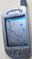
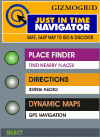
Gizmogrid, Inc. - A location-based services platform provider for push applications in target marketing and viral marketing, and pull applications in friend finder and navigation.The "Just in Time Navigator (TM) delivers map content on demand from a server to a mobile device.The company used ESRI's ArcWeb Services in their application development for the LBS Challenge. The services uses a PAY-AS-YOU-USE model for delivering dynamic map content on mobile handhelds and cellular phone platforms.GIZMOGRID delivers its platform and technology through operators, wireless application service providers and location service portals. |  |
 Wi-Fi Positioning Service™ (WPS) Runner Up - LBS Challenge |
The Wi-Fi
Positioning System (WPS) from Quarterscope
Solutions claims to be the first outdoor positioning network to utilize
Wi-Fi rather than GPS or cell tower systems to pinpoint location.
Building on the explosive growth of Wi-Fi enabled devices, WPS includes
a nationwide network of location beacons used to accurately pinpoint a
user's location. WPS works in
metro areas of the United
States and provides accurate location readings to within 20 meters. Quarterscope has also developed WhereIsIt?™, a useful application for PDAs that demonstrates the power of the WPS system.WhereIsIt? by Quarterscope Solutions can identify the nearest hotel, coffee shop, gas stations or restaurant. According to Ted Morgan, Founder & President, one of the applications that he is pushing is to be the "Lojack" of personal laptop computers.With WPS installed on the laptop, you can locate missing machines by having it covertly send the location of the machine to the owner . |
 |
 TeleNav™ |
Think of the TeleNav service as an expert navigator sitting in your passenger seat.You just tell it where you want to go, and it will take care of the rest, including giving you the best route and step by step guidance on the way.To get the service, you need a Java phone and Televigation is working with Nextel for provide a service called "Total Connect" for just $9.95 per month for 10 trips. More information can be found here. |  |
