UAS Mapping of Cemeteries in the Czech Republic

Summary:
The largest Czech unmanned aerial systems (UAS) company, in cooperation with Brno City Hall, conducted a project to capture images of adjacent cemeteries and integrate the data into a GIS system for the administrators of city cemeteries.
The largest Czech unmanned aerial systems (UAS) company, UPVISION, in cooperation with Brno City Hall (the second largest city in the Czech Republic), conducted a project to capture images of adjacent cemeteries and integrate the data into a GIS system for the administrators of city cemeteries.
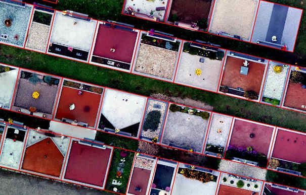
For this project, unmanned aerial vehicles were used to create high-resolution orthophotos and the subsequent vectorization of grave sites with the possibility of adding raster data (orthophotos) as well.
"The actual mapping takes place with a hexacopter outsidethe growing season, when trees block the graves and the recognition of ground control points is very difficult (known points, corners paths)," said Jakub Karas UPVISION’s UAS manager.
Each cemetery was captured from one flight by the UAV. For smaller cemeteries the hexacopter was used whereby the image resolution obtained was 1 cm/pixel, with an overlap of 80/60. The entire mission was completed within 10 minutes.
For larger cemeteries in the Czech Republic, such as the Central Brno cemetery with over 80,000 graves, a fixed wing UAS was used such that the resolution was 2 cm/pixel with an overlap of 85/65. Given the terrain and the coverage necessary, the entire flight was completed in 40 minutes.
Orthophotos were created from the UAS mapping with an image resolution of 1 cm/pixel in the Czech coordinate system and with the objective of semi-automated vectorization of grave sites.

At the same time, oblique aerial images of the graves from the UAS were obtained, which allowed analysts to describe and quantify the number of graves.
The study resulted in the creation of a very large database of imager (orthophoto maps with high resolution, a vector layer with delineated limits of every grave and attribution including grave number, and an associated photo).
These data will serve to populate the existing database of all cemeteries for those in the city administration.


