 In August, Rand McNally introduced a new portable navigation device specifically for professional truckers. The IntelliRoute TND 500
has more truck-specific road attributes and truck-related points of
interest. Information that impacts routing, such as construction areas,
is updated every two weeks. Directions Magazine asked Rand McNally to
comment on some of the specific functionality of the product.
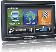
In August, Rand McNally introduced a new portable navigation device specifically for professional truckers. The IntelliRoute TND 500
has more truck-specific road attributes and truck-related points of
interest. Information that impacts routing, such as construction areas,
is updated every two weeks. Directions Magazine asked Rand McNally to
comment on some of the specific functionality of the product. Directions Magazine (DM): Can you provide some of the details about the hardware and data used to manufacture the IntelliRoute TND? Who was the hardware manufacturer? Were the basic road network data derived completely from Rand McNally data or was the information supplemented by data supplied by other sources?
Rand McNally (RM): Rand McNally's manufacturing partners build our products. The road network was provided by NAVTEQ, but the truck attribution was supplied by Rand McNally in addition to NAVTEQ, resulting in 35% more truck-specific details than any other provider. The router was developed by Rand McNally. The result is patent pending.
DM: We noticed that real-time traffic information was not included in the services. Will this feature be added or is an add-on service available?
RM: There is a plan to add real-time traffic information in the future. However, we do think that traffic has a smaller value than construction data, as most over-the-road drivers plan out their routes beforehand, and try to avoid going through cities where traffic is heaviest.
Note: There is no "service fee" with this device. Add-ons will be free or purchased.
DM: What is the source of the RoadWork construction information? Is this information gathered entirely from state or local departments of transportation, and how is the information ingested into your database? What is the refresh rate of the information?
RM: RoadWork is updated every two weeks and includes about 2,000 construction projects nationwide at any given time, up to as many as 3,000 during the summer. Rand McNally's IntelliRoute TND is the only truck-specific GPS device that includes road construction information. It is researched by our GIS team, and gathered from many sources across the country including the state and local departments of transportation.
RoadWork is downloadable from the Internet when the device is connected to a computer with Internet connectivity.
DM: Can the information that the driver can capture about "time on duty" or "fuel tax reporting" be exported to the standard format that trucking companies use to report to federal or state authorities?
RM: At launch, a reporting package is not available, but this is one of the many products and services we intend to provide to users in the future.
DM: In the printed version of the Motor Carrier's Road Atlas, information about bridge height restrictions is supplied. Will the driver be automatically notified if he approaches a potentially dangerous weight or height restriction? Or alternatively, will this route be automatically discarded from a planned route?
RM: The user sets the device routing to conform to his vehicle or haul (48-ft, 53-ft, single, double, triple and hazmat or car). The router will take these parameters into account and supply a route that conforms to them. So, if you are running a 53-ft truck, it will not route you under a low bridge. However, you can also set warnings about upcoming features (bridges, tolls, weigh stations, etc.) if desired.
DM: How quickly can the driver be notified of a real-time event (accident, construction, etc.)?
RM: Construction is available every two weeks via Internet download. This device does not have two-way connectivity to introduce real-time information.
From Our Homepage
Saying Farewell to an Amazing Journey
Communicating with Maps
Is There a GIS Career Ladder?
What does it mean to be geospatially smart? Series
Ways Real Estate and Property Developers Utilize Melissa GeoData for Data-Driven Decisions
Unlocking Value From Daily Satellite Imagery and Insights
Maximizing the Value of Your Address Data with Geo Addressing
How Indoor Mapping Enhances the Security of Smart Buildings
Look Ahead: AI, Location Intelligence and Efficiency
Collaboration Takes on Sea Level Rise & Dynamic Technology Environments
Brownies for Brownfields
Has Everything Been Mapped Already?
How Is Data Literacy Changing in an Artificial Intelligence Landscape
Portfolios for GIS Professionals: More Than Just Maps
How to Create a Distance Matrix in QGIS - A Step-by-Step Guide
7 Ideas for Bringing GIS into the K-12 Classroom
The Geography of Movement