Nora Parker (NP): Can you tell us in layman's terms, what is RiskReview?
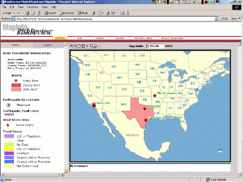
Kimberly Morton (KM): RiskReview™ is a web-based solution that MapInfo has developed for the insurance industry as well as for the re-insurance industry.RiskReview, like any other MapInfo solution, is a global solution.It is an "alert tracking system." It allows insurers and reinsurers to quickly assess risk accumulation across multiple lines of business.
I don't know how familiar you are with these insurance terms, so let me explain some of them."Risk accumulation" is, for example, when 9/11 happened, many insurers didn't know how many policies they had just in the World Trade Center, and not just how many policies they had, but how many policies ran across multiple lines.A "line" of insurance might be auto, home or life, for example. They also might sell multiple products in a line.For example, in auto, you might have your personal auto that you drive, and then perhaps for an ATV vehicle - they could have some specialty lines like for a boat. Now coming back to risk accumulation and 9/11, most insurers didn't know what their PML - "probable maximum loss" - might be as a result of that catastrophic event.
That was when insurance carriers began to embrace mapping and geospatial technology.But to give you some background and history, insurers started to realize this need back in the early 90's, in 1992, when Hurricane Andrew hit in the south.There were certain parts of Florida that were just leveled.So adjusters would go out to talk to claimants and try to assess the damage, and what they found was that there no street signs and there were no landmarks.FEMA helped adjusters at the time, and told them that insurers should attach a latitude and longitude coordinate to each policy.So, going forward, all the adjuster would need to do would be to go out with a GPS unit and establish where a house stood, for example.We saw many of the more progressive carriers start doing this in the 1990s.
But it wasn't until 9/11 that the other carriers jumped in.So that brings us back to RiskReview and the present.With RiskReview, a CEO of a reinsurance carrier could go in and look at different "what-if" scenarios, like "what is the accumulated risk potential we have in this area if a natural catastrophe occurs?" RiskReview will pop up an alert if the risk is high, which allows the reinsurance carrier to get in touch with the insurance carrier and ask them if they realize they're carrying too much risk in the area.
NP: Can you explain reinsurance?
KM: Sure.At times, insurance companies will work with reinsurance carriers to protect themselves so they're not on the hook for tens or hundreds of millions of dollars. Simply put, a reinsurance carrier is an insurance carrier's insurance policy. RiskReview is very helpful in looking at accumulated risk to help with reinsurance issues.
Another area where RiskReview applies is in keeping a handle on the amount of risk coming in via independent agents.In the insurance industry right now, we're starting to see a real shift from using captive agents to using independent agents.A captive agent is an agent who can only sell insurance from a specific company. Independent agents can sell insurance from various insurance companies. So in the past, it was possible for the insurance company to keep a handle on how many policies were being taken on in an area.But with independent agents, it's a lot harder to cap the amount of policies that could be written in an area.Right now, there isn't a good system in the industry to track that.And who is going to be on the hook for too much risk in an area if a catastrophe occurs? Not the independent agent, but the insurance carrier. That's a serious problem.That's exactly what RiskReview helps you do is to look at that alert.It's not that the independent agents are doing anything wrong - they have an incentive to write as many policies as possible - they just don't know how much risk is being accepted in an area, and the insurance carrier needs to know that.
This industry is very conservative, and had been behind the telco industry, for example, in terms of this technology. I think we are being so widely accepted due to Envinsa.We have web service technology and an XML platform.The insurance industry wants to know that if they're going to make investments in IT, that the technology will integrate. RiskReview right now is Java-based, but will be ported over to Envinsa.

Click image for larger
view.
MapInfo's RiskReview
Web-based rating system represents policies geographically to help insurers
understand hotspots and identify where preset limits are being violated
for different policies.
NP: Who might
be the actual user within the company?
KM: We would work with the
underwriters, and we'd also work with the MGA's, or managing general agents.
One of the largest carriers across the globe writes multiple lines and
multiple different products.They might work with an MGA to take on one
specific line, like workers' compensation, for example.Workers' compensation
is a popular insurance product, and big insurance companies have to offer
it.But it can be pretty complicated.Typically, a carrier outsources that
business to an MGA.So then RiskReview is key, because it again lets insurers
look at whether too much risk is being taken on by the MGAs.
RiskReview is basically
MapInfo's core capabilities, but more structured for the insurance industry.
We focus on a per-line of business approach, because that's what insurance
carriers are concerned about.When you talk to those in charge of personal
auto, for example, they might not be concerned with what someone in personal
commercial lines is doing.They just want to know what will help them.
And that's been a real challenge for the IT people in the insurance industry
because they have different groups of people using different solutions.

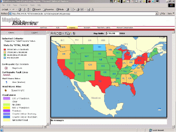
Click image for larger
view.
RiskReview helps insurers
view policies in relation to specific historical threats, such as windstorm,
hail, earthquake and floods, to improve the underwriting process and risk
assessment.
NP: So you're really dealing with some history there of systems that have been implemented over time, which is different from, for example, the telco industry with a more recent IT history.
KM: Yes, very much so.
NP: Could we switch over and talk a little bit about data? Obviously the system needs to have the users' policies loaded into RiskReview, but what about the historical risk data?
KM: Sure.MapInfo has a dataset we're offering that's called RiskDataInfo™, and that's been integrated into RiskReview.Those datasets include historical weather data - information for hurricanes, tornados, earthquakes, hail storms, windstorms and flood data.Right now it's a U.S.dataset.It allows users to run these "what if" scenarios, and it also helps underwriters figure out whether they can write a policy for homeowners, for example.
NP: What's the history of that dataset?
KM: We acquired a company called OnTarget Mapping, with a dataset called HazardData.We decided to take a look at some of the components in that, update it, add some newer data sets, and deliver it to the insurance industry.The flood data comes from a company called First American Flood Data Services (formerly TransAmerica). We also are starting to work with another company called Phoenix Data Systems that has interesting environmental datasets such as soil types, especially for underwriting.
NP: Thank you, Kimberly,
for your time in helping our readers better understand RiskReview and how
it applies in the insurance industry.