Editor's Note: This report is from Royce Jones, who works for the CA/NV/HI office of ESRI in Honolulu.
Yesterday (Monday) our office here in Honolulu still did not have power.
Today we're back up [Tuesday, 10/17].
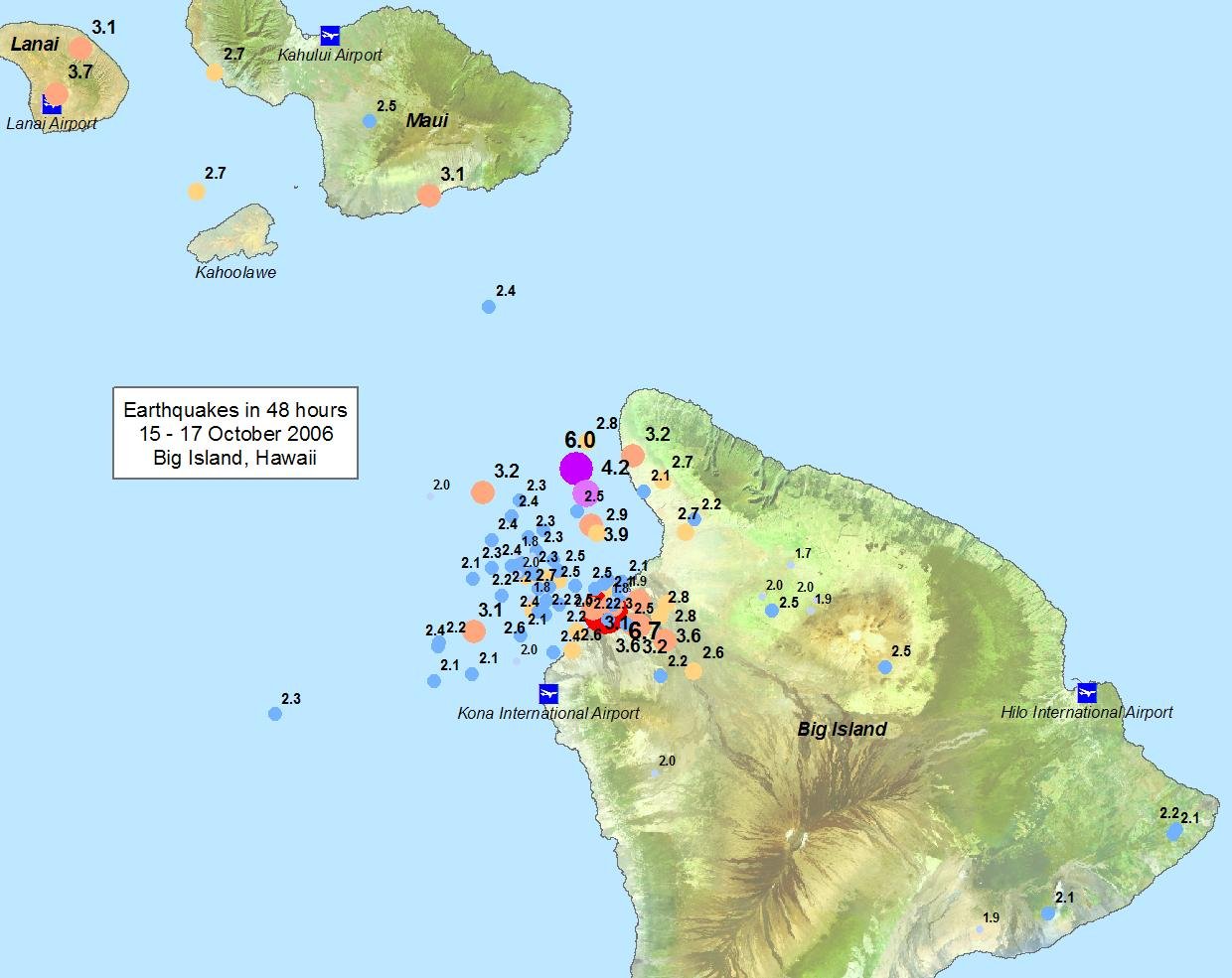
Big Island (Hawaii County) got hit hardest (see attached [graphics]). I have talked with Cheryl Chan (County GIS Coordinator) and offered our help.
Most damage data is being entered into spreadsheets which she will be given to map.
I have also talked with Julie Greely at State Civil Defense. She said that PDC [Pacific Disaster Center] is helping them with maps so they're doing fine right now.
While there was some structural damage on Oahu, the biggest impact was the loss of electricity for more than 24 hours in some places. This then impacted the Honolulu Board of Water Supply since their pumps rely on electricity to refill their water tanks. However power was restored soon enough that this didn't become an issue.
I created them [the maps below] using ArcGIS and data from the USGS. I have the earthquake data as a 3D shapefile and it's interesting to see it in ArcScene with depth shown.
 |
 |