Unmanned aerial vehicles (UAVs) have been used for well over a decade for collection of airborne video to support military operations. Lately, there has been explosive growth in the use of these systems, not only for defense and intelligence customers, but also for civilian purposes. On the civilian front, these systems are well suited for missions that cover broad expanses of terrain or water, such as patrolling borders or monitoring large-scale oil spills, and for support of dangerous operations, such as fighting large forest fires.
The Expansion of Motion Video Platforms and Data
There has also been recent growth in the sophistication, reliability and sheer volume of raw data being collected by UAVs. As the variety of UAVs also grows, it is important to understand some key distinctions among them. The traditional full motion video (FMV) system, which captures video at or near 30 frames per second, is now being supplemented with additional systems that provide much broader coverage and collect airborne imagery at rapid frame rates, such as two frames per second. The resulting wide area airborne surveillance (WAAS) systems, composed of arrays of many sensors, can provide coverage for an entire city, as compared to a single street intersection an FMV might provide. Related systems, designed to provide continuous "eyes" on large areas across a span of days and even weeks, are known as wide area persistence surveillance (WAPS). "Motion imagery" is the overarching term used to encompass the wide variety of collection systems, including FMV, WAAS and WAPS.
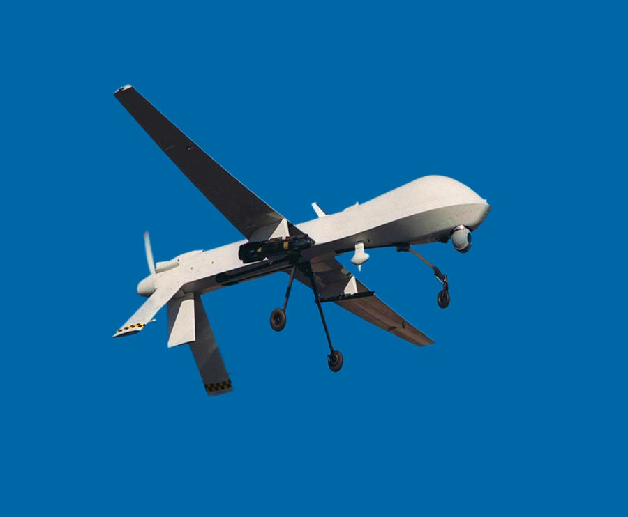 |
The Department of Defense (DoD) is advocating a change in terminology from "unmanned aerial vehicles" to "remotely piloted vehicles" (RPVs) for two key reasons, both of which relate to the term "unmanned" being misconstrued to imply computer-controlled. First, this leads to an improper expectation that fewer personnel are required to operate and maintain these systems. Second, suggesting that these systems are computer-controlled raises concerns regarding reliability and safety. The reality is that these aircraft are piloted by ground-based crews, some located within a line of sight of the aircraft, and others that are located halfway around the world.
Explosion of Video Usage Leads to Concerns Over Managing Data Processing and Exploitation
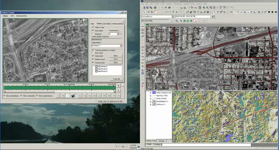
Since the staggering amount of data captured by these systems can be overwhelming, the U.S. DoD and the intelligence community have recently placed a strong focus on improving the ability to process, analyze and disseminate the video and imagery being collected. Integrating these video and imagery feeds with other forms of intelligence, including geospatial intelligence (GeoINT), can better orient operators and analysts to the operational environment, dramatically improving analytical results and decision making ability. For example, if the recently determined locations of known insurgents can be viewed on a map along with real-time video, operators have a better understanding of the situation and are better equipped to guide ground assets in their missions.
The United States Geospatial Intelligence Foundation (USGIF) conducted a series of activities from May 17-21, 2010 under the banner of "GeoINT Community Week," which included exhibits, presentations, workshops and other activities focused on the topic of GeoINT. To emphasize the importance of motion imagery within the GeoINT community, the event culminated with a motion imagery workshop sponsored by several USGIF industry members, including Intergraph. The workshop included several prominent keynote speakers and three panels that focused on an operational view, an intelligence perspective and a strategic vision. Government agencies, such as the U.S. Air Force, U.S. Army, National Geospatial Intelligence Agency (NGA), National Reconnaissance Office (NRO), the Office of the Under Secretary of Defense for Intelligence, and others were represented.
In addition to discussing the significant improvements in the collection of motion imagery, the panels discussed the recent focus on the processing, exploitation and dissemination segments of the overall process. The volume of data being collected is unfathomable and the statistics are staggering. One of the NGA panelists shared his perspective that without some type of automation, it will take 20 times more human analysts to keep up with the demand and volume of data. The increasing number of sensors means that thousands more analysts will be required to analyze every piece of data if automated processing, filtering, fusion and other improvements are not made. This also represents a shift away from "feature-based" GeoINT, which focuses on specific geographic locations and objects (such as roadways, buildings, etc.) and toward "activity-based" GeoINT, which focuses on gaining a better understanding of the dynamic nature of the environment, and then deriving "patterns of life."
There is also a greater demand for forensic video analysis and robust data management, which is absolutely critical for the success of motion video exploitation. If we look back on the history of forensic analysis using DNA testing, we see that robust data management was essential to the success of that process as well. DNA analysis came on the scene in 1985. However, due to proper handling, storage and retrieval of evidence from past cases, lawyers were able to go back five to 10 years and even further to successfully reopen cases, capture criminals and exonerate those who were wrongly imprisoned. Essentially, this ability to apply a modern technique to past cases was possible only with effective data handling and management practices. The same concept can be applied to video analysis. Proper handling and management of video collected today will preserve it, so innovative analysis techniques that have yet to be invented may be applied in the future.
 |
 |
Finding the Enemy, Taking Quicker Action
During the motion imagery workshop's opening keynote, Maj. Gen. James O. Poss, U.S. Air Force, compared the current war in Afghanistan with wars of the past. In World War II, the enemy was easy to find, yet hard to kill. By comparison, today's enemies are hard to find, but easy to kill. The timeframe from an initial cue, or tipoff, to mission execution can sometimes be just a matter of minutes. As these timeframes continue to compress, opportunities for success may quickly disintegrate, unless a motion imagery system is available to improve mission success rates under these conditions. It's worth noting that throughout the workshop, all panelists clearly communicated one message: We must collectively do even more to improve the warfighter's edge over the enemy.
One thing is clear as we step back and look at where we stand together as a community: No one company has all of the answers. Partnerships and collaboration are essential for success. We see a clear need for a convergence of various technologies and tradecrafts. It will take strong collaboration among government, academia and industry to address the current requirements and expectations.
Adhering to Standards Will Accelerate Innovation
A strong adherence to standards allows partnerships to forge at a rapid pace. Standards make it possible to integrate technologies from various companies, academic institutions and government agencies, accelerating innovation within the community. For example, the U.S. Army may desire to integrate innovative technologies from two or more companies in order to create a best-of-breed video analysis solution. If each of these companies has built its respective technologies according to the standards of the Motion Imagery Standards Board (MISB), the technologies can be more easily and quickly integrated. Organizations such as the Open Geospatial Consortium (OGC) and MISB are essential in making the development and adoption of standards a reality. Innovation within the community can truly accelerate only when all can participate, and standards make that possible. Intergraph continues to be a driving force in the development of geospatial and video-based standards. We have also started to forge critical partnerships centered on advancing motion video solutions, and have looked internally to bring together strengths and technologies from various organizations within our company.
Access to video from RPVs and integration of this video in a geospatial context will one day be ubiquitous for military and civilian agencies, even at the local level. A growing number of GIS professionals and analysts will be involved in projects in which video integration is necessary. As companies such as Intergraph continue to seamlessly integrate georeferenced video into a geospatial context in a responsible manner, the industry will see improved mission and project success, and realize even greater benefits.