Ed. note: This article originally appeared on the IRIN website and reprinted here by permission.
The National Aeronautics and Space Administration Agency (NASA) is devising remote sensing methods to monitor the environmental conditions that cause Rift Valley Fever.
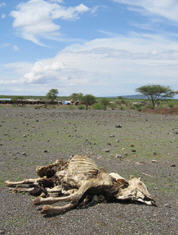 |
This episodic livestock disease, which occurs every five to ten years and can be transmitted to humans, was first identified by a British veterinary surgeon in Kenya more than 50 years ago. It has since been detected across the African continent and as far afield as the Indian Ocean islands of Comoros and Madagascar.
Rift Valley Fever can be transmitted to humans through the handling of animal tissue during slaughtering or butchering, and similar activities, which make pastoralist communities particularly susceptible to the disease.
Infection can also occur through inoculation, for example via a wound from an infected knife or through contact with broken skin, as well as from infected mosquitoes, most commonly the Aedes mosquito.
Remote sensing, a technique that uses recorded or real-time wireless sensing devices to collect information on an object or phenomenon, can be used to determine the environmental conditions that lead to outbreaks.
"The purpose of our research is to provide the first line of defence through international collaborations," Assaf Anyamba, an associate research scientist at NASA's Goddard Earth Sciences and Technology Center, told IRIN during the International Geoscience and Remote Sensing Symposium, Earth Observation - Origins to Application, at the University of Cape Town.
"The satellite information we collect and analyze to produce end-user products is then disseminated to our partners; the Food and Agricultural Organization (FAO) takes care of livestock-related disease threats, while the World Heath Organization (WHO) deals with the information relating to human health," he said.
Mapping environmental conditions
Researchers use a variety of remote sensing measurements, including sea surface temperatures, rainfall and vegetation, to predict when parts of Africa and the Middle East might become vulnerable to Rift Valley Fever, which is triggered by persistent, above-normal levels of rainfall in drought-prone areas.
The Horn of Africa experienced outbreaks in 1997-98 and 2006-07 when El NiÑo struck, bringing the atypical weather patterns associated with a rapid spread of the disease that killed nearly 3,000 people and thousands of livestock.
El NiÑo is the abnormal warming of surface ocean waters in the eastern tropical Pacific, usually around Christmas, which often occurs simultaneously with the see-saw pattern of reversing surface air pressure between the eastern and western tropical Pacific, called the Southern Oscillation.
"We also produce risk maps based on satellite vegetation data to pinpoint exactly where potential danger lies, as newly formed vegetation usually means rain has just fallen. We can then provide public health officials with an efficient way of being able to focus their resources for control and prevention efforts," Anyamba said.
A drawback in remote sensing is the inability of satellites to penetrate cloud cover, but a pilot project by scientists from Denmark's University of Copenhagen to test new and improved optical systems is underway at weather stations in Senegal, Mali and Kenya.
"The issue is to be able to provide data with a turnaround of three to five [cloud-free] days ... as the whole point of an early warning system is the timeliness of the data," Anyamba said.
Attention for neglected diseases
A number of diseases that have either been neglected or not wholly understood are prevalent in Africa, and it is hoped that the use of remote sensing will also provide a greater understanding of these.
One of them, Buruli ulcer, a treatable but neglected disease caused by the family of bacteria also responsible for tuberculosis and leprosy, is estimated by WHO to affect more than 40,000 people annually in West Africa alone.
Infection leads to the "extensive destruction of skin and soft tissue, with the formation of large ulcers usually on the legs or arms", according to WHO, and "patients who are not treated early often suffer long-term functional disability, such as restriction of joint movement as well as the obvious cosmetic problem."
According to WHO how infection of Buruli ulcer occurs was not entirely understood.
The reservoir of Buruli ulcer is not known, but scientists and software engineers from Jenoptik, a German defence and civil systems company, have teamed up with the Swiss Tropical Institute to find the source of the disease and map risk areas.
Two studies in Cameroon and Ghana have uncovered several different types of Buruli ulcer, contradicting the assumption that only one type existed, which often led to ineffective treatment.
Kathrin Weise, a Jenoptik software engineer, noted: "The land cover classification and statistical methods ... will be used in our projects to map risk areas and environmental conditions for an outbreak of epidemics of different vector-borne diseases like malaria, meningitis, and Buruli ulcer disease."