In March, American Sentinel University announced new learning tools for students in its Master of Geospatial Information degree program including a learning lab and competency-based badges (press release). Directions Magazine interviewed Dr. Stephen McElroy, GIS program chair at American Sentinel University, who spoke about these innovations at this year’s Association of American Geographers meeting in Los Angeles in early April.
Directions Magazine (DM): How does the Learning Lab environment go beyond discussion threads and Facebook groups often used in online classes?
Stephen McElroy (SM): We deployed a number of educational technologies, such as VoiceThread, Yammer and other interactive, multimedia resources to facilitate the interaction and exchange of ideas and information. Discussions in the classroom and in the online environment are simply a difference in the format. Standard text-based discussion forums are a good way to get students involved. They are useful for posing questions to the group and for responding with a few sentences or paragraphs, but they have significant limitations.
The use of a more interactive multi-media platform like VoiceThread takes the discussion to the next level. We want to leverage the functionality of VoiceThread within the Geospatial Learning Lab as much as possible. Simply put, VoiceThread is a tool for having conversations around media. Using VoiceThread, students can interact using images, videos, documents and other media. They can add to the conversation by commenting in a variety of ways, including via telephone, webcam, microphone, text and file upload.
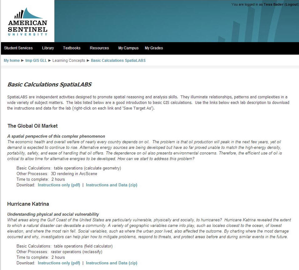
VoiceThread enables a group to have an asynchronous conversation around a specific topic – this is vital to the online learning environment in which students are located around the country and find it difficult to interact at the same moment in time.VoiceThread and Yammer are the two primary interaction tools. We hope to implement a single sign-on [for both technologies], but we have not gotten there yet.Figure 1: Some exercises in the Geospatial Learning Lab are from Esri’s SpatiaLABS (click for larger image).
DM: Do other programs at the university host similar labs?
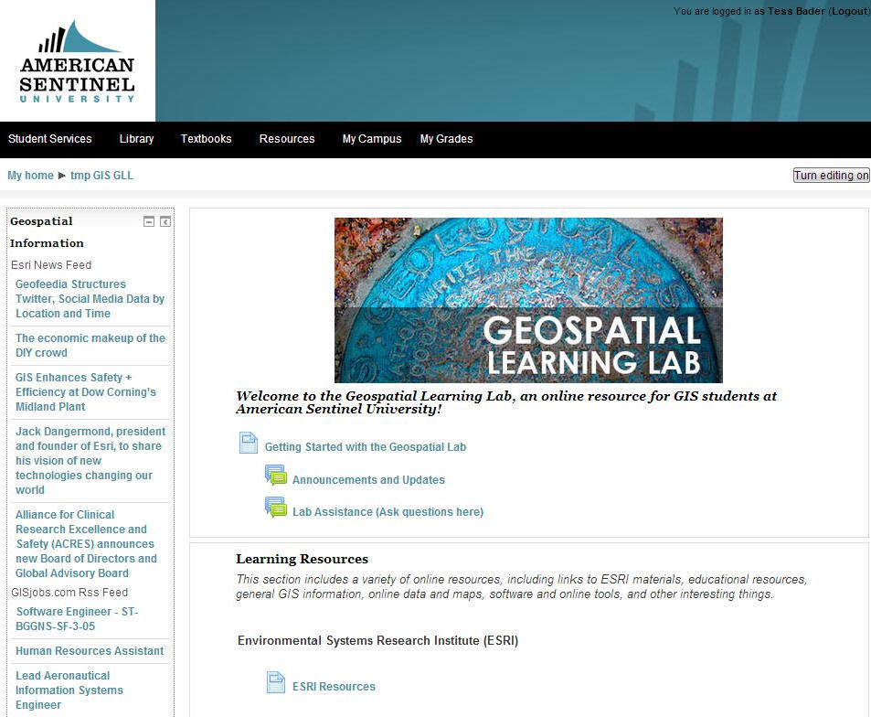
SM: No. The Geospatial Learning Lab is the first university initiative of its kind at American Sentinel University.Figure 2: The homepage of the Geospatial Learning Lab (click for larger image).
DM: What was the motivation to build the Geospatial Learning Lab? Did you seek advice from outside the university?
SM: It was an internal idea that we developed over time. The badge concept as applied in other contexts was appealing, so we decided to apply it to competency-based learning for geospatial information systems.
DM: There are three levels of badges in six content groups. How are these achieved? By quiz? Participation in the lab?
SM: To track student achievement, we implemented an online badging system in which students are issued a badge (basic, intermediate or advanced) upon the demonstration of specific competencies in one of five concept groups: geospatial data management, geoprocessing, remote sensing and imagery, spatial modeling / raster analysis, and spatial statistics. Students incorporate their badges into an ePortfolio that documents student learning throughout their studies.
To achieve a badge, a student must complete a series of prescribed activities. Currently, the completion of these activities must be evaluated by a qualified individual, but we hope to construct an automated mechanism to track, evaluate and issue the badges.
DM: The Learning Lab was designed as part of the new online Master of Geospatial Information degree program. If successful, could it, perhaps with different content, be used in the undergraduate degree/grad certificate program, as well?
SM: The Geospatial Learning Lab complements the GIS degree programs, including the AS, BS and MS levels of study. It also serves the broader university by providing a mechanism to support an initiative to implement geospatial thinking across the curriculum. The Learning Lab also promotes the use of aspects of GIS and geospatial technologies in other university courses. This includes university courses in business, healthcare, computer science and information technology. Although GIS students are the primary focus, all university students will be able to utilize the Geospatial Learning Lab to develop geospatial skills related to their discipline.
DM: When will the Learning Lab be up and running? Or is it already? If so, what’s the early feedback?
SM: The Learning Lab initially went live for a short round of beta-testing and since then we have taken it offline to improve it to make it a better tool for students. We expect the Learning Lab to be officially up and running by Memorial Day.
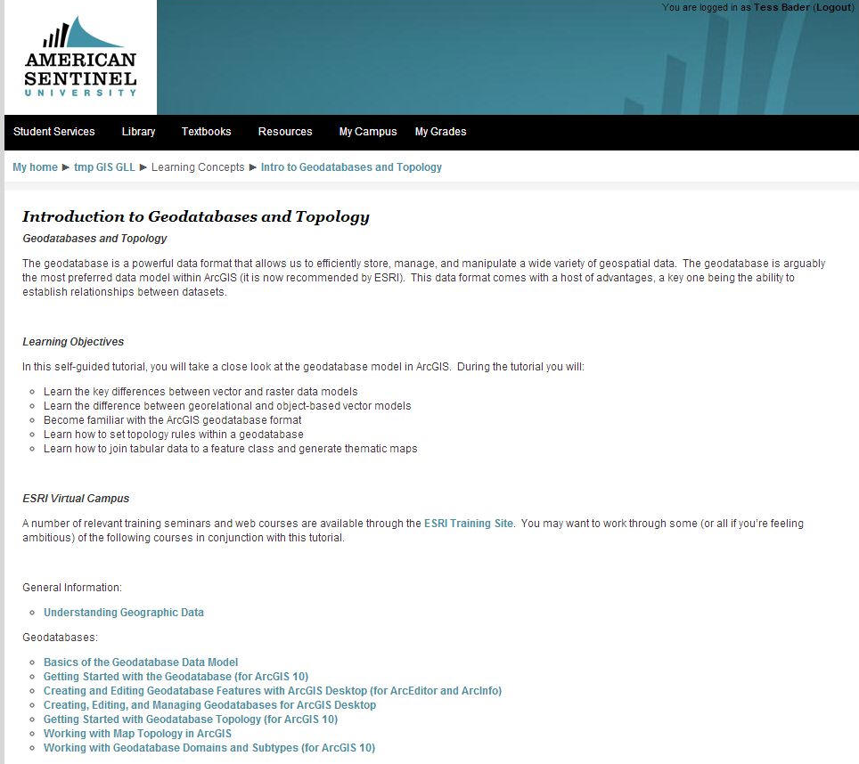
Figure 3: Tutorials and Esri Virtual Campus courses are available through the Geospatial Learning Lab (click for larger image).
From Our Homepage
Saying Farewell to an Amazing Journey
Communicating with Maps
Is There a GIS Career Ladder?
What does it mean to be geospatially smart? Series
Ways Real Estate and Property Developers Utilize Melissa GeoData for Data-Driven Decisions
Unlocking Value From Daily Satellite Imagery and Insights
Maximizing the Value of Your Address Data with Geo Addressing
How Indoor Mapping Enhances the Security of Smart Buildings
Look Ahead: AI, Location Intelligence and Efficiency
Collaboration Takes on Sea Level Rise & Dynamic Technology Environments
Brownies for Brownfields
Has Everything Been Mapped Already?
How Is Data Literacy Changing in an Artificial Intelligence Landscape
Portfolios for GIS Professionals: More Than Just Maps
How to Create a Distance Matrix in QGIS - A Step-by-Step Guide
7 Ideas for Bringing GIS into the K-12 Classroom
The Geography of Movement