As chairman of the Rocket City Geospatial Conference, I had a front row seat (literally) in observing how emotional the issue of collecting, maintaining and sharing geospatial data and metadata has become. This is especially true for those whose job it is to process, analyze and distribute information to politicians and other government officials. The conference was held on November 17th and provided a forum for state and local officials, as well as technology providers.
Why does the issue of data collection and dissemination elicit such an emotional response? First, it's not easy getting cooperation to share data from the "herd of cats" known as county and city government - and with good reason. They are often the ones paying for data collection initially. Second, the job of collecting data is never finished. I made a statement that much of the data necessary to perform spatial modeling has been collected already and that we should move on to the job of analysis and not become so enamored with simply visualizing geospatial information. I was swiftly corrected by those closer to the problem. What I failed to appreciate was that while abundant data are available today from many sources, having access to the timeliest, most current information is essential. Old data just won't cut it especially when critical infrastructure is the focus of many projects. In addition, more data are being collected than ever before. Airborne and ground-based data collection instruments that capture billions (think LiDAR) of data points are capable of churning out image maps that require expert interpretation. But, you can't put these kinds of data in the hands of politicians ... just yet.
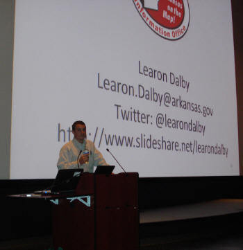 |
Learon Dalby, past president of the National States Geographic Information Council (NSGIC), GIS coordinator for the state of Arkansas and keynoter for the conference, stated that millions of sensor data points from passive crowdsourcing are and will be collected from location-aware devices. "The phone is going to become the primary I/O device for geodata in the near future," said Dalby. So, while our more traditional sources of data collection (remote sensing, surveying, etc.) provide increasingly accurate and near-real-time data, new sources of location-based information will also be inundating geospatial databases.
The challenge for geospatial professionals is, according to Dalby, "to be relevant." Dalby made it clear that presentations to governors, mayors and emergency management directors using maps must be cogent, direct and succinct. The question I would pose is whether the new visualization tools with simple pin or thematic maps are taking precedent over more in depth spatial analysis? Is a pin map worth 1,000 words for the public relations people?
The answer is not that politicians are incapable of understanding "heat maps" or spatial interaction models. It is more a matter of getting geospatial information at the ready to be presented quickly. In the case of a small town, like Prattville, Alabama, a town of 35,000 people, GIS coordinator Ryan Pecharka must serve many different agencies. Speaking at the conference, Pecharka described how he supports the fire, police, emergency management, planning and engineering departments with geospatial information. With more data coming in all the time, good visualization tools can be tremendously helpful. Will tools like Google Maps supplant his GIS? Perhaps not, but they may supply ancillary baseline data that he might not have been able to afford or have had time to collect otherwise.
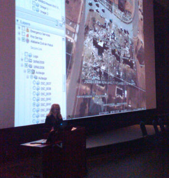 |
Virtual Alabama, a Google Earth Enterprise Web service repository, provides statewide imagery to county and city governments. Imagery collected by one county can be shared statewide through the Web service as long as the collecting authority retains control. The shared resources of Virtual Alabama present questions about whether a statewide spatial data infrastructure (SDI) is necessary. Does Virtual Alabama provide a kind of SDI platform for the state? Or is a central, statewide clearinghouse for data more appropriate with a common data model where all counties must conform to certain geospatial specifications?
While the answer is not simple, expediency certainly plays a big part. After Hurricane Katrina hit the state's coast in 2005, Governor Bob Riley turned to the state homeland security director, Jim Walker, to fix the problem and Virtual Alabama was the outcome. It was not necessarily the product of extensive forethought and planning around how the state could use GIS to conduct business. Rather, the incentive was the very immediate need to know where to dispense federal funding and how to get problems fixed in a hurry. In November 2007, Riley signed an executive order establishing the Alabama GIS Executive Council. Today, the state's Geospatial Office and the GIS Executive Council are running at full speed, working on a variety of initiatives, collecting data and getting those data to the people who need them.
So, while discussions about platforms, visualization and which GIS to select are necessary, the emphasis among state and local geospatial leaders will continue to be "all about the data." They will be "all about the data" as long as timely and more accurate information can be obtained in near real-time. As long as satellites bring higher resolution imagery, it will be "all about the data." And as sensor networks and community-sourced location-based data begin to flood our information solutions, it will continue to be "all about the data."