Autodesk shared details of its next iteration of
AutoCAD and non-AutoCAD-based products last Thursday and Friday. Here's
a brief rundown of some of the products and features of interest to the
geospatial community.
AutoCAD
One big change in AutoCAD 2010 will impact everyone who uses DWG files. There's a new "enhanced," aka "different," file format. AutoCAD 2010 includes the "SaveAs" command to create drawings in recent DWG formats. The SaveAs AutoCAD Release 12 DXF command should work for those needing access to data in older formats. It's unclear when products that read DWG (via their own, third-party or the Open Design Alliance code) will be able to read the DWG 2010 format.
The enhanced functions in AutoCAD of particular interest to mapping users include PDF import and underlay tools that integrate PDF'd data into the drawing environment. There are also more options for PDF output. Autodesk at one time pushed its DWF as the answer for sharing, but demand for PDF integration has clearly guided these additions. I saw no mention of GeoPDF, however. 3D printing capabilities may be useful for those who produce physical models of their designs or analysis.
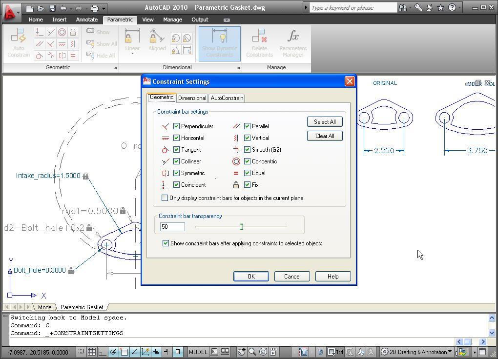
Autodesk highlighted tools aimed more at designers, including "free-form design" that allows "pushing and pulling" of faces and edges, and integration of smooth surfaces which makes design more like reshaping a true 3D feature with your hands. There's also parametric drawing, where constraints limit what changes can be made. For example, if two lines are meant to remain parallel (say the edges of a roadway), the user will not be able to "get around" that limitation. Enhancements to "blocks" (reused items in a drawing) streamline their creation and editing.
AutoCAD Map 3D
AutoCAD Map 3D inherits its base from AutoCAD 2010 and includes its own set of enhancements geared to mapping and geospatial users.
The user interface sports a customizable ribbon-style menu that aims to reduce the number of steps required to access commands. There's also support for 64-bit operating systems.
The reprojection tools for raster imagery accessed through Feature Data Object (FDO) Data Access Technology have been updated to be more accurate. Recall that FDO is an open source software technology that allows a software package to access and share spatial and nonspatial information. Editing tools for features and attributes both get a boost. There are new object snap options including intersection, extension, apparent intersection and parallel object snaps. The Properties Palette now allows ending of attributes of several features at one time.
There's a new FDO data provider for Microsoft SQL Server Spatial available to all, but the FDO Provider for GE Smallworld is only available to Autodesk Subscription members. As with many software vendors, an annual subscription program includes extra tools, support training and software upgrades. There are more survey tools aimed at better integration of data from traditional survey methods.
New to AutoCAD Map are the geospatial analysis commands that include intersect, union, erase, identity, clip, paste and symmetric difference analysis. What is symmetric difference analysis? "A symmetric difference analysis overlay defines an output area that includes the total area of both inputs except for the overlapping area." (I had to look it up in Wikipedia.)
It's possible, via new analysis tools, to combine FDO datasets. A new Expression Builder can create composite queries that apply across multiple FDO data sources.
Frankly, the most interesting enhancement is the ability to automate tasks via the Windows Workflow Foundation (WF). The WF offers a visual editor (similar to the ESRI Model Builder or FME Workbench, if you are familiar with those products) that links together commands and can ask for user input in simple or complex workflows. In the presentation, WF was touted as a way for less experienced users to perform more complex work, and a way of documenting workflows "in people's heads."
If I understand it correctly, the strange name comes from the underlying Microsoft technology called Window Workflow Foundation. I'm curious why this was implemented in Map first and not introduced into core AutoCAD.
Autodesk MapGuide Enterprise
Autodesk's MapGuide Enterprise is a packaged and supported version of the MapGuide Open Source Web mapping platform. MapGuide Enterprise boasts performance enhancements, new on-the-fly reprojection of raster content, FDO support for Microsoft SQL Server 2008 Spatial and GE Energy Smallworld, and better error reporting. The package also benefits from the open source community: OpenLayers' libraries can tap into MapGuide Enterprise and MapGuide Open Source as data sources. In short, OpenLayers can serve as a client-side scripting toolkit.
MapGuide Studio (the authoring package for MapGuide Enterprise) is available for free download for Enterprise customers. It appears that Enterprise customers can use more than one copy at no additional cost.
Launch Videos
Autodesk has made the launch videos available on the Web (registration required):
AutoCAD 2010
Architecture, engineering, construction, utilities and geospatial industries
Availability
aProduct availability details were not shared. Visit the Purchase Options website, starting March 24, 2009, for the most up-to-date information.
AutoCAD
One big change in AutoCAD 2010 will impact everyone who uses DWG files. There's a new "enhanced," aka "different," file format. AutoCAD 2010 includes the "SaveAs" command to create drawings in recent DWG formats. The SaveAs AutoCAD Release 12 DXF command should work for those needing access to data in older formats. It's unclear when products that read DWG (via their own, third-party or the Open Design Alliance code) will be able to read the DWG 2010 format.
 |
The enhanced functions in AutoCAD of particular interest to mapping users include PDF import and underlay tools that integrate PDF'd data into the drawing environment. There are also more options for PDF output. Autodesk at one time pushed its DWF as the answer for sharing, but demand for PDF integration has clearly guided these additions. I saw no mention of GeoPDF, however. 3D printing capabilities may be useful for those who produce physical models of their designs or analysis.
Autodesk highlighted tools aimed more at designers, including "free-form design" that allows "pushing and pulling" of faces and edges, and integration of smooth surfaces which makes design more like reshaping a true 3D feature with your hands. There's also parametric drawing, where constraints limit what changes can be made. For example, if two lines are meant to remain parallel (say the edges of a roadway), the user will not be able to "get around" that limitation. Enhancements to "blocks" (reused items in a drawing) streamline their creation and editing.
AutoCAD Map 3D
AutoCAD Map 3D inherits its base from AutoCAD 2010 and includes its own set of enhancements geared to mapping and geospatial users.
The user interface sports a customizable ribbon-style menu that aims to reduce the number of steps required to access commands. There's also support for 64-bit operating systems.
 |
The reprojection tools for raster imagery accessed through Feature Data Object (FDO) Data Access Technology have been updated to be more accurate. Recall that FDO is an open source software technology that allows a software package to access and share spatial and nonspatial information. Editing tools for features and attributes both get a boost. There are new object snap options including intersection, extension, apparent intersection and parallel object snaps. The Properties Palette now allows ending of attributes of several features at one time.
There's a new FDO data provider for Microsoft SQL Server Spatial available to all, but the FDO Provider for GE Smallworld is only available to Autodesk Subscription members. As with many software vendors, an annual subscription program includes extra tools, support training and software upgrades. There are more survey tools aimed at better integration of data from traditional survey methods.
New to AutoCAD Map are the geospatial analysis commands that include intersect, union, erase, identity, clip, paste and symmetric difference analysis. What is symmetric difference analysis? "A symmetric difference analysis overlay defines an output area that includes the total area of both inputs except for the overlapping area." (I had to look it up in Wikipedia.)
It's possible, via new analysis tools, to combine FDO datasets. A new Expression Builder can create composite queries that apply across multiple FDO data sources.
Frankly, the most interesting enhancement is the ability to automate tasks via the Windows Workflow Foundation (WF). The WF offers a visual editor (similar to the ESRI Model Builder or FME Workbench, if you are familiar with those products) that links together commands and can ask for user input in simple or complex workflows. In the presentation, WF was touted as a way for less experienced users to perform more complex work, and a way of documenting workflows "in people's heads."
If I understand it correctly, the strange name comes from the underlying Microsoft technology called Window Workflow Foundation. I'm curious why this was implemented in Map first and not introduced into core AutoCAD.
Autodesk MapGuide Enterprise
Autodesk's MapGuide Enterprise is a packaged and supported version of the MapGuide Open Source Web mapping platform. MapGuide Enterprise boasts performance enhancements, new on-the-fly reprojection of raster content, FDO support for Microsoft SQL Server 2008 Spatial and GE Energy Smallworld, and better error reporting. The package also benefits from the open source community: OpenLayers' libraries can tap into MapGuide Enterprise and MapGuide Open Source as data sources. In short, OpenLayers can serve as a client-side scripting toolkit.
MapGuide Studio (the authoring package for MapGuide Enterprise) is available for free download for Enterprise customers. It appears that Enterprise customers can use more than one copy at no additional cost.
Launch Videos
Autodesk has made the launch videos available on the Web (registration required):
AutoCAD 2010
Architecture, engineering, construction, utilities and geospatial industries
Availability
aProduct availability details were not shared. Visit the Purchase Options website, starting March 24, 2009, for the most up-to-date information.
From Our Homepage
Saying Farewell to an Amazing Journey
Communicating with Maps
Is There a GIS Career Ladder?
What does it mean to be geospatially smart? Series
Ways Real Estate and Property Developers Utilize Melissa GeoData for Data-Driven Decisions
Unlocking Value From Daily Satellite Imagery and Insights
Maximizing the Value of Your Address Data with Geo Addressing
How Indoor Mapping Enhances the Security of Smart Buildings
Look Ahead: AI, Location Intelligence and Efficiency
Collaboration Takes on Sea Level Rise & Dynamic Technology Environments
Brownies for Brownfields
Has Everything Been Mapped Already?
How Is Data Literacy Changing in an Artificial Intelligence Landscape
Portfolios for GIS Professionals: More Than Just Maps
How to Create a Distance Matrix in QGIS - A Step-by-Step Guide
7 Ideas for Bringing GIS into the K-12 Classroom
The Geography of Movement