Editor-in-Chief Joe
Francica
traveled to Baltimore to adjudicate the Bentley Systems annual Awards
of
Excellence in geospatial technology held in conjunction with their
user's
conference.Below are the winners and an explanation of the reasons why
these
projects were selected from among the 44 submitted entries.
| Award Category | Project Name - Submitting Organization | Project Information and Highlights | Examples from Project |
| Communications | KeySpan Communications Corp.Fiber Network | Company
Profile:
KeySpan Communications manages a network of 66,000 miles of fiber optic
cable in New York, Long Island and New Jersey.The company's mission is
to support broadband services to meet all their telecommunications
needs
while providing the opportunity to connect to more than 100 service
providers for voice, Internet and video requirements.
Project Overview: In 1998, the company realized the need to upgrade the CAD systems to manage a growing fiber network. Results Achieved: Bentley Fiber and Bentley Inside Plant software was implemented to more effectively address troubleshooting, tracking customer circuit data and restoring service in the event of an outage.The amount of engineering time was significantly reduced over conventional methods for identifying strand availability and splicing strategy.The investigative time to detect outages is anywhere from two to four hours, showing a significant reduction in down time.Other applications include a complete pole attachment database to track pole licensing and fees to produce circuit traffic and fiber usage data reports for regulated utility back charges. Editor's Comments: The services that KeySpan provides to the regional growth of the communication infrastructure were key to being recognized in this category.Although KeySpan only manages a limited area of the infrastructure, it is critical to the growth of their business and for maintaining the "up time" for their customers and that their technology be reliable.The company reported zero hours downtime related to hardware, software or data loss during the last three years.The data was kept at 98% "real time" accuracy. |
 Click for larger image |
| Geospatial Modeling | Japan Conservation Engineers Examples of Construction of Landslide GIS | Company
Profile:
Japan Conservation Engineers Co., Ltd.was the consultant to several
municipalities
on a contract to model landslide potential and help them develop early
warning solutions.
Project Overview: Users can now evaluate three-dimensional cross sections in a system called Landslide GIS using MicroStation and Geopak.Grid data is being generated from modeling sliding mass or slipping surface in the system for three-dimensional analysis. Results Achieved: Because several large areas had to be evaluated and modeled, time savings were realized in the revision of technical drafts for 3D map visualization. Manual drafting was eliminated and now cross section models are consistent. Editor's Comments: In terms of impact upon the community, this project provided critical information regarding landslide potential, in particular in areas where landslides have already occurred such as the Sumikawa district in Akita, Douzan River district in Nagasaki, and Sounzan district in Kanagawa.The analysis now provides information for planning and prevention and forms the basis for simulation models.The project was comprehensive in scope and showed the potential of integrated civil engineering information with geospatial data. |
 Click for larger image |
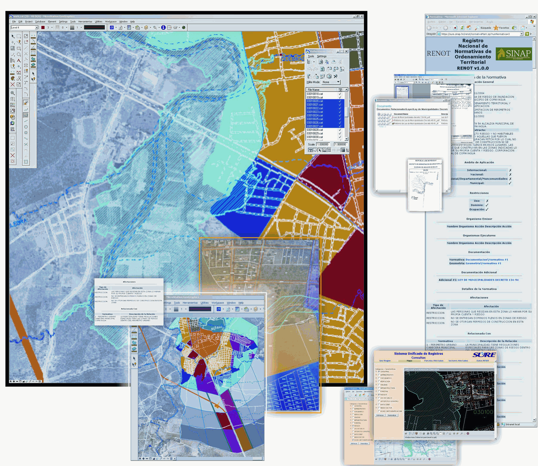
| Government | PATH RENOT | Company
Profile:
The National Registry of Territorial Ordering Norms/Laws (RENOT) is
part
of the National System of Property Administration (SINAP) and is a
pivotal
tool of the Honduras Land Administration Project, or PATH.
Project Overview: The system has been conceived with the purpose of administering and publishing the administrative rights that emanate from the institutions that have law ministry in the territorial ordering field in Honduras.The scope of administration and publishing extends to the geometric and alphanumeric attributes of these norms and their respective legal reference.The development of the first phase of RENOT started in July of 2004 and was finalized in December of the same year.This first phase includes the administrative registry process, storing of documents and zoning (vector) management via MicroStation GeoGraphics with Oracle Spatial.In the second phase, RENOT will have a full connection with the cadastral and land registry system. Results Achieved: The key benefit of this project was data integration, both legal and administrative, in a single zoning system.Analytical processing to determine parcel with zoning information was achieved.Cadastral and zoning information was published via an Intranet.The time to create a single map was reduced by a factor of four.The time to perform zoning analysis was reduced from three days to 15 minutes. Editor's Comments: In a capitalist society, taxation forms the backbone of a government's ability to provide services.Land registry is the means by which taxation is managed and you can't have land registry without maps.In Honduras, the country has established a nationwide land registry repository and it is an impressive feat to have these resources online to the public so that laws established by the Public Registry are easily accessible to the general public. |
 Click for larger image |
| Managed Environments | Total E&P Nederland B.V. | Company
Profile:
Total E&P Nederland is an oil exploration and product company.Its
parent company, Total, is based in Paris.
Project Overview: This specific project focused on implementing a solution where all graphic files for the Geosciences division were to be stored in a central database. Because of the dispersed location of many thousands of map documents, the project's objective was to create a geospatial index of these documents for geoscience professionals via an Internet application. Results Achieved: Bentley's ProjectWise was implemented to create the spatial index.Two thousand maps and 20,000 graphics files were indexed within a four week period. Editor's Comments: To begin a geological investigation of a suspected oil reservoir requires massive amounts of information, most of which has been captured on a map. It helps that when a specific area is first identified that all available map data be gathered as quickly as possible.Total now has these resources indexed for searching using a web-based application. |
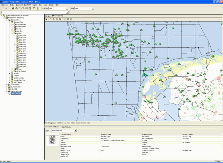 Click for larger image |
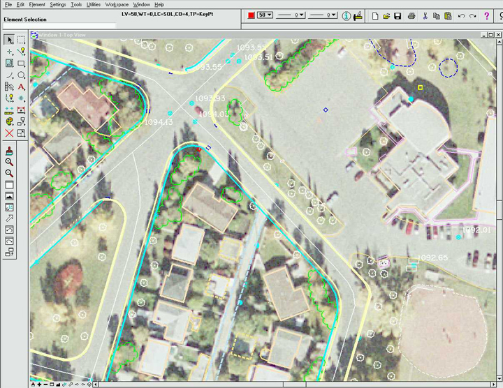
| Mapping & Cadastre | The City of Calgary Base Mapping Management Program | Company
Profile:
The City of Calgary, Alberta, Canada has had an ongoing project to
develop
a corporate-wide GIS since 1990.The base mapping project has been
evolving
over this period in which MicroStation was used to capture geographic
information
including four primary elements: the cadastral base, parcel fabric,
single
line road network and digital aerial survey.
Project Overview: These integrated production systems are tied to multiple Oracle databases as well as the Corporate addressing system.They are maintained/accessed concurrently.All base mapping products overlay seamlessly in the Calgary 3TM coordinate frame.As a result, Calgary enjoys highly accurate and rich information in all the engineering, emergency dispatch, utilities and asset management, transportation and planning business functions both in the CAD and GIS environments within and across the city. Results Achieved: The most significant impact of this project has been made within the customized base mapping environment centers around the maintenance of the addressing and parcel mapping systems and workflows.The city reports that through customization utilizing MicroStation MDL and associated applications, with some minor modification of the supporting database schemas, they were able to integrate the parcel application with the addressing system, thereby virtually eliminating the possibility of creating mismatches. Augmenting this with automated QA and reporting, the city has reduced the number of address/parcel anomalies to approximately 2,000 from 8,000 (less than 1% of the total 300,000), a number that is still improving. Editor's Comments: What is impressive about this project is that while many cities talk about the "integrated city" approach, few have attempted it; fewer have accomplished it.Calgary seems to be doing it in spades.The city relies heavy on customized MDL applications and an Oracle database.Even agencies like police and fire that are typically skeptical about sharing data leverage the central database of base maps, address layer and parcel layers. |
 Click for larger image |
| Public Works | City of Toronto-Toronto Water Integrated Network Skeletonization (TWINS) | Company
Profile:
The Survey & Mapping Unit of the Technical Services Division of the
City of Toronto maintains an as-built mapping environment that emulates
the real world network with 307,956 pipes/segments.The system
architecture
includes MicroStation 2004, GeoGraphics, Bentley Water and Oracle.The
Bentley Water data model has been extended to include feature
attributes
to populate the City's data warehouse and work order management
system.
Project Overview: TWINS is the project that was designed to provide information about the water features that are essential to the operation and maintenance of the water system.The Canadian climate increases the occurrences of water main breaks and potential service disruption.With the acquisition of Bentley WaterGEMS, the City began to generate the twin water network; a less granular data set to support current business processes. Results Achieved: The project was launched in December 2004, approx.five days of staff time was required to develop the conversion rules, the pilot conversion was confirmed in January 2005, and the existing network is scheduled for completion by February 2005 to coincide with the start of Capital Works Planning.The cost of not creating a twin presented a risk that the Physical Water Network with its increased level of detail would disable the asset management and capital planning activities. Editor's Comments: What was impressive about this project was simply that the city undertook this project at all.Many cities of similar size and with similar resources have not undertaken modeling on this level of complexity.Toronto's 3D surface and subsurface infrastructure models takes political commitment and dedicated resources, both financial and technological.As impressive, the technology managers recognized that much of the work of the project could be accomplished with Skelebrator, a $2,000 product by Haested Methods, a company acquired by Bentley.The city estimates that this software solution is "cheap" compared to the estimated cost of CAN $1.1 Million to create and maintain a skeletonized network over the next 10 years. |
 Click for larger image |
| Utilities | AEM Cremona SIT AEMCR | Company
Profile:
AEM Cremona is a consultant to the city of Cremona, Italy.
Project Overview: AEM manages several tasks for the city including utility networks, road signals, transportation, waste collection, environment management.The objective of this project was to have integrated tools capable to effectively reference a single database framework. Results Achieved: The main benefit achieved in this project was improved business process management.AEM Cremona was able to improve the quality of services internally and to the city.The company solved interaction problems between different products, and they are now able to import, read and edit native data from different tools. Editor's Comments: Even smaller cities can benefit from a more integrated spatial data management implementation. |
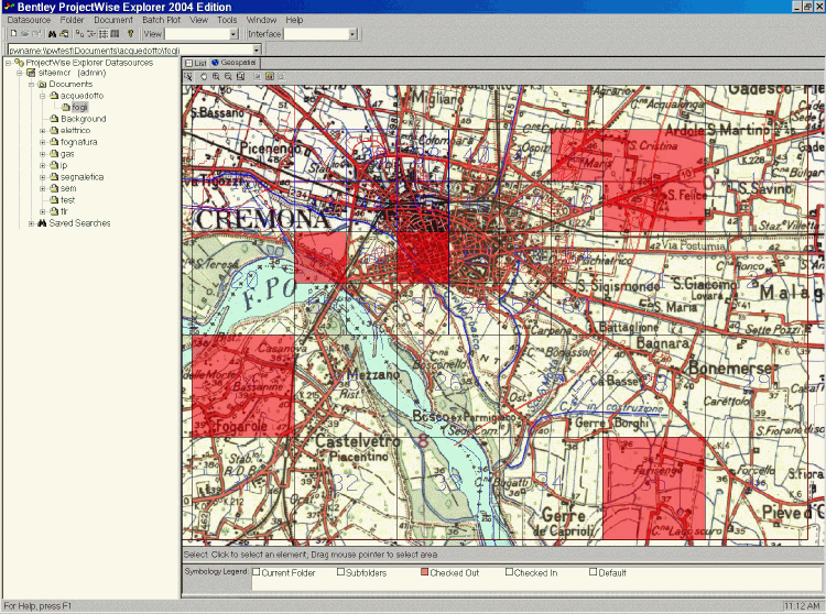 Click for larger image |
| Well-trained Organization | Indiana DOT CAD Training | Company
Profile:
The Indiana Department of Transportation (INDOT) has been using Bentley
products to create road designs and drawings since 1997.
Project Overview: INDOT has a significant investment in Bentley products.They also had a major project that demanded significant and "trained" resources to accomplish the mission of the project. Results Achieved: There are 15 different departments or functions at INDOT using various Bentley products in a variety of ways to aid road planning, design, construction and maintenance processes.In the past, some of these functions used different software and file structures that complicated the flow of information through the enterprise.INDOT needed an improved enterprise system to manage the flow of a project through planning, survey, land acquisition, design and construction, as well as the archiving of all design, construction and maintenance information.To accomplish all of these objectives, INDOT and Bentley developed 10 workspaces and custom training classes. Editor's Comments: The interesting fact here is that INDOT recognized the need to not only standardize on software but recognized that standard training at the same time to the staff responsible for the project was necessary to maintain a consistency to project maintenance.Having all team members train at the same time on the same software allows them to obtain a knowledge base consistent with the goals of the project without the fragmentation of personal expertise and experience. |
 Click for larger image |
Source: Some information presented above was provided by Bentley Systems in their nomination reports of each project.