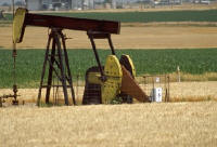
 Oil and
gas exploration relies on decades' worth of documents that have been
generated and/or purchased by oil companies to aid in exploration,
drilling, production and all facets of upstream activities. As a
result, energy companies invest billions of dollars each year gathering
and processing data contained within these documents. Organizing these
data can translate into a competitive advantage for the exploration of
natural resources.
Oil and
gas exploration relies on decades' worth of documents that have been
generated and/or purchased by oil companies to aid in exploration,
drilling, production and all facets of upstream activities. As a
result, energy companies invest billions of dollars each year gathering
and processing data contained within these documents. Organizing these
data can translate into a competitive advantage for the exploration of
natural resources. Structured databases have helped manage much of the data explorers use, but most data is not structured. According to the National Science Foundation, approximately 80% of information stored within an enterprise is "unstructured" content that does not fit properly into a relational database. Unstructured content includes information found in emails, messages, Web pages, reports, analysis, well and field reviews and correspondence. According to research conducted by the Gartner Group, about 80% of business decisions are made based on this type of information. Compounding the difficulty is the fact that unstructured data is growing at a rate of 60% per year, according to the National Science Foundation.
If users could leverage all historical data, both structured and unstructured, to understand why decisions were made in the past, an exploration team could make smarter and more cost-effective decisions for the future. There are massive amounts of information found in all corners of an organization, but organizing these data is a difficult and costly enterprise. Leveraging the geography within documents provides a simple means of organizing information in a way that people understand.
To use the mountains of information that companies in this industry have, you might ask, "How can we possibly ‘georeference' thousands, if not millions, of pieces of data and information?" After all, manually georeferencing data is a Herculean effort that is cost- and time-prohibitive. MetaCarta technology solutions are tailored to locate the unstructured content distributed across an enterprise and enable knowledge workers within an enterprise to find important information wherever it may be located.
Using complex solutions, we have greatly enhanced geospatial presentations. This process transforms data and unstructured content into information that is "location-aware," creating geographically relevant collections. Such a solution enables a means of indexing these data, provides methods of searching them, and allows a map to be used as a search filter to help users discover the information regardless of where it is stored in the enterprise.
At MetaCarta, we are often asked what exactly it is that we sell - a service, tools, a database? Very specifically, it is software in the form of computer code and scripts that works on top of mapping software, such as ArcGIS and others. In fact we make a software package that plugs right into ESRI products. It works with all the major mapping providers' software, as well.
Those who use our solutions are able to discover, visualize and act on important location-based information that may not otherwise have been available. This is obviously a very lucrative exercise in the oil and gas industry, where the stakes are high. Combining geography with text search allows users to find documents that mention specific words or phrases and references to places contained inside the map window. The technology employs a geospatial, natural language processing engine for an enterprise infrastructure. What this means is that it is able to analyze, extract and georeference both structured and unstructured content for names, places and other kinds of geographic references.
The greatest obstacle in trying to do this lies is in the many ambiguities that exist in data. When the solutions were developed, they excelled in deciphering ambiguous tags to data. For example, the solution can automatically differentiate between "Paris, France," "Paris, Texas," "Paris Hilton" (the person), and the "Paris Hilton" (hotel) as the terms appear in different contexts and disparate content collections. Once data are tagged and indexed, they can be located and used. In other words, when a GIS user pulls up a map, the information can be displayed spatially according to the desired search as the database has been populated, referenced and indexed.
For example, one energy company aggregated content from more than 50 diverse repositories across the organization, allowing a single geospatial query to retrieve information from multiple sources. These repositories included information such as company reports, studies, geographical accounts, field analysis and miscellaneous documentation about various locations for exploration. The company built onto the large gazetteer provided them by including company-specific geographic information - adding the names and locations of energy fields, well heads, pipelines and pumping stations. A gazetteer is an index of place names as they might appear in the index of an atlas, although with MetaCarta solutions the gazetteers are very extensive. The gazetteer identifies the latitude and longitude of over eight million places, and allows additional locations to be added to it. This company was able to create an intelligence resource that will easily translate into a competitive advantage.
Another company used MetaCarta technology to aggregate data from internal and external Web sources, such as major discoveries and competitive analysis. The company also included environmental information such as hazards, wildlife preserves and environmental impact studies, as well as travel restrictions and reports of civil unrest.
In another instance, a company believed that 75,000 technical documents received through an acquisition might be critical in supporting exploration decisions in South America. The company estimated that five full-time employees would need up to one year to manually sift through the data and organize them in a form that could be used in a database. When MetaCarta technology solutions were used, the documents were handled in less than two hours.
The solutions are implemented via an appliance that plugs directly into a company's infrastructure, leveraging all existing securities. Connectors crawl and process documents from Windows shared drives, document management systems, Web content (intranet, Internet), databases, and RSS news feeds, providing valuable content for users within a few days.
"Black Gold, Texas Tea" has been the resource that challenges natural resource explorers who rely on its discovery for their profitability and ultimately the world's use. It is located somewhere in the earth. But it is quite a bit more easily discoverable, and its exploration much more manageable, in an information age that allows useful data and information to be linked to its geography.
From Our Homepage
Saying Farewell to an Amazing Journey
Communicating with Maps
Is There a GIS Career Ladder?
What does it mean to be geospatially smart? Series
Ways Real Estate and Property Developers Utilize Melissa GeoData for Data-Driven Decisions
Unlocking Value From Daily Satellite Imagery and Insights
Maximizing the Value of Your Address Data with Geo Addressing
How Indoor Mapping Enhances the Security of Smart Buildings
Look Ahead: AI, Location Intelligence and Efficiency
Collaboration Takes on Sea Level Rise & Dynamic Technology Environments
Brownies for Brownfields
Has Everything Been Mapped Already?
How Is Data Literacy Changing in an Artificial Intelligence Landscape
Portfolios for GIS Professionals: More Than Just Maps
How to Create a Distance Matrix in QGIS - A Step-by-Step Guide
7 Ideas for Bringing GIS into the K-12 Classroom
The Geography of Movement