MapAsia.com
8/F., Cochrane Commercial House,
13-17 Cochrane Street, Central, Hong Kong
Tel: (852) 27409680
Fax: (852) 27891758
Email: mapsale@mapasia.com
www.MapAsia.com, www.ChinaInfoMap.com
Key points:
- Maps and data for China, and software
- Maps and data can be pushed to your mobile device.
- Some other areas in the Far East are available as well.
- Software bundled with city maps and data.
MapAsia produces software and map data for China and other countries in the Far East. The company can push maps to your cell phone. Routing and points of interest are also available from the company for a number of cities.
While MapAsia is a MapInfo partner, the company also provides data in several other formats. The company has its own software products which it provides with data bundles, including China infoMap for China and MapKing, which is mobile software. MapKing provides the POIs, routing and a large collection of maps and data for much of the Far East. These products support up to six languages, including traditional and simplified Chinese, English and local languages. In some markets they can also provide maps and data as a Web service.
China infoMap
For Chinese demographics data, MapAsia builds on a license granted by the Statistics Bureau of China to All China Marketing Research (ACMR). The license gives the company access to the best available, most current data for China. While street centerlines and boundary files are available, precise address matching continues to be a challenge. However, MapAsia's products can provide routing between and among intersections and points of interest (POIs) in many cities.
According to MapAsia, China infoMap's characteristics are as follows.
- Provides an overview of China's geography and demographics
- Data can be exported in standard formats
- Data can be accessed in various formats (maps, charts, tables and thematics)
- Maps are presented as vectors, for optimum scaling
- 'My Map'ï¿1⁄2 functionality that allows the program to remember user-defined map and data definitions
- Comes with street level maps for Beijing, Shanghai, Guangzhou, Shenzhen, Tianjin and Chongqing
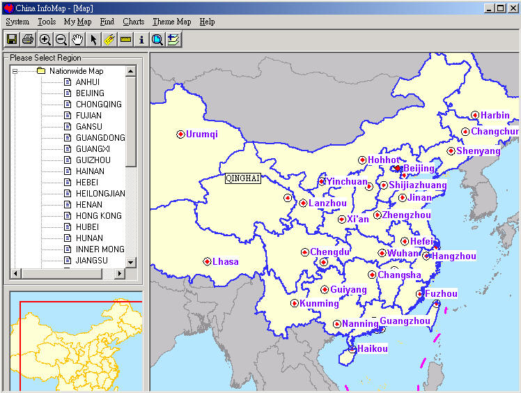 |
The national level map data includes administrative boundaries (province, prefecture, city, county), point locations for 2,300 cities and counties, coastal islands, rivers, lakes and reservoirs, railway lines, expressways and national highways. City level map data include city roads and streets (expressway, main road and city street), major landmarks, railway and subway lines and stations, parks, rivers and lakes (additional details).
MapKing
MapKing is a 'pan-regional multi-lingual GPS enabled mobile map product.' MapKing supports multiple operating systems and languages. It provides routing, POIs and location search on mobile devices.
Coverage includes Greater China (Beijing, Shanghai, Hong Kong, Guangzhou, the Pearl River Delta road network, Shenzhen, Dongguan Macau Hong Kong Hiking Trial, Taipei, TaiChung, Tainan, Hsinchu, KaoHsiung and points for 2,300 more cities). Additional cities in other countries include: Bangkok, Manila, Singapore, Johor, Jakarta, New Delhi, Tokyo, Kuala Lumpur, and tourist maps for Ho Chi Minh City Tourist and Seoul.
MapAsia has a surprisingly robust selection of products for a part of the world where data collection is not easy. If you are doing business in this part of the world, or if you just plan to travel there as a tourist, check it out.
From Our Homepage
Saying Farewell to an Amazing Journey
Communicating with Maps
Is There a GIS Career Ladder?
What does it mean to be geospatially smart? Series
Ways Real Estate and Property Developers Utilize Melissa GeoData for Data-Driven Decisions
Unlocking Value From Daily Satellite Imagery and Insights
Maximizing the Value of Your Address Data with Geo Addressing
How Indoor Mapping Enhances the Security of Smart Buildings
Look Ahead: AI, Location Intelligence and Efficiency
Collaboration Takes on Sea Level Rise & Dynamic Technology Environments
Brownies for Brownfields
Has Everything Been Mapped Already?
How Is Data Literacy Changing in an Artificial Intelligence Landscape
Portfolios for GIS Professionals: More Than Just Maps
How to Create a Distance Matrix in QGIS - A Step-by-Step Guide
7 Ideas for Bringing GIS into the K-12 Classroom
The Geography of Movement