I'm the first to admit that as a geospatially focused
journalist, I keep my focus on geospatial technologies. As geospatial
technology users or providers, I know many readers do the same. I'm
lucky enough to be teaching online this semester and that's forced me
to explore some emerging non-geo technologies. One technology has
really impressed both my students and me, and I think it will have
immediate use for readers. It's called Jing, or officially, Jing Project and it's from TechSmith, a company about which
you may have heard because it offers a screen capture program called
"SnagIt."
Picture and Video are Faster and More Accurate than Typed Words
The Jing Project is a technology focused on screen capturing (both still and video), but combined with a hosting service so that once captures are made, they can be almost immediately shared with others. Those two combined capabilities make Jing an exceptional tool for demonstrating, for example, the steps in creating a schema in AutoCAD Map 3D.
Think of Jing in terms of return on investment (ROI). Is it easier to capture a graphic or video to help someone, or to write a bunch of text (and most likely forget a step or mislabel an option)? The answer, I'm finding, is it's easier to mark up a screen-captured image or capture a quick video and send a URL to the person for whom you’ve made it.
How it Works
Once you sign up for a free for now (no promises about later, though)
Jing account, which includes 200 Mb of hosting on Screencast.com, you
download a small app (8 Mb, Windows and Mac!) and install it. When
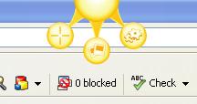
the program starts, a shiny yellow ball (the Jing sun, I call it)
appears at the top of the screen. When you want to capture something on
your screen you choose the Jing capture option, draw a box of the area
of interest, then choose to capture either an image or a video.
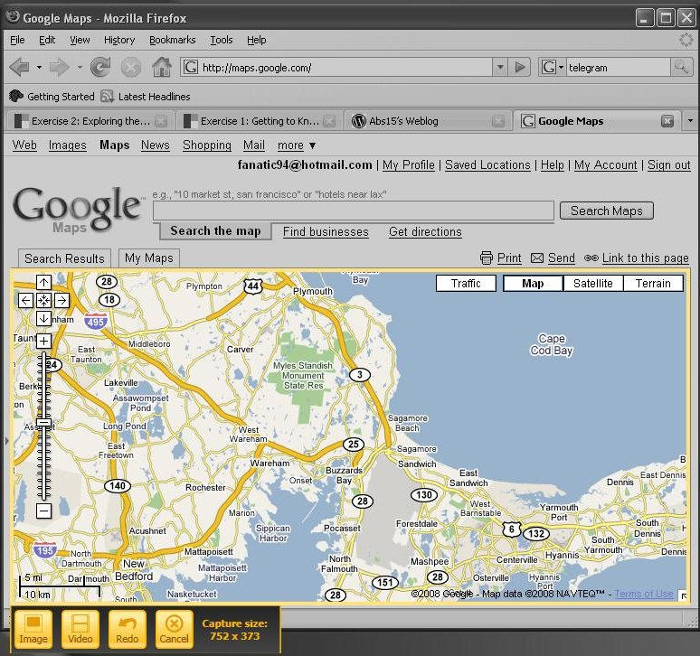
In the case of an image, once it's captured, you can draw arrows on it, type text, etc. and then save it locally. In my line of work, it’s more efficient to save it to Screencast.com. When you select the latter and complete the upload, Jing populates your clipboard with the URL of the image. You can then post it in your blog, an e-mail, whatever. Here's a capture I made to help students understand the interface in AutoCAD Map 3D.
The difference in the case of a video is that Jing will record (video and audio, if you like) what's in the box you drew until you pause or stop the recording. Pausing allows you to put "other things" (images, apps) in the box and then continue recording. Again, when you are done, the video can be saved locally (it's Flash, SWF, so it can be used elsewhere) or posted to Screencast.com. Again, you receive a URL of the video to use as you like. You can't edit your video with Jing, but that's not what the application is really about - it's about "quick and informal" videos.
Challenges
Jing is not a fully formed product or service, so there are glitches, for sure. And I know some of my students couldn't quite figure out how it worked, even with the Jing help, blog and video about how Jing works (illustrated in Jing, of course). I had to walk one of the students through the process by phone, but afterward she was a pro. Another concern is that Flash format (.SWF) files can be large when the entire screen is captured. That, in turn, can cause choppy playback and very slow uploads. To date, however, we've gotten around those challenges by changing screen resolution and drawing smaller recording boxes.
Jing Changes Everything
I knew Jing had made an impression on my students when they started including Jing URLs in their comment posts to each other's questions about their assignments. I had not asked them to do so; they just did! And, I knew I had Jing in my blood when, after beginning a long, step-by-step set of instructions, I did a "V8" type bang on the head and said, "I could have used Jing!" Two minutes later the short video was captured and posted, and I went out for coffee.
For now, my Jing use has been exclusively with my students, but I can see Directions Media using it as we add new interfaces to our internal tools for managing our publications. I can also see myself using it when I get those calls from my dad saying he's lost a toolbar in Word or Internet Explorer. I think showing him will be far better than trying to talk him through it on the phone.
I suspect readers will find all sorts of ways to use Jing in connection with their geospatial (and other) work and play. It's worth the few minutes to download and learn. After that, I predict Jing use opportunities will present themselves regularly in your work and other endeavors online.
Picture and Video are Faster and More Accurate than Typed Words
The Jing Project is a technology focused on screen capturing (both still and video), but combined with a hosting service so that once captures are made, they can be almost immediately shared with others. Those two combined capabilities make Jing an exceptional tool for demonstrating, for example, the steps in creating a schema in AutoCAD Map 3D.
Think of Jing in terms of return on investment (ROI). Is it easier to capture a graphic or video to help someone, or to write a bunch of text (and most likely forget a step or mislabel an option)? The answer, I'm finding, is it's easier to mark up a screen-captured image or capture a quick video and send a URL to the person for whom you’ve made it.
How it Works
 |
In the case of an image, once it's captured, you can draw arrows on it, type text, etc. and then save it locally. In my line of work, it’s more efficient to save it to Screencast.com. When you select the latter and complete the upload, Jing populates your clipboard with the URL of the image. You can then post it in your blog, an e-mail, whatever. Here's a capture I made to help students understand the interface in AutoCAD Map 3D.
The difference in the case of a video is that Jing will record (video and audio, if you like) what's in the box you drew until you pause or stop the recording. Pausing allows you to put "other things" (images, apps) in the box and then continue recording. Again, when you are done, the video can be saved locally (it's Flash, SWF, so it can be used elsewhere) or posted to Screencast.com. Again, you receive a URL of the video to use as you like. You can't edit your video with Jing, but that's not what the application is really about - it's about "quick and informal" videos.
 |
Challenges
Jing is not a fully formed product or service, so there are glitches, for sure. And I know some of my students couldn't quite figure out how it worked, even with the Jing help, blog and video about how Jing works (illustrated in Jing, of course). I had to walk one of the students through the process by phone, but afterward she was a pro. Another concern is that Flash format (.SWF) files can be large when the entire screen is captured. That, in turn, can cause choppy playback and very slow uploads. To date, however, we've gotten around those challenges by changing screen resolution and drawing smaller recording boxes.
Jing Changes Everything
I knew Jing had made an impression on my students when they started including Jing URLs in their comment posts to each other's questions about their assignments. I had not asked them to do so; they just did! And, I knew I had Jing in my blood when, after beginning a long, step-by-step set of instructions, I did a "V8" type bang on the head and said, "I could have used Jing!" Two minutes later the short video was captured and posted, and I went out for coffee.
For now, my Jing use has been exclusively with my students, but I can see Directions Media using it as we add new interfaces to our internal tools for managing our publications. I can also see myself using it when I get those calls from my dad saying he's lost a toolbar in Word or Internet Explorer. I think showing him will be far better than trying to talk him through it on the phone.
I suspect readers will find all sorts of ways to use Jing in connection with their geospatial (and other) work and play. It's worth the few minutes to download and learn. After that, I predict Jing use opportunities will present themselves regularly in your work and other endeavors online.
From Our Homepage
Saying Farewell to an Amazing Journey
Communicating with Maps
Is There a GIS Career Ladder?
What does it mean to be geospatially smart? Series
Ways Real Estate and Property Developers Utilize Melissa GeoData for Data-Driven Decisions
Unlocking Value From Daily Satellite Imagery and Insights
Maximizing the Value of Your Address Data with Geo Addressing
How Indoor Mapping Enhances the Security of Smart Buildings
Look Ahead: AI, Location Intelligence and Efficiency
Collaboration Takes on Sea Level Rise & Dynamic Technology Environments
Brownies for Brownfields
Has Everything Been Mapped Already?
How Is Data Literacy Changing in an Artificial Intelligence Landscape
Portfolios for GIS Professionals: More Than Just Maps
How to Create a Distance Matrix in QGIS - A Step-by-Step Guide
7 Ideas for Bringing GIS into the K-12 Classroom
The Geography of Movement