INTRODUCTION
The Fairfax-Falls Church Community Services Board (CSB) is responsible
for the provision of quality mental health, mental retardation, alcohol
and drug, and early intervention services to more than 20,000 people a
year. Services are provided in more than 16 outpatient clinics and
350 residential sites throughout Fairfax County and the Cities of Fairfax
and Falls Church, Virginia. Federal and State mandates provide directives
for protective measures to be undertaken by service providers in the event
of a terrorist attack or natural disaster. The CSB Emergency Response
System evolved from the need to integrate agency administrative data with
existing County GIS data layers for emergency and disaster planning.
The notification procedure (Notifier) within the Emergency Response System
follows the County Emergency Operations Plan for response, evacuation and
recovery of all county facilities and sites occupied by populations with
special needs.
CSB EMERGENCY RESPONSE SYSTEM (INTERFACE)
GIS is helping make the CBS's emergency management program a faster,
more accurate means of assisting CSB providers and clients in coping with
disaster. A secure GIS-CSB program site database has been developed
which is used to pinpoint outpatient and residential sites that may be
in the path of disaster. Once the County's Emergency Operations Center
conveys information to the CSB about a particular disaster, this real time
information is used by the CBS's Emergency Management Team to assess the
need for an evacuation and/or sheltering-in-place.
The CSB Notifier organizes critical information and displays the information in a format that can be immediately analyzed and reported in the event of an emergency. The quick response system displays a group of interactive maps (layers) and GIS screens allowing the first responder to immediately access and view the location of the incident. The system upon query, returns data on the location of CSB programs and lists all affected sites within a specific radius of the point of incident. Further, it presents a hierarchical phone tree of staff who should respond to the emergency; the level and availability of responders is made available from the list of sites identified through the query.
As a stand-alone system on the first responder's laptop computer, the CSB application is designed to operate independently of the County's electronic power supply source in the event of a situation where all central electronic systems are impaired and communication hampered. Wireless technology enhances the value of the response system by allowing information from the incident site to be disseminated. The CSB first responder informs other responders in the line of command who in turn notify the sites/programs of the developments and procedures to be followed. The CSB Notifier enables the first responder to access and view the location of the incident, providing essential data on program population at risk to other CSB personnel and program areas.
Details of the Notifier Functionality
The user can query a location by street address or intersection.
That location is displayed together with the various information layers
that have been selected from a menu. Figure 1 presents a display
of a query location.
Figure 2 presents data on the location of CSB programs within a specific
radius of the point of incident. Figure 3 illustrates how the user
can identify CSB sites or other data base items in the display and access
detailed information on the particular entity. The auxiliary information
in Figure 3 is displayed in a separate dialog box.
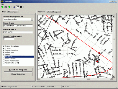
Figure 1.Click for larger view
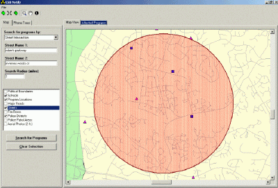
Figure 2
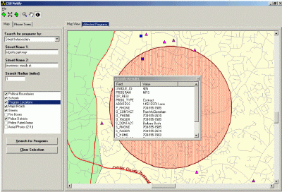
Figure 3
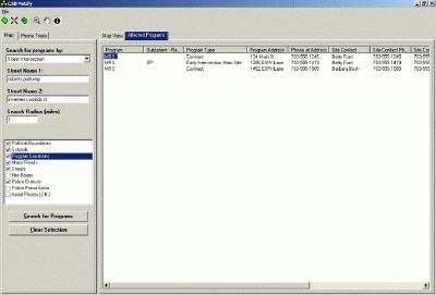
Figure 4
Figure 4 presents a list of CSB sites that are within the selected radius of the queried location.
Figure 5 illustrates the zoom capabilities of Notifier. Users
can view impacted areas at various scales or evaluate an affected location's
relationship to larger portions of the County.
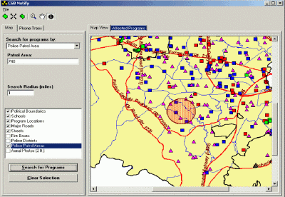
Figure 5
The data base includes aerial photography for all of Fairfax County. Figure 6 presents a rendering of the queried location with aerial photography. The capability to analyze a realistic view of a site adds a dimension of physical information that might positively impact emergency planning. Figure 7 illustrates the high level of detail that is achieved by zooming the aerial photography rendering of the location. Such detail is expected to be quite valuable in response planning and communication between responders. Fairfax County's excellent existing aerial photography data base was utilized to provide this option in Notifier.
Notifier Phone Trees
An important functionality that motivated the development of Notifier
was the need to identify and communicate with those responders who needed
to be
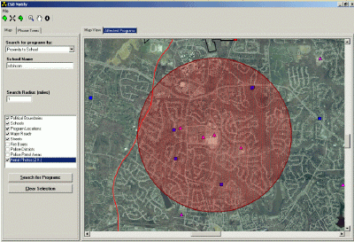
Figure 6
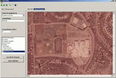
Figure 7
notified of their role in the emergency response. A phone tree
application is built into Notifier to provide this capability. Figure
8 presents a phone tree example. The screen presents responsible
personnel associated with particular CSB sites that were identified by
the processes described above. These personnel are organized into
a communication phone tree. This phone tree is activated to kick
off the actual emergency response. Notifier is the key application
supporting the CBS's plan to convey real time messages to out patient and
residential sites managed by the CSB. Over 350 CSB sites have been
loaded into the data base.
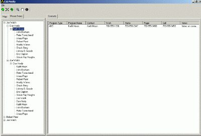
Figure 8
Summary
Notifier was designed and implemented for the CSB to demonstrate the
value of a GIS based support system for emergency planning. The project
was facilitated by Fairfax County's existing sophistication in GIS infrastructure
including analytic expertise and data bases. Notifier demonstrations
have led other County offices to seek similar GIS based emergency response
support. The goal is to continue development of the Notifier system
as a viable emergency or case management tool for County Social Services.
Acknowledgments:
The authors have benefited from the guidance, support and involvement
of the following managers and co-developers:
Margo Kiely, Director, Dept.of Systems Management for Human Services;
Dr.James Stratoudakis, Director, Quality Improvement, Managed Care
and Emergency Preparedness Coordinator, Fairfax-Falls Church CSB;
Tom Conry, Manager, Dept.of Information Technology, GIS Branch.
Chip Gertzog, Director, Planning, Dept.of Systems Management for Human
Services;
Authors:
Lathan S.Dennis, MSc., GIS Analyst
Fairfax County, Human Services
12011 Government Center Parkway, Suite 946,
Fairfax, VA 22035
Voice (703) 324-5648 Fax (703) 324-7572 Email ldenni@fairfaxcounty.gov
Jim Callahan,
Fairfax County, GIS & Mapping Services
12000 Government Center Parkway, Suite 117
Fairfax, VA 22035
Voice (703) 324-2980 Fax (703) 324-3937 Email jcall3@fairfaxcounty.gov