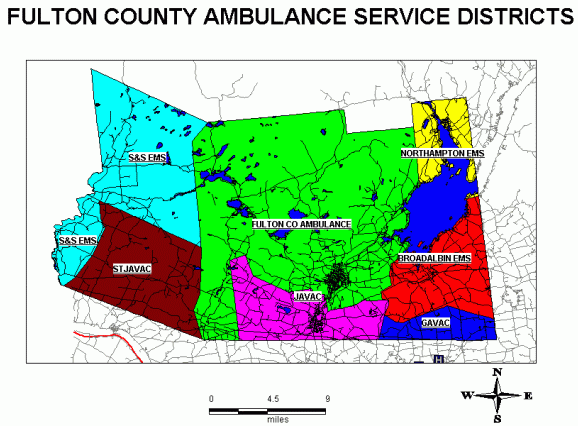
The first county map below shows the county broken into individual fire districts and Ambulance district boundaries.This information immediately gives the E-911 dispatcher information on whose fire district the emergency is in and information on which ambulance service to notify.

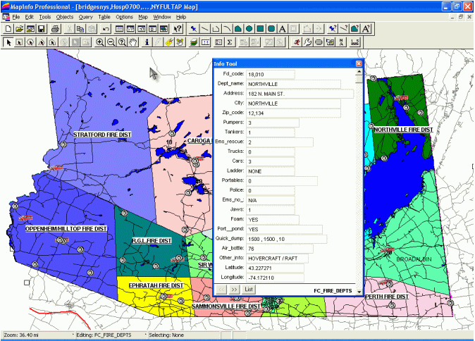
In the event of a particular fire district needing additional resources in a major incident the next map not only locates each districts location but also using the info tool gives the resources available in each Fire Department.
Click for larger image
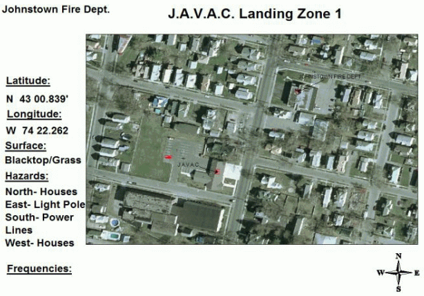
Fulton County is a rural area with the nearest trauma center an hour away by ambulance delaying immediate care needed in emergency situations. Using G.I.S.and G.P.S.technology county wide predetermined helicopter landing zones were established.These predetermined landing zones included landing coordinates, ground conditions and hazards in the area.
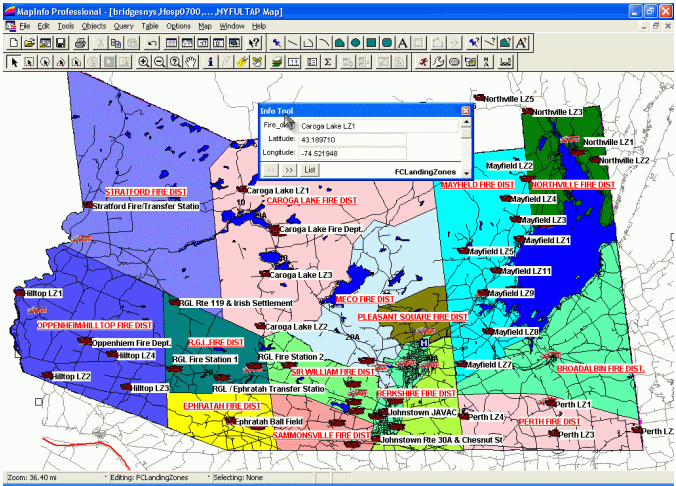
All landing zones are hotlink with the latest Ortho-Imagery allowing
emergency workers on the ground and the helicopter pilots an aerial view
of conditions in the area.The above not only identifies landing zones
throughout the county but also gives the E-911 dispatcher information on
who's fire district the emergency is in.An actual incident occurred approximately
a year ago where a hunter was hurt in the western part of the county and
as the ambulance was heading East, Med-Flight (traumas center helicopter)
was heading west.Had this mapping been available to the E-911 dispatcher
a landing zone could have been chosen where the ambulance could have intercepted
the helicopter enroute.
Click for larger image
Other possible events that could occur could be such things as Dam failures, natural disasters such as earthquakes, or a haz-mat incidents.Evacuation of county citizens becomes crucial, immediate notification becomes necessary. Using MapInfo's MapMarker geocoding of resident's addresses was easy, but before this can be done an accurate address database is needed to be updated. A problem occurred here as no one database gives you all addresses of residents. It was necessary to combine the telephone database, the electrical service database, the United States Postal Service database and Real Properties data were used.The reason all these had to be combined was that not everyone has a telephone, not everyone has an electrical service, (believe it or not) and some residents use a Post Office box.Next is an example of a city residents address locations.

Once this was completed the buffer tool in MapInfo can be used and by clicking with your pointer in that particular buffer all names, addresses and telephone number list appears for immediate resident notification.
Other areas mapped in the county include all dams and bridges as shown next.Fulton County is not an area of frequent earthquakes but should an event such as an earthquake or other natural disaster occur, the first concerns are dams and bridges.The next two maps show fault lines in relation to the bridges and dams in the county.
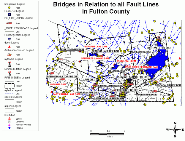
Click for larger image
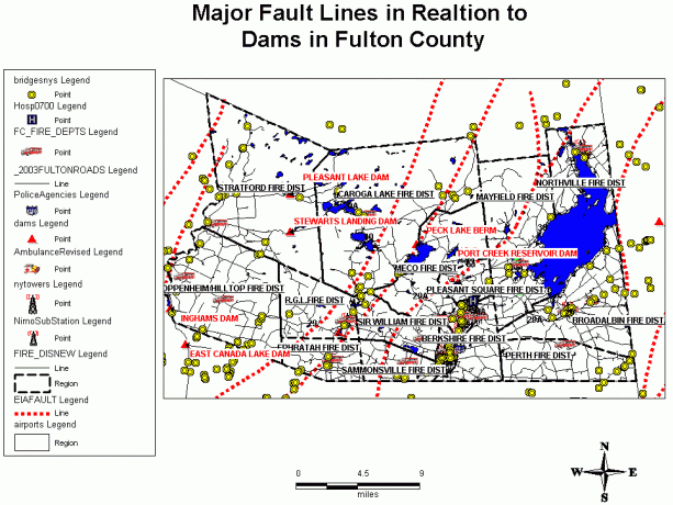
Click for larger image
As a Fire Chief, another valuable tool is the ability to hotlink floor plans, giving firefighters a look into the buildings room locations from the outside.Using the hotlink tool, a direct link is established with Autodesk's AutoCAD for a 3-dimensional look into the building as shown next.
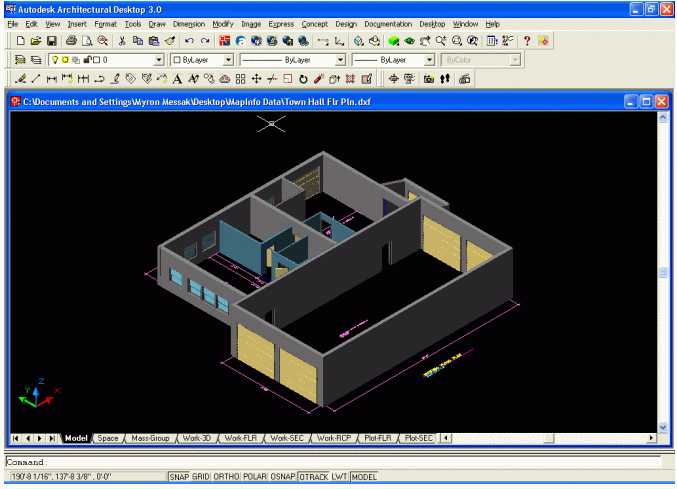
Click for larger image
The ease of adding G.P.S.Locations of fire hydrants, not only for a fire
departments own hydrants but also if a mutual aid fire department is called
in, they would have the other fire districts hydrant locations.

Click for larger image
Thus far, three fire district's hydrant locations have been plotted in the county.

Click for larger image
In conclusion, this article only scratches the surface of what Fulton County and other counties and cities can do to improve all types of information needed in the event of emergencies.Other Locations mapped in the county include G.P.S.locations and resources available of heavy construction equipment with types of equipment each resource has, Lumber Company locations and resources, School locations with capacity of gym and cafeteria size to be used as shelters, just to name a few.