The use of "spatial
analysis" to discern the proximity, or juxtaposition on a location-by-location
basis of each shooting is now getting much "air time" in the national media.
Of course, at this time, there does not appear to be a pattern, at least
none that can be immediately interpreted.The maps below show the locations
of each of the eleven incidents to date, represented by a red diamond shape
and the chronological number in which they occurred.

Montgomery County, Maryland
Area
It was appalling to
hear one analyst on a Sunday morning CNN
program immediately suggest that the attacks appeared to be heading "south"
and that we could expect to see the next incident in that direction.Isn't
it amazing how some TV talking heads are becoming experts in GIS as the
camera zooms in? How incredibly irresponsible and naive it was to make
an interpretation on such slim evidence!
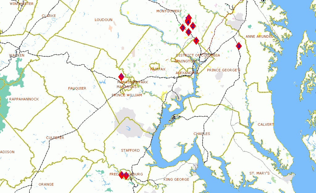
Northern Virginia and Washington
D.C.Area
Click map
for larger image
If you are interested in Crime Mapping or Geographic Profiling, follow the links below:
- National Institute of Justice, Mapping and Analysis for Public Safety (MAPS) program
- National Crime Prevention Council
- National Crime Statistics Links Guide
- Environmental Criminology Research Inc. (ECRI) - See also related story below HERE.
- Crime Laboratory - Geographic Profiling
"Geographic Profiling" by Dr.Kim Rossme