 It's all about the "last tactical mile" or LTM.The GEOINT
conference, sponsored by the U.S.Geospatial Intelligence Foundation (USGIF) and heavily supported by the
National Geospatial-Intelligence Agency (NGA) is a gathering
of primarily military brass, defense contractors, and
intelligence-gathering agencies with the common purpose of
understanding and using geospatial information.That said, a very
prominent theme of this year's conference was LTM, or how geospatial
"knowledge" is communicated to the warfighter, i.e.the soldiers in
combat.
It's all about the "last tactical mile" or LTM.The GEOINT
conference, sponsored by the U.S.Geospatial Intelligence Foundation (USGIF) and heavily supported by the
National Geospatial-Intelligence Agency (NGA) is a gathering
of primarily military brass, defense contractors, and
intelligence-gathering agencies with the common purpose of
understanding and using geospatial information.That said, a very
prominent theme of this year's conference was LTM, or how geospatial
"knowledge" is communicated to the warfighter, i.e.the soldiers in
combat.
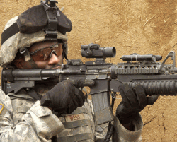
The LTM theme was repeated often, from the exhibits on the floor to the plenary sessions.Faced with a changed enemy, stealthier and more dispersed, geospatial information forms the base of knowledge that comprises both military tactics and covert intelligence gathering.From unmanned aerial vehicles (UAVs) to the much maligned FBCB2 (don't worry, it's just a CRT display inside of Humvees), getting information to the "boots on the street" has taken center stage in the quest for real-time geospatial intelligence.The problem facing all of the stakeholders mentioned above is not gathering too little data, but filtering and disseminating these data that have been acquired by airborne, satellite and ground-based sensors.Those sensors may be the soldiers themselves, which is an acknowledgment that the military understands just how essential it is to equip their forward-based assets with information technology that sends feedback to the brigade commander.
Another common theme was need to eliminate "stove pipes" or what have also been called "islands of automation," where data comes in but is never shared or disseminated at the right time to the right people.The conference speakers represented many who were members of joint technology task forces, or interagency and inter-service teams that were looking at how to eliminate the duplication of these "silos" and act to develop teams with a common mission.
The Whole World is the Last Tactical Mile
In a session dedicated to "GEOINT TO THE LAST TACTICAL MILE," moderator Mike Thomas, vice president of Lockheed Martin's Geospatial-Intelligence Solutions division, said that "the whole world is the last tactical mile." He is referring to the fact that there are no well-defined battlefields anymore and that conflicts are not necessarily "regional" but global.The war on terrorism is a perfect example, with no geographical "front line" and a dispersed cell-based enemy among a civilian population.In fact, the LTM may be just about anywhere in the world.Hence, the problem faced by all stakeholders is getting accurate geospatial intelligence any where at any time.
Speaking in the same session, Air Vice Marshal Stuart Peach, Director General, Intelligence Collection in the UK's Ministry of Defense said, "Our structures had been regional to deal with cold war missions.Now the mission is global and we need to transition the structures to face a global challenge."
In Times of Disaster
Turning from a topic of wartime to one of disaster management, Captain Jeffrey Best, Deputy Oceanographer of the U.S.Navy illustrated three events with in the last year that necessitated getting immediate geospatial information to the field commanders:
** The tsunami of Southeast Asia - Navigation aids in the Straits of Malacca were destroyed rendering supply and aid ships helpless in understanding subsurface obstacles.
** The submarine USS San Francisco hit an obstacle on a seamount that was previously unmapped.Navigation charts omitted the location of the object; apparently other sources had information about the obstacle but were not consulted.There was one fatality on board the submarine due to this incident.
** Hurricane Katrina - $1 Billion was lost for every day the New Orleans harbor remained shut down.
Best feels that there is tremendous duplication of efforts among the intelligence gathering agencies and hope the work of the Joint Interagency Task Force (JIATF) can solve this dilemma.
The Right Information that is Actionable
Major General Charles Simpson, U.S.Air Force, and a member of the Joint Forces Command (JFCOM) responsible for requirements and information integration, asked, "How do we keep GEOINT (geospatial intelligence) relevant in the last tactical mile?" In other words, with so much information from human, signal, and other forms intelligence, what is it that remains actionable? The warfighter can comprehend just so much, given the extreme situations in which they find themselves.Vice Marshal Peach commented that, "we need to moderate the appetite for data and give the soldier what they need; not what they think they want.There is no way we can deliver everything in that room [referring to the exhibit hall] to the warrior; all they may need is a JPEG or line drawing."
That point was supported by Chief Warrant Officer Jason Feser, just three weeks removed from the battlefield, as he described his job in Mosul, Iraq (See "GEOINT on the Front Lines: A Soldier's Story").As brigade commander, he was responsible for supplying geospatial intelligence to platoon leaders.His command included four other soldiers that created more than 1500 maps each month in support of target packages for platoons tasked with eradicating insurgent threats in the urban environment. When it became too much trouble to upload digital map data to the FBCB2 in each vehicle, a printed map was the best form of communicating the geospatial intelligence.
The military is clearly making strides in bringing technical expertise in geospatial intelligence directly to where the information is needed most.The information gathering technology is solidly in place but the ability to filter the intelligence so that it is communicated in the most effective manner is a work in progress.
From Our Homepage
Saying Farewell to an Amazing Journey
Communicating with Maps
Is There a GIS Career Ladder?
What does it mean to be geospatially smart? Series
Ways Real Estate and Property Developers Utilize Melissa GeoData for Data-Driven Decisions
Unlocking Value From Daily Satellite Imagery and Insights
Maximizing the Value of Your Address Data with Geo Addressing
How Indoor Mapping Enhances the Security of Smart Buildings
Look Ahead: AI, Location Intelligence and Efficiency
Collaboration Takes on Sea Level Rise & Dynamic Technology Environments
Brownies for Brownfields
Has Everything Been Mapped Already?
How Is Data Literacy Changing in an Artificial Intelligence Landscape
Portfolios for GIS Professionals: More Than Just Maps
How to Create a Distance Matrix in QGIS - A Step-by-Step Guide
7 Ideas for Bringing GIS into the K-12 Classroom
The Geography of Movement