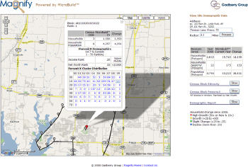
By contrast, however, access to data which accurately describe the populations of these locations has lagged significantly. For those involved in the business of location analysis, this scenario is frustrating. Why? Because while in the U.S. and elsewhere, vast repositories of consumer data exist, the information is virtually unusable with current geographic analysis tools. It is like having a microscope without a specimen to examine.
Again the question, why? First, relating population and demographics to the physical geographies containing those populations is not as easy as it may seem. Consider the fact that over 300 million people, representing over 120 million households, live in the United States. Adding to this complexity, experts estimate that over 20%, or roughly 24 million, of these households move every year. That's a lot of moving parts.
Second, even if companies keep up with the sheer mass, determining exactly where people live presents challenges. Most people consider a mailing address to be the physical identifier for where people live. But this fundamental assumption can be misleading because mailing addresses, while almost always deliverable by a mail carrier, can't always be used to identify the physical location for the household due to limitations of the technologies that translate addresses into locations. In order to create latitude and longitude, these technologies only work with already recognizable addresses. Depending on the area, results often yield an approximation of the address, which can be a great distance from the actual location of the household.
The most widely used sources of data in location analysis are the U.S. Census databases and products built using Census data. These databases and products provide households, populations, demographics and an array of other variables that form the baseline for describing the population for an area. Understanding the base population is the cornerstone for any location-based analysis. The breadth and depth of its coverage, consistency in the compilation processes, cost and availability make Census data an extremely powerful data asset. However, Census data and estimates constructed from Census data also have significant limitations.
It's no secret to those who use Census data that the primary disadvantage lies in the age of the data. Produced once every decade, with only annual estimates in between, Census data do not reflect the dramatic changes in population that occur across the U.S.
In contrast, marketing departments have long recognized the power of household level data. As a result, those marketers license national consumer demographic databases to understand their customers and prospective customers. These databases contain very current and very accurate demographics for virtually every household in the U.S.
Using current technology, most companies can meet the challenge of slicing these data into smaller chunks to focus on more targeted marketing solutions. However, finding data that provide accuracy and precision, and that can also be compared with historic Census data has been a challenge. Most products built to provide population and demographics begin as summarized data at levels of macro-geography such as county or ZIP Code. When used as directional data, these products give researchers a sense of whether an area is growing, shrinking or stable. Savvy marketers know that, based on the aforementioned fluctuation of population throughout the U.S., the goal is to evaluate growth or demographic characteristics for much smaller areas; these products paint the landscape with a very broad brush.
While many believe the market interest in household-level data will grow, there is a challenge using this type of data in geographic-based applications. The ability to relate 120+ million addresses to the physical geographies of those households is not a trivial task. Integrating household level data into geospatial analysis tools and relating the results to historic Census data can yield results that do not portray an accurate number or distribution of households and population. In some cases, these differences can be grossly inaccurate.
So, what are these companies missing when they ask, "Where is the best location for my business?" They don't have a solution that combines the best that Census data have to offer with the most complete and current population and demographic information available, combined in a single dataset. Such a dataset can provide valuable data to research, site location, and marketing departments.
To illustrate the current problems involved in gathering and working with location analysis data, let's look at a scenario of a day in the life of a typical research analyst. The analyst, Sarah Peacock, works for a major retail chain. In addition to her pure research workload, Sarah is also responsible for locating, acquiring, testing and integrating dozens of databases used by her company to understand the differences in populations that make up its trade areas. Sarah's job involves analyzing data that describe what occurred in the past and what is happening in the present, and then predict the future performance of current locations to help model and identify new locations. It’s a critical job, but it’s often made more difficult because the data she needs are rarely compatible and require extensive work before they can be used. These critical differences help Sarah interpret the performance of retail locations.
The demand for more recent and accurate data in location analysis is fueling the development of next generation data products known as Household Geo- Demographic products. The new products deliver powerful insights into base populations, customers and prospective customers. Not only do they provide the benefits of household demographics, they also provide a "bridge" to include the longitudinal context needed for their use in trending applications which include historic Census data. These data products are also available in standard geographies, making them usable in GIS systems.
Household Geo-Demographic data products offer significant advantages to companies that demand the most current, accurate and precise population and demographic data. These new data deliver new levels of precision just in time to fuel the latest advances in location intelligence technology.
