 Marin
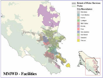
Municipal Water District (MMWD) is a veteran GIS user that has relied
on systems from ESRI since 1993. As a public agency tasked with
providing high-quality drinking water to approximately 185,000 people
in a 147 square mile area of Marin County, California, it strives to
use the latest technology to efficiently manage its infrastructure and
natural resources. Over the past 13 years, its staff has been using GIS
to update, inventory and maintain water infrastructure data and to
recreate paper maps used by its personnel.
 |
After first installing ESRI over 10 years ago, Marin integrated it with legacy billing and work order databases so the two systems could share data, creating an easier interface for users. But when MMWD upgraded to a back-end system from SAP, it realized that the improved and advanced features meant a more complicated integration with its mapping system.
In 2001, Marin retired the old and highly customized systems and chose to implement an enterprise resource planning (ERP) system from SAP that was more manageable and up-to-date. This included replacing the work order system that stored all water infrastructure attributes, such as pipe size and material type. Having linked its legacy systems with mapping systems from ESRI in the past, Marin required similar functionality within its new solution. It was imperative that users be able to access equipment attribute data, now located in the SAP database, using the GIS interface. To solve this problem, Marin began to customize the integration between the two systems at the same time that it began to roll-out SAP.
Marin invested considerable time and resources building a custom interface between the two systems and in 2002 – about a year after the SAP system had gone live – finished development and was ready to put the custom GIS/SAP interface to use.
After the initial roll-out, each change or addition to either the SAP or ESRI system required a custom project involving both contractors and Marin’s IT department to maintain the integration. Often, contractors would have to invest considerable time familiarizing themselves with the one-of-a-kind system before performing any new work. In addition, if problems arose, Marin had nowhere to turn. The ongoing support and maintenance of the interface proved to be costly and time-consuming, prompting the agency to seek a commercially available solution.
At the recommendation of ESRI, Marin chose to work with Impress Software of Waltham, MA. Impress provides packaged integration applications, which identify complex but common processes between two systems in order to enable flexible and efficient synchronization. Through its work with Impress, Marin found that a packaged solution to a critical pain point required fewer people, less time, less money and produced better information than a custom job. Once the project at Marin was started, implementation of Impress for GIS, linking its SAP and ESRI systems, was completed in only a few months.
As an added benefit, the integration at Marin is now fully supported by Impress Software, which is certified by both ESRI and SAP. This means that Marin now has expert technical consultation when faced with questions or problems. In contrast to its custom integration, Marin can leverage best practices from Impress that have been consolidated and incorporated into its product. This not only provides domain expertise to Marin if problems arise, but also ensures that links will stay in tact when changes are made to the ESRI or SAP systems, or when either system is upgraded to a newer version.
Benefiting from Packaged Integration
The benefits of integrating its SAP and ESRI systems extend throughout Marin Municipal Water District and to its customers. It has resulted in decreased service times, reduced error frequency, lower operation costs and increased overall efficiency. It helps to lower the cost of asset maintenance and service, and provides better asset inventory management.
For example, with standard SAP functionality, a user could not select a large group of objects and change a certain attribute value for all of those objects at one time. If a data entry person added the wrong job number to 50 pipes in SAP, the solution was to go back through those pipes, one by one, and make the change. Using the integrated solution, a user can select all 50 pipe equipments from the map, enter the correct job number value once, and have that value applied to all 50 pipes in a single action. Time savings and benefit depend largely on the need to use this tool, but, like Marin, anyone who manages a large amount of data would likely find this to be of great value.
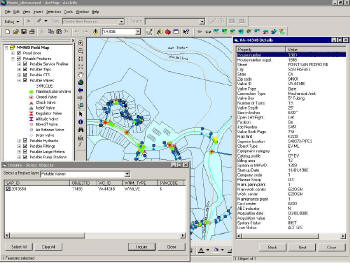
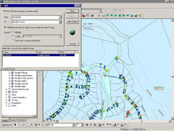
The integration also enables a faster and more accurate service response since data on maps and in SAP are easily accessible and guaranteed to be identical. Much like selecting a large group of objects to change an attribute, users can get a detailed look at infrastructure including pipes, valves and service meters directly through the GIS interface. By selecting an entire area or one specific attribute on the map, users can click a single button to see all the pertinent information related to those attributes in SAP.
 |
 |
For employees of Marin, the integration improves user friendliness and acceptance of its systems, and reduces the time users must spend in training. This is invaluable because users who depend heavily on this information are often field technicians who have less experience with computer systems and more experience in the field using maps. These users are already familiar with maps, which makes it very simple for them to locate features, click on an item, and receive information while still in the field, as opposed to waiting to return to the office and having to locate the information in SAP.