National
hydrographic organizations, commercial chart producers, and naval
commands are discovering that GIS technology can streamline the
production and maintenance of their nautical data. ESRI is assisting
this effort by working with international organizations on the
development of new standards.
Leading this charge is Rafael Ponce, program manager for ESRI's
maritime team in the Professional Services Group. Before joining ESRI,
Ponce spent 24 years in the Mexican Navy serving on various ships as
well as ashore, participating in hydrographic surveys, bathymetric
analyses, tidal analyses and nautical chart production. He was the
commanding officer of a navy hydrographic ship and the deputy director
at the Mexican Office of Hydrography and Cartography.
ESRI writer Karen Richardson recently discussed with Ponce ESRI's involvement in International Hydrographic Organization (IHO) standards and activities around the world.
ESRI: Can you explain the mission of the IHO?
Rafael Ponce (RP): IHO is the technical expert body recognized by the International Maritime Organization, a United Nations agency that provides standards and recommendations for all hydrographic activities throughout the world. This includes survey planning, data collection, postprocessing and data product creation.
The ESRI maritime team's primary objective is to serve this community by providing the best quality software and most efficient services. Our commitment does not begin with the production of excellent software and end with providing technical support; it goes beyond that. We are invested in creating standards and product specifications to continually improve our software.
ESRI: How exactly does ESRI contribute to the development of IHO standards and product specifications?
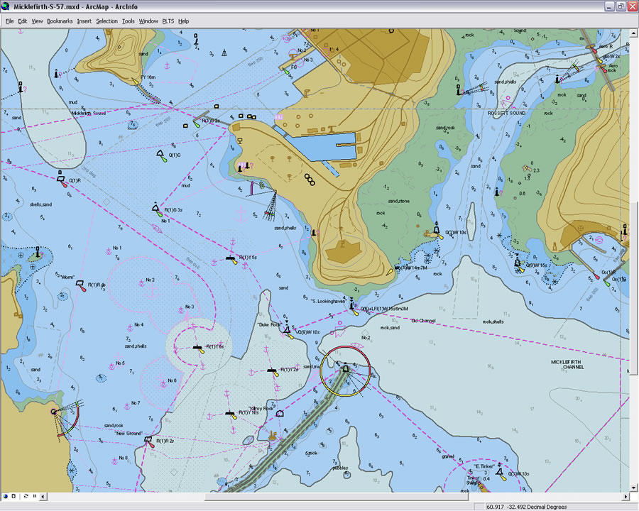
RP: The maritime team represents ESRI at key IHO technical working groups, such as the Transfer Standard Maintenance and Application Development Working Group. We provide expertise for defining and documenting specifications and GIS tools for testing data against them. For example, ESRI assisted in the development and extension of the S-57 standard, the IHO transfer standard for digital hydrographic data, as well as the new IHO Universal Hydrographic Data Model, known as S-100. Working with IHO, we are also developing the next generation of Electronic Navigational Chart (ENC) product specifications, S-101.
ESRI recently joined the Chart Standardization and Paper Chart Working Group to help write documents that help preserve the fundamental concepts of marine cartography. Additionally, we will start working with the Marine Spatial Data Infrastructure Working Group to develop better marine SDIs and help hydrographic offices connect with their national SDIs.
Last but not least, ESRI is involved with the Radio Technical Commission on Maritime Services (RTCM), which informs international agencies on maritime radio navigation and radio communication policy issues, changes, and technical standards development. ESRI represents RTCM as a nongovernmental organization at the Hydrographic Services and Standards Committee (HSSC).
ESRI: You mentioned the Radio Technical Commission on Maritime (RTCM) Services at the IHO Hydrographic Standards and Specifications Committee; can you tell me more about RTCM?
RP: RTCM was founded in 1947 as an international nonprofit scientific, professional and educational organization. RTCM works closely with many international bodies to develop standards for different maritime services. RTCM has several special committees and ESRI's interest lies in the Special Committee (SC) 109 on Electronic Charts and the fairly recent e-Navigation concept, which aims to harmonize ship- and shore-based systems through a communications infrastructure. Working with this committee, ESRI hopes to provide the technology to make this concept a reality.
ESRI: Tell me more about ESRI's relationship with IHO.
RP: ESRI's relationship with IHO began with the International Hydrographic Bureau, which works as the secretariat for IHO. ESRI maintains communications with delegates to the bureau, who include administrative personnel and retired hydrographers from various member states.
The IHO recognizes ESRI as one of its main stakeholders in the private industry, allowing the ESRI maritime team to participate in IHO's technical working groups and contribute to improving hydrography around the world. For example, ESRI attended the Hydrographic Database workshop hosted by the Colombia Hydrographic Office in Cartagena last year.
ESRI: Are there other groups within IHO in which you are involved?
RP: Yes, besides technical committees and working groups, the IHO has a capacity building committee (CBC) and several regional hydrographic commissions. I also have the privilege of being the technical coordinator for the Electronic Chart Committee (ECC) of the Meso-American and Caribbean Hydrographic Commission (MACHC).
ESRI: Can you describe your role as technical coordinator of the ECC in MACHC?
RP: I support the committee as a facilitator in determining the level of ENC coverage in the region using Worldwide ENC Database (WEND) principles as a guide. The WEND principles are a series of guidelines on how IHO member states should produce, organize and distribute their ENC data. Because ENCs cannot overlap for safety purposes, I help identify issues where there is a problem and facilitate a resolution. For example, two different ENCs may pinpoint more than one object at the same location. It is impossible for more than one object to be in the same spot on the earth, so I work with the conflicting states to rectify this. I also provide advice if some member states require rescheming of their ENC catalog. I basically try to ensure that member states follow the IHO production and distribution of charts to their end users, who are mariners worldwide.
ESRI: Is ESRI involved in any other maritime organizations?
RP: Yes, ESRI recently joined the Technical Advisory Group on Port Security, which serves the Inter-American Committee on Ports (CIP) at the Organization of American States. This group provides guidance to port authorities in the Americas on all aspects of port security so that they have the information and necessary means to mitigate risks, improve security and increase efficiency at ports throughout the Western Hemisphere.
ESRI: What can we expect from ESRI's involvement with IHO and other maritime organizations in the coming year?
RP: ESRI is committed to continuing our efforts with IHO and its member states particularly, participating in the development of S-101 and any future specifications. Our work with RTCM will continue, specifically in the Special Committee 109 for Electronic Navigational Charts as well as continuing to represent the group at HSSC if they allow us the honor.
We look forward to promoting the Marine Spatial Data Infrastructure initiative by IHO among its member states. We are particularly looking forward to working on other international projects like the Infrastructure for Spatial Information in Europe (INSPIRE), where we were recently accepted to participate in the development of product standards for bathymetry and oceanography.
 |
ESRI writer Karen Richardson recently discussed with Ponce ESRI's involvement in International Hydrographic Organization (IHO) standards and activities around the world.
ESRI: Can you explain the mission of the IHO?
Rafael Ponce (RP): IHO is the technical expert body recognized by the International Maritime Organization, a United Nations agency that provides standards and recommendations for all hydrographic activities throughout the world. This includes survey planning, data collection, postprocessing and data product creation.
The ESRI maritime team's primary objective is to serve this community by providing the best quality software and most efficient services. Our commitment does not begin with the production of excellent software and end with providing technical support; it goes beyond that. We are invested in creating standards and product specifications to continually improve our software.
ESRI: How exactly does ESRI contribute to the development of IHO standards and product specifications?
RP: The maritime team represents ESRI at key IHO technical working groups, such as the Transfer Standard Maintenance and Application Development Working Group. We provide expertise for defining and documenting specifications and GIS tools for testing data against them. For example, ESRI assisted in the development and extension of the S-57 standard, the IHO transfer standard for digital hydrographic data, as well as the new IHO Universal Hydrographic Data Model, known as S-100. Working with IHO, we are also developing the next generation of Electronic Navigational Chart (ENC) product specifications, S-101.
ESRI recently joined the Chart Standardization and Paper Chart Working Group to help write documents that help preserve the fundamental concepts of marine cartography. Additionally, we will start working with the Marine Spatial Data Infrastructure Working Group to develop better marine SDIs and help hydrographic offices connect with their national SDIs.
Last but not least, ESRI is involved with the Radio Technical Commission on Maritime Services (RTCM), which informs international agencies on maritime radio navigation and radio communication policy issues, changes, and technical standards development. ESRI represents RTCM as a nongovernmental organization at the Hydrographic Services and Standards Committee (HSSC).
ESRI: You mentioned the Radio Technical Commission on Maritime (RTCM) Services at the IHO Hydrographic Standards and Specifications Committee; can you tell me more about RTCM?
RP: RTCM was founded in 1947 as an international nonprofit scientific, professional and educational organization. RTCM works closely with many international bodies to develop standards for different maritime services. RTCM has several special committees and ESRI's interest lies in the Special Committee (SC) 109 on Electronic Charts and the fairly recent e-Navigation concept, which aims to harmonize ship- and shore-based systems through a communications infrastructure. Working with this committee, ESRI hopes to provide the technology to make this concept a reality.
ESRI: Tell me more about ESRI's relationship with IHO.
RP: ESRI's relationship with IHO began with the International Hydrographic Bureau, which works as the secretariat for IHO. ESRI maintains communications with delegates to the bureau, who include administrative personnel and retired hydrographers from various member states.
The IHO recognizes ESRI as one of its main stakeholders in the private industry, allowing the ESRI maritime team to participate in IHO's technical working groups and contribute to improving hydrography around the world. For example, ESRI attended the Hydrographic Database workshop hosted by the Colombia Hydrographic Office in Cartagena last year.
ESRI: Are there other groups within IHO in which you are involved?
RP: Yes, besides technical committees and working groups, the IHO has a capacity building committee (CBC) and several regional hydrographic commissions. I also have the privilege of being the technical coordinator for the Electronic Chart Committee (ECC) of the Meso-American and Caribbean Hydrographic Commission (MACHC).
ESRI: Can you describe your role as technical coordinator of the ECC in MACHC?
RP: I support the committee as a facilitator in determining the level of ENC coverage in the region using Worldwide ENC Database (WEND) principles as a guide. The WEND principles are a series of guidelines on how IHO member states should produce, organize and distribute their ENC data. Because ENCs cannot overlap for safety purposes, I help identify issues where there is a problem and facilitate a resolution. For example, two different ENCs may pinpoint more than one object at the same location. It is impossible for more than one object to be in the same spot on the earth, so I work with the conflicting states to rectify this. I also provide advice if some member states require rescheming of their ENC catalog. I basically try to ensure that member states follow the IHO production and distribution of charts to their end users, who are mariners worldwide.
ESRI: Is ESRI involved in any other maritime organizations?
RP: Yes, ESRI recently joined the Technical Advisory Group on Port Security, which serves the Inter-American Committee on Ports (CIP) at the Organization of American States. This group provides guidance to port authorities in the Americas on all aspects of port security so that they have the information and necessary means to mitigate risks, improve security and increase efficiency at ports throughout the Western Hemisphere.
ESRI: What can we expect from ESRI's involvement with IHO and other maritime organizations in the coming year?
RP: ESRI is committed to continuing our efforts with IHO and its member states particularly, participating in the development of S-101 and any future specifications. Our work with RTCM will continue, specifically in the Special Committee 109 for Electronic Navigational Charts as well as continuing to represent the group at HSSC if they allow us the honor.
 |
We look forward to promoting the Marine Spatial Data Infrastructure initiative by IHO among its member states. We are particularly looking forward to working on other international projects like the Infrastructure for Spatial Information in Europe (INSPIRE), where we were recently accepted to participate in the development of product standards for bathymetry and oceanography.
From Our Homepage
Saying Farewell to an Amazing Journey
Communicating with Maps
Is There a GIS Career Ladder?
What does it mean to be geospatially smart? Series
Ways Real Estate and Property Developers Utilize Melissa GeoData for Data-Driven Decisions
Unlocking Value From Daily Satellite Imagery and Insights
Maximizing the Value of Your Address Data with Geo Addressing
How Indoor Mapping Enhances the Security of Smart Buildings
Look Ahead: AI, Location Intelligence and Efficiency
Collaboration Takes on Sea Level Rise & Dynamic Technology Environments
Brownies for Brownfields
Has Everything Been Mapped Already?
How Is Data Literacy Changing in an Artificial Intelligence Landscape
Portfolios for GIS Professionals: More Than Just Maps
How to Create a Distance Matrix in QGIS - A Step-by-Step Guide
7 Ideas for Bringing GIS into the K-12 Classroom
The Geography of Movement