I attended the MapInfo Professional Roadshow on
September 9 as it came through Boston. Jessica Krowkowski, product
manager; Moshe Binyamin, global product manager; and Dana Hickey from
product marketing represented Pitney Bowes MapInfo. They were joined by
Will Mitchell of Maine-based Mitchell Geographics. About 50 people
signed up to attend, and about 27 appeared at one point or another
during the day-long free event.
The one big takeaway I want to share is this: If you think that MapInfo is somehow a lesser or "toy" GIS, think again. The questions and concerns of the users in attendance sounded just like those you'd hear at any GIS event. Further, many long-time users took copious notes during the tips and tricks and open question periods as they documented tools of which they were not aware. That's one sign, I'd argue, of a rich set of tools. As one attendee put it after being shown a "new to him" tool: "I was unaware of the power."
Having said that, let me jump first to the "best" part of the very worthwhile day: the focus group. I was pleased that when I asked if I could stay, I received a firm "Sure!" At last year’s Roadshow, MapInfo also facilitated focus groups (Round 1). Two hundred ninety-one people participated in events around the world and identified these top four areas that "needed improvement":
The rest of the day involved a tips and tricks session wisely focused not on the new version (9.5), but on the "currently in use" 9.0 version. Thus, everyone could go home and use these tips. Many of the tips seemed like "simple" ones, but I was reminded that once users fall into a habit using software, they don't have the chance to seek out new tools and explore new options. The variety of customization options sparked much note-taking, as did some tricks for working with layers. The final set, related to attributes and the data browser, was also popular. One question prompted a demonstration of the "workspace resolver," a tool that walks you through "fixing" a "broken" workspace (one not able to find its data).
The final session focused on new features in MapInfo Professional 9.5. Many related to the interface: simplifying access and changes to layer properties, streamlining the selection of symbols via a grid of options, and better management of named views. Others included labeling enhancements, custom symbols from multiple formats, support for MS SQL Server Spatial, Oracle 11G and annotation text support, Web Feature Service Transactional (WFS-T) support (editing via WFS), more projections, enhanced .NET support, and enhanced licensing. Coming in an update release slated for November are vector and label translucency, anti-aliasing (to make line work "smoother") and a few other goodies.
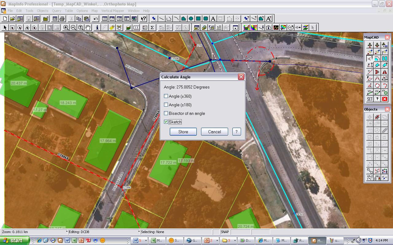
The one enhancement that excited me most after reading Paul Amos' review was the addition of a "comprehensive data editing package," called MapCAD. It includes 40 tools to do CAD-like editing. They are aimed at cadastral mapping, transportation network edits and utility use in electric, telecommunications, water and gas networks. Why? Because customers of MapInfo's German partner AGIS, from whom the MapBasic code was licensed, needed those tools. While not a full CAD package, I found many of the "most used" tools from my days using AutoCAD and MicroStation: polyline split, split at node, smooth, offset, combine, copy style, mirror, rotate, fillet/chamfer... Interested? Watch this demo that AGIS put together to introduce the MapCAD tools. My immediate thought was that if you need this level of editing, this one set of tools will justify the upgrade. (Speaking of which - there's a special upgrade deal for those with version 7.8 or earlier until the end of September. Contact MapInfo or your reseller. After that date, those with 7.8 or earlier releases will no longer have access to upgrade pricing; they'll need to buy a new license.)
I'll conclude with an interesting story. At the first break, a
conversation started in which one attendee noted that he must not have
the "Professional" version of MapInfo because his software looked
completely different. There is no "just" MapInfo, it's all MapInfo
Professional, so several of us scratched our heads. Later, Will
Mitchell determined that the individual must use Microsoft's MapPoint
2006, which he'd mistakenly called MapInfo 2006. That said, the
attendee found MapInfo Professional quite intriguing!
The one big takeaway I want to share is this: If you think that MapInfo is somehow a lesser or "toy" GIS, think again. The questions and concerns of the users in attendance sounded just like those you'd hear at any GIS event. Further, many long-time users took copious notes during the tips and tricks and open question periods as they documented tools of which they were not aware. That's one sign, I'd argue, of a rich set of tools. As one attendee put it after being shown a "new to him" tool: "I was unaware of the power."
Having said that, let me jump first to the "best" part of the very worthwhile day: the focus group. I was pleased that when I asked if I could stay, I received a firm "Sure!" At last year’s Roadshow, MapInfo also facilitated focus groups (Round 1). Two hundred ninety-one people participated in events around the world and identified these top four areas that "needed improvement":
- Usability
- Easy-to-read maps
- Data creation
- Analytics
The rest of the day involved a tips and tricks session wisely focused not on the new version (9.5), but on the "currently in use" 9.0 version. Thus, everyone could go home and use these tips. Many of the tips seemed like "simple" ones, but I was reminded that once users fall into a habit using software, they don't have the chance to seek out new tools and explore new options. The variety of customization options sparked much note-taking, as did some tricks for working with layers. The final set, related to attributes and the data browser, was also popular. One question prompted a demonstration of the "workspace resolver," a tool that walks you through "fixing" a "broken" workspace (one not able to find its data).
The final session focused on new features in MapInfo Professional 9.5. Many related to the interface: simplifying access and changes to layer properties, streamlining the selection of symbols via a grid of options, and better management of named views. Others included labeling enhancements, custom symbols from multiple formats, support for MS SQL Server Spatial, Oracle 11G and annotation text support, Web Feature Service Transactional (WFS-T) support (editing via WFS), more projections, enhanced .NET support, and enhanced licensing. Coming in an update release slated for November are vector and label translucency, anti-aliasing (to make line work "smoother") and a few other goodies.
The one enhancement that excited me most after reading Paul Amos' review was the addition of a "comprehensive data editing package," called MapCAD. It includes 40 tools to do CAD-like editing. They are aimed at cadastral mapping, transportation network edits and utility use in electric, telecommunications, water and gas networks. Why? Because customers of MapInfo's German partner AGIS, from whom the MapBasic code was licensed, needed those tools. While not a full CAD package, I found many of the "most used" tools from my days using AutoCAD and MicroStation: polyline split, split at node, smooth, offset, combine, copy style, mirror, rotate, fillet/chamfer... Interested? Watch this demo that AGIS put together to introduce the MapCAD tools. My immediate thought was that if you need this level of editing, this one set of tools will justify the upgrade. (Speaking of which - there's a special upgrade deal for those with version 7.8 or earlier until the end of September. Contact MapInfo or your reseller. After that date, those with 7.8 or earlier releases will no longer have access to upgrade pricing; they'll need to buy a new license.)
 |
From Our Homepage
Saying Farewell to an Amazing Journey
Communicating with Maps
Is There a GIS Career Ladder?
What does it mean to be geospatially smart? Series
Ways Real Estate and Property Developers Utilize Melissa GeoData for Data-Driven Decisions
Unlocking Value From Daily Satellite Imagery and Insights
Maximizing the Value of Your Address Data with Geo Addressing
How Indoor Mapping Enhances the Security of Smart Buildings
Look Ahead: AI, Location Intelligence and Efficiency
Collaboration Takes on Sea Level Rise & Dynamic Technology Environments
Brownies for Brownfields
Has Everything Been Mapped Already?
How Is Data Literacy Changing in an Artificial Intelligence Landscape
Portfolios for GIS Professionals: More Than Just Maps
How to Create a Distance Matrix in QGIS - A Step-by-Step Guide
7 Ideas for Bringing GIS into the K-12 Classroom
The Geography of Movement