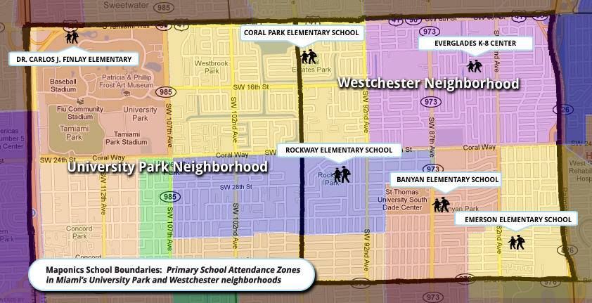
At the heart of the new Maponics School Boundaries offering are the School Attendance Zones (SAZs). I'm first to admit that I really was not 100% sure of what they were before I chatted with Darrin Clement, Maponics CEO. Here's how he explained it to me. First, there are school districts; those are the boundaries for the areas managed by the local school board. In some areas, like where I grew up outside of Boston, the town was the school district. In other areas, a school district might match up with a county.
An SAZ is something else entirely. It defines which geographies attend which schools. In my hometown, which of the then nine elementary schools you attended depended on where you lived. But, when I got to junior high (we didn't yet have middle school) the town launched "open enrollment," meaning students could go to whatever school their parents chose. (I loved that since I could go to a different junior high than my smarter big brother!) Then, once it was time for high school, there was just one, so everyone came back together. My story highlights how complex gathering and sorting out SAZs can be. And, per Clement, there are other oddities. There are areas where assignment is by lottery, so there are no polygons to speak of! And, there are towns so small and remote that the town pays for the local students to attend a private school, in another town!
What Maponics is launching this week is the first phase of School Boundaries. It includes:
- SAZs for top metros, covering 20% of U.S. student population
- School Districts for the whole U.S.
- School Points for the whole U.S., and rooftop locations for areas where SAZs are complete
The data include "tags" to highlight oddities like the ones I mentioned above. The company will be adding at least another 20% each quarter so that by a year from now the SAZ dataset should be complete for the entire country. The long-term goal is to maintain relationships with the authors of these data to keep those zones up-to-date.
 |
Why is this dataset important or valuable? The group most anxious to see the data - and the one that approached Maponics first - is the real estate industry. It's easy for a real estate site to include school locations on maps and note which schools are closest. But, without accurate SAZs, there's no way to know if a student who lives in a nearby house will attend that school! And, let's face it, families with children choose locations for many reasons, but a big one is the school. (That's in part why my family ended up in Winchester, MA.)
Another potential user of that dataset? Marketers. You can probably imagine why a local university might want to market its summer sessions to an overachieving high school population and why a business that helps boost SAT scores might want to market to a different population.
A third use? A school zone could act as a safe proxy for a youngster's "location" in a social media application. Right now, on Twitter you can share your lat/long (not so meaningful unless fed to a rendering tool) or your location (which is actually your Maponics "Neighborhood," which is more meaningful and less exact). An SAZ might fill that same role and be even more meaningful for young people who consider their school a key part of their identity.
Finally, Clement points out, some of the less tech savvy areas of the country don't even have digital maps of the SAZs. Maponics is hoping, after helping to create those files, that it can host them and share them back to the communities for use and easy updating. He's quick to point out that "hosting SAZs for small towns in the cloud" is not part of the business plan, but serves both the company's need for a complete dataset and the locality's need for an easy-to-update digital file. It's a win-win.
Maponics began putting this dataset together last year and found it labor intensive. For that reason, and because these data can be critical for some types of searches, customers will pay a bit of a premium. But considering that until now such a dataset has not been available for the entire U.S., the company feels it'll be worth it.