 One common thread that connects these varied tasks is spatial data analysis.When Sawchuck first began working as a forest technician, paper maps and light tables were the preferred method for presenting data in a geographic format.Unfortunately, this traditional method offered little in terms of data analysis and presentation options.Today, Sawchuck and an increasing number of conservation department employees combine the speed and accuracy of a GPS with the analytic and presentation capabilities of a Geographic Information System (GIS).
As a forester, Sawchuck finds that GPS and GIS technologies enable him to more rapidly collect and geocode data and then present it in numerous formats ranging from text-based tables to detailed color maps.But the most valuable asset that the GPS/GIS combination brings to this forester's job is its analytical power."A lot of people view GIS as a great mapmaking tool," Sawchuck notes."It does that really well, but the real power behind GIS is the ability to do analysis of your information."
Over the past few years, Sawchuck has noticed that more people in forestry and environmental conservation are adapting GIS technology to their jobs because of its ability to analyze and present data in a spatial format.
"Generally, people agree that somewhere in the neighborhood of 75 to 80 percent of data has a spatial component to it," notes John Steffenson, forestry specialist with ESRI, a GIS and mapping software company with headquarters in Redlands, CA."GIS is a spatially organized database and geography is the integrating theme.So GIS is a pretty compelling solution for many fields." To date, fields ranging from municipal planning to disease control are integrating the capabilities of GIS/GPS technology into their jobs.And that list is growing as people such as Sawchuck learn to adapt this technology to their particular jobs.
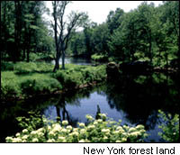
Recently, Sawchuck was assigned the task of taking an environmental inventory of an area south of Albany, New York.This inventory meant that Sawchuck would report, count and geocode the locations of trails, archaeological sites, bird nests, snakes, diseased trees, rare plants and animals.All of this diverse information would be separated into distinct files such as "rare plants," or "trail routes." Then, these files would be made available as sources for reports, charts, or maps.
Sawchuck says his "weapons" for this job were Trimble's GPS Pathfinder® Pro XR, a GIS data collection unit with differential GPS capability for collecting and geocoding data, and ESRI's ArcView GIS 3.2 for analyzing and presenting the data.
"Jobs like this are large and include lots of data," Sawchuck says."In this particular inventory, I had six days of data from six hours in the field each day." Sawchuck picked the Trimble unit because of its versatility."It has all the functions and features that I can customize for jobs like this." For example, while walking along a trail, Sawchuck will set the Trimble to record his latitude/longitude every five seconds.In tighter areas--or areas with a heavy canopy that can create multipath error problems--Sawchuck sets the Trimble to take readings every second.Moreover, if Sawchuck is mapping a trail and finds an archaeological site off the trail, he can pause the trail data collection and walk to the site, where he can add text comments and geocode that location.Then he simply walks to where he left the trail and resumes the trail mapping sequence.
These types of stops occur often--for bird nesting sites, rare plants and so on.Once back into the office, Sawchuck will load the data from the Trimble field unit to a PC that has Trimble's Pathfinder Office software installed.At this point, Sawchuck uses the differential GPS feature to correct any multipath and atmospheric errors by correlating the field data he has just collected with base-station data.The result: 2-5 meter accuracy and sometimes, sub-meter accuracy.
Once the data is corrected for multipath, Sawchuck converts it from a WGS8latitude-longitude format to an ArcView shape file format that is compatible with his ESRI GIS software."Then, if you don't have anything more, you have your final product: A GIS dataset that you can overlay on maps."
GIS/GPS Grows in Forestry Field
The use of GPS/GIS by foresters in rural New York is percolating up from field workers to offices.Foresters and field personnel were among the first to recognize the multiple uses of the first handheld GPS units.Then, when more sophisticated GPS units were integrated with powerful desktop GIS software, foresters found that this powerful combination added speed, accuracy and a new dimension of data analysis to their work."It's becoming standard and will be used more widely as time goes on," Sawchuck predicts.Mapping software alone is useful and handheld GPS units are very popular with consumers, but from Sawchuck's perspective, the real power of these technologies emerges when they are integrated: "If you are using the GIS, the GPS is useful.If you are not using the GIS, the GPS isn't as important." This powerful combination actually will make foresters more valuable as employees, Sawchuck notes: "We are moving to the GIS system in terms of individual foresters using it.So instead of depending on one map expert per region, the individual foresters become more valuable because they do the mapping themselves.It is quicker and easier.I am always producing maps and I don't use an ink pen and a light table anymore."
If Sawchuck had to sum up the application of GPS and GIS for a forester, the term "value added" would be accurate.The GIS analytical and presentation power actually makes the data he collects more valuable because it can be analyzed, used, and presented over and over in many different formats and applications."A map is just a piece of paper with dots on it.But a GIS gives us the power to sort this information.We can analyze it, put it on charts, or present the data on a map anytime without having to redo it.GIS allows us to re-use the information in many ways and in many formats."
For more information: