MapInfo StreetPro "" Benefiting from a Powerful Synergy of Data
Web services.Service oriented architecture.Business intelligence. Dashboards.All of these applications are designed to serve up data so that intelligent business decisions can be made.But they don't address one fact "" that data is the key to the intelligent decision.No matter how informative the display, the decision is only as good as the data on which it is based.
Combining Two Centerline Network Databases "" What did it Entail?
At the time of the acquisition, both data providers had comprehensive North American databases of street data based on years of data collection.Tele Atlas has spent more than a year merging the two databases into one.This required comparing the databases in detail and identifying and reconciling differences on a segment-by-segment basis. The process included the following:
- Tele Atlas and GDT each had about 4.8 million miles of streets with the same information (e.g., overlapping data that agreed completely)
- GDT had an additional 1.3 million miles of data not contained in the original Tele Atlas database; and
- Tele Atlas had an additional 600,000 miles of data not in the original GDT database
 2005 during the database comparison and integration process,
there have been:
2005 during the database comparison and integration process,
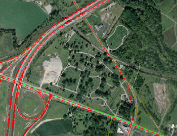
there have been:- More than 62.5 million automated edits
- More than 19.5 million manual edits
- More than 4.2 million miles of roads have been driven
- More than 1 million miles of new geometry added; and
- Nearly 310,000 miles of streets aligned to 12 meter accuracy or better
Historically, Tele Atlas and GDT used two different methodologies to build their products and deliver them to market.Both of these methodologies had their strengths.
The Tele Atlas Field Survey and Validation team concentrated on driving the streets to collect new data and verify existing information and reported changes.This approach helps guarantee accuracy, but is not enough to make sure you capture all the changes.With over 8 million miles of roadways in North America, it would require a fleet of 500-1,000 vehicles driving every day to cover all the roads in one year.Obviously, driving the roads is not enough.In some ways, a model that relies on driving-only as a change detection methodology is "brute force," haphazard, and not cost-effective.
Conversely, the GDT method specialized in compiling data acquired from over 35,000 government and other 3rd party, authoritative sources throughout North America.This extensive network monitors and documents all changes and additions to streets in both the U.S.and Canada, and on average, delivers 15 million+ changes and updates per quarter. Combining these two methodologies provides the opportunity to generate a remarkably accurate and up-to-date street data.
 |