 The 90-plus members of the MapPoint 2002 development team included several significant improvements over previous versions.These improvements are designed to win over larger enterprise users while maintaining a growing customer base of licensed Microsoft customers.MapPoint 2002 features GPS compatibility, the ability to embed mapping into business applications using ActiveX controls, plus expanded demographic data that is linked to geographies down to the census tract level.MapPoint 2002 will be sold in North American and European editions.The North American edition includes 6.4 million miles of roads and 830,000 points of interest, while its European counterpart includes 4.8 million kilometers of roads and 320,000 points of interest.
In the North American version, Microsoft utilizes Geographic Data Technology's street database, plus it "stitches in" highly-detailed information about 49 metropolitan areas using Navigation Technologies' street database, which includes information such as speed limits, turn restrictions, entry ramps, and one-way roads.The bundled US demographic data comes from Claritas, while the Canadian demographic data comes from Compusearch, which is now owned by MapInfo.
Many of the improvements to MapPoint 2002 are designed to address the lack of expandability and versatility in the previous two versions.For example, built-in ActiveX controls and an extended Object Model push MapPoint's capabilities well beyond the standard user interface, and will enable Visual Basic 6 programmers to embed custom mapping right into their own business applications.Moreover, enterprise users who are using MapInfo or ESRI file formats can import those existing files into MapPoint 2002 and overlay that data on MapPoint maps.
"Many customers have huge investments in MapInfo and ESRI.Now you can bring MapInfo files or ESRI shape files right in and lay them on top of a MapPoint map," notes BJ Holtgrewe, a senior product manager with Microsoft."We are not trying to replace what MapInfo or ESRI does.We are providing a way for an enterprise customer with investments in those formats and applications to work in harmony with MapPoint."
Other new features in MapPoint 2002 include:
- GPS compatibility.Users with any NMEA 2.0 and above GPS receiver can add waypoints, routes and do real-time analysis by linking their GPS to a desktop or laptop that is running MapPoint 2002.
- Custom pushpin symbols.In previous MapPoint versions, users were limited to symbols offered on the MapPoint CD.With the new version, users can download any bitmap image, cursor or icon file and display it on maps.
- Drive-time zones.MapPoint 2002 users will be able to create drive-time zones that will be especially accurate in the 49 metro areas that have Navigation Technologies' details such as speed limits, turn restrictions, and one-way roads.
- Pull datasets off a map and display on a spreadsheet: With MapPoint 2002, users can draw a polygon on a map and then pull datasets out of the area displayed in the polygon and display it on a spreadsheet with one right mouse click.
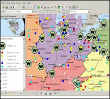
- Territory manager.Business users can create a territory, whether it comprises a few city blocks or several states.These territories enable users to define and analyze marketing and sales areas, delivery zones, or service areas.Data can alternately be analyzed and displayed statically on a chart or spatially on a map.
- Redesigned import wizard enables users to use the included Claritas or Compusearch demographic data or else import data from any Access, Excel, Oracle, or text delimited files.
- New map types.Five new map types are being added to the latest version of MapPoint.The new map types include multiple symbol, pie chart, sized pie chart, column chart, and series column chart.
- Enhanced Web features.Previous versions enabled users to save maps as Web pages.When MapPoint 2002 users save maps as Web pages, they have the options of creating thumbnail previews of saved maps, increasing or decreasing map size, and automatically creating hyperlinks.
For additional information about MapPoint 2002, visit www.microsoft.com/office/mappoint/