Ed. note: This article originally
appeared in NASA's online NASA in Your Life publication.
A group of atmospheric research scientists at NASA's National Space
Science and Technology Center, or NSSTC, felt a little like they were
in a foreign country when they first met with representatives from the
University of Alabama at Birmingham's School of Public Health recently
to discuss a research partnership.
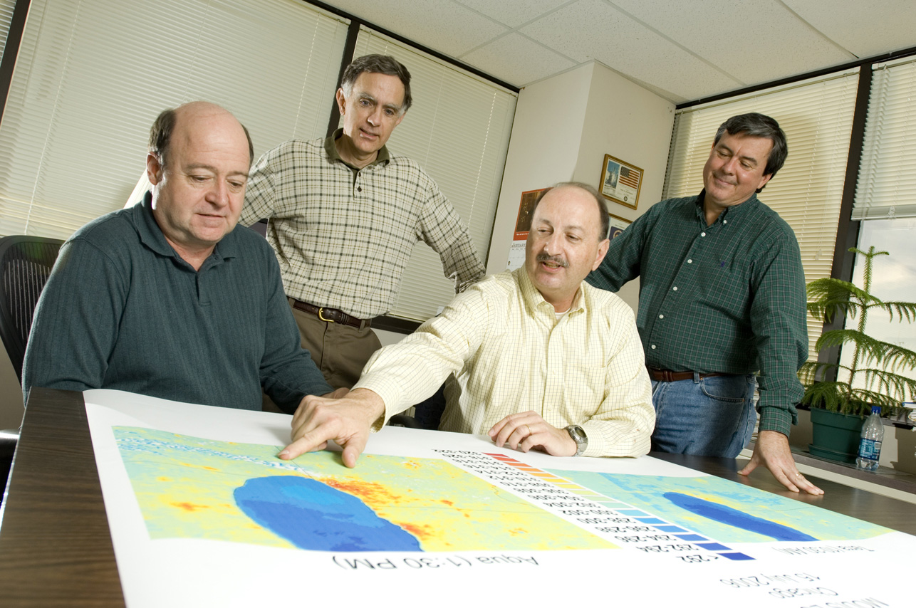
"When we first got together, it was as if we were speaking entirely different languages," says NASA's Dale Quattrochi.
But soon both parties began to realize how NASA satellite data could translate into useful public health information.
"We started seeing how it was really a great fit. It was wonderful. The lights clicked on!" Quattrochi said. "Besides, collaboration is NSSTC's specialty."
Thus, a unique partnership began.
UAB had been working on a large study called REGARDS, short for Reasons for Geographic and Racial Differences in Stroke. The study, funded by the National Institute of Health, sampled over 30,000 people across the U.S. with in-home surveys which included taking their blood pressure and blood samples and administering a detailed health questionnaire. The survey focused mostly on African-Americans because research has shown that group to have a higher risk of contracting the conditions the study examined - cardiovascular disease, hypertension, and stroke - to name a few.
As a result of the study, UAB now has a huge database of public health information. But how, exactly, does NASA fit into this picture?
"Both UAB and NASA want to understand, using NASA satellite data on air quality, heat indexes, temperature, humidity, and other environmental elements, how the environment is influencing the diseases and conditions targeted by REGARDS," explains Quattrochi.
Over the last few years, studies have pointed to a link between environmental conditions and cardiovascular events, including stroke. These studies, though, have been limited or have not covered a large enough territory, so more research is needed.
NASA satellites can help.
"In our study, the REGARDS data gathered from across the country are coded based on the longitude and latitude where the participants live. So we can merge the REGARDS data with our NASA remote sensing data," Quattrochi explained. "With our combined data, we'll be able to pinpoint any statistical relationships between these diseases and where these people live, how hot their climate is, and so forth. We're analyzing the data now. With the wide geographic coverage, this study's findings could help health officials with environmental exposure and health recommendations."
But there's more to this story, according to NSSTC scientist Jeff Luvall.
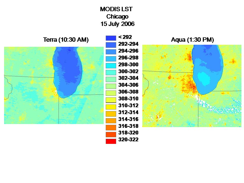
NASA MODIS satellite image compares temperatures in the morning with those in the afternoon over northern Illinois, southern Wisconsin, and northern Indiana.
This NASA MODIS satellite image compares temperatures in the morning with those in the afternoon over northern Illinois, southern Wisconsin, and northern Indiana. Researchers aim to pinpoint any statistical relationships between environmental conditions and certain diseases. View large image
Image Credit: NASA
"Working with the public health people made us realize that we needed
to cross-train people - that is, teach them to cross professional lines
to understand both what we do and what the medical profession does," he
said.
UAB created a remote sensing lab within its Laboratory for Global Health Observation to do just that. This lab is the first U.S. dedicated remote sensing lab for medical and public health use. Students at the lab take "cross-training" courses in remote sensing and GIS, many of which have NASA/NSSTC scientists such as Dr. Dale Quattrochi, Dr. Jeff Luvall, Dr. Douglas Rickman, Dr. Mohammad Al-Hamdan, Dr. William Crosson, and Mr. Maurice Estes who are also UAB adjunct professors as guest lecturers and invited experts. The professors teach students how satellite data can be used in medicine and health. Best of all, the lab promotes productive collaborations such as REGARDS.
In the summer of 2006, Dr. Sarah Parcak, anthropologist, and Dr. Tennant McWilliams, former dean of Social and Behavioral Sciences, developed the Global Health Observation Lab as a partnership between the Schools of Social and Behavioral Sciences and Public Health. The potential for a remote sensing lab, in particular the medical and health research possibilities, evolved into a partnership with Dr. Max Michael, dean of the School of Public Health. The primary focus of the remote sensing lab is medical and health-based applications for satellite remote sensing. Its mission is to look at broad-scale applications of satellite remote sensing and ways in which this information can be used across diverse fields in the context of international outreach programs.
"This will help both our own generation and future generations, helping researchers identify the environmental factors that play a part in disease," said Luvall. "This is a turning point in public health. Who knows where it will lead?"
It has already led to vital research in fighting malaria. Satellite remote sensing is locating standing water - fertile breeding ground for mosquitoes - so these areas can be treated effectively and precisely. The lab has also been instrumental in tracking environmental influences on childhood asthma. Many other valuable studies are planned or in progress.
Quattrochi and Luvall agree that both the lab and the partnerships it supports are shining examples of what NSSTC does best - bring a diverse group of bright minds together from various disciplines to foster cutting-edge research and education of the next generation of scientists and engineers.
That's good news in any language.
 |
"When we first got together, it was as if we were speaking entirely different languages," says NASA's Dale Quattrochi.
But soon both parties began to realize how NASA satellite data could translate into useful public health information.
"We started seeing how it was really a great fit. It was wonderful. The lights clicked on!" Quattrochi said. "Besides, collaboration is NSSTC's specialty."
Thus, a unique partnership began.
UAB had been working on a large study called REGARDS, short for Reasons for Geographic and Racial Differences in Stroke. The study, funded by the National Institute of Health, sampled over 30,000 people across the U.S. with in-home surveys which included taking their blood pressure and blood samples and administering a detailed health questionnaire. The survey focused mostly on African-Americans because research has shown that group to have a higher risk of contracting the conditions the study examined - cardiovascular disease, hypertension, and stroke - to name a few.
As a result of the study, UAB now has a huge database of public health information. But how, exactly, does NASA fit into this picture?
"Both UAB and NASA want to understand, using NASA satellite data on air quality, heat indexes, temperature, humidity, and other environmental elements, how the environment is influencing the diseases and conditions targeted by REGARDS," explains Quattrochi.
Over the last few years, studies have pointed to a link between environmental conditions and cardiovascular events, including stroke. These studies, though, have been limited or have not covered a large enough territory, so more research is needed.
NASA satellites can help.
"In our study, the REGARDS data gathered from across the country are coded based on the longitude and latitude where the participants live. So we can merge the REGARDS data with our NASA remote sensing data," Quattrochi explained. "With our combined data, we'll be able to pinpoint any statistical relationships between these diseases and where these people live, how hot their climate is, and so forth. We're analyzing the data now. With the wide geographic coverage, this study's findings could help health officials with environmental exposure and health recommendations."
But there's more to this story, according to NSSTC scientist Jeff Luvall.
NASA MODIS satellite image compares temperatures in the morning with those in the afternoon over northern Illinois, southern Wisconsin, and northern Indiana.
This NASA MODIS satellite image compares temperatures in the morning with those in the afternoon over northern Illinois, southern Wisconsin, and northern Indiana. Researchers aim to pinpoint any statistical relationships between environmental conditions and certain diseases. View large image
Image Credit: NASA
 |
UAB created a remote sensing lab within its Laboratory for Global Health Observation to do just that. This lab is the first U.S. dedicated remote sensing lab for medical and public health use. Students at the lab take "cross-training" courses in remote sensing and GIS, many of which have NASA/NSSTC scientists such as Dr. Dale Quattrochi, Dr. Jeff Luvall, Dr. Douglas Rickman, Dr. Mohammad Al-Hamdan, Dr. William Crosson, and Mr. Maurice Estes who are also UAB adjunct professors as guest lecturers and invited experts. The professors teach students how satellite data can be used in medicine and health. Best of all, the lab promotes productive collaborations such as REGARDS.
In the summer of 2006, Dr. Sarah Parcak, anthropologist, and Dr. Tennant McWilliams, former dean of Social and Behavioral Sciences, developed the Global Health Observation Lab as a partnership between the Schools of Social and Behavioral Sciences and Public Health. The potential for a remote sensing lab, in particular the medical and health research possibilities, evolved into a partnership with Dr. Max Michael, dean of the School of Public Health. The primary focus of the remote sensing lab is medical and health-based applications for satellite remote sensing. Its mission is to look at broad-scale applications of satellite remote sensing and ways in which this information can be used across diverse fields in the context of international outreach programs.
"This will help both our own generation and future generations, helping researchers identify the environmental factors that play a part in disease," said Luvall. "This is a turning point in public health. Who knows where it will lead?"
It has already led to vital research in fighting malaria. Satellite remote sensing is locating standing water - fertile breeding ground for mosquitoes - so these areas can be treated effectively and precisely. The lab has also been instrumental in tracking environmental influences on childhood asthma. Many other valuable studies are planned or in progress.
Quattrochi and Luvall agree that both the lab and the partnerships it supports are shining examples of what NSSTC does best - bring a diverse group of bright minds together from various disciplines to foster cutting-edge research and education of the next generation of scientists and engineers.
That's good news in any language.
From Our Homepage
Saying Farewell to an Amazing Journey
Communicating with Maps
Is There a GIS Career Ladder?
What does it mean to be geospatially smart? Series
Ways Real Estate and Property Developers Utilize Melissa GeoData for Data-Driven Decisions
Unlocking Value From Daily Satellite Imagery and Insights
Maximizing the Value of Your Address Data with Geo Addressing
How Indoor Mapping Enhances the Security of Smart Buildings
Look Ahead: AI, Location Intelligence and Efficiency
Collaboration Takes on Sea Level Rise & Dynamic Technology Environments
Brownies for Brownfields
Has Everything Been Mapped Already?
How Is Data Literacy Changing in an Artificial Intelligence Landscape
Portfolios for GIS Professionals: More Than Just Maps
How to Create a Distance Matrix in QGIS - A Step-by-Step Guide
7 Ideas for Bringing GIS into the K-12 Classroom
The Geography of Movement