NOAA Captures NorthEast Blackout
NOAA posted these satellite images online taken before and after of the historic blackout of the Northeastern United States, which plunged millions of people into darkness.NOAA processed the night lights data taken by the Defense Meteorological Satellite Program (DMSP).NOAA archives the data from the satellite.The image below is a view of the Northeastern USA taken Aug.14, 2003, at 9:03 p.m.EDT. 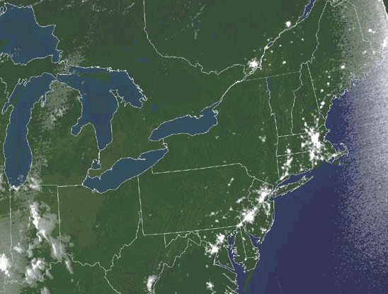
Click above for larger (low resolution) image
Clich HERE for a high resolution image.
Before the blackout images
Click below on the image for larger view (low resolution) of night lights before the blackout in the Northeastern USA taken Aug.13, 2003, at 9:21 p.m.EDT. 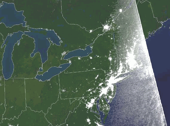
Click HERE for higher resolution of the image above; NOAA processed the data from the Defense Meteorological Satellite Program.
For more image from NOAA, click HERE.
Images coutesy of NOAA/DMSP