
Q1.Rand McNally has been known as the premier map maker for many years and built on its brand by entering the retail business.What model, going forward, will the company seek to follow, especially now that it has emerged from Chapter 11?
A: Rand McNally will continue to pursue its long-held strategic aims.We strive to be an indispensable guide to travelers and to provide this information anytime, anywhere, through whatever medium the customer chooses.
We do this now by providing maps for handhelds, desktops, the web, and, of course, in all sorts of printed forms. Increasingly, these maps include references to the other forms, so electronic products guide to the right page and grid in the paper product, and Express Access Codes in the paper map take the user to the same map on randmcnally.com.
Let me clarify that the Chapter 11 restructuring did not alter our business operations, and normal business continued through the very short, seven-week process.We reduced our debt to a more manageable level.We also executed a debt-to-equity swap.The fact that we have new equity investors is a huge vote of confidence in the company and our future.
Q2.How has technology, and specifically map-making technology, altered
this business model, either from a cost or marketing standpoint?
A: Technology allows us to innovate.From PDAs to mobile phones
to desktops to the Web, technology has allowed us to deliver maps in new
ways.Our customers can chose the format that's most useful to them.
Technology has also allowed us to better integrate formats, like directions
on your mobile phone that also refer to the page and grid in the print
Road Atlas or Street Guide atlas.Our expertise is in understanding how
people use maps and the different formats they prefer for different uses.
Integrated mapping lets the customer use the best features of the medium,
whether this is instant information through digital means or more easily
seeing spatial context on paper.
Q3.The company has sought to segment its business into map publishing,
travel items, and electronics in support of both, in addition to niche
products for business travelers or Motor Carrier Atlases, etc.Is this
a correct characterization of your business and will you continue to segment
the market in a similar way?
A: The core of our business is mapping. A good map is
easy to use and highlights the information most important to the user.
Different users prefer different attributes that are most useful to them.
We aim to continue to provide useful products that our customers view as
indispensable.With this specialization, we can also serve niche markets
like truckers.
Q4.What is the share of your revenue from each of your business
units?
A: Since Rand McNally is a private company we do not disclose
financial information.
Q5.How are you managing your spatial databases? What software are
you using? What is the size of your spatial database?
A: We draw on our significant base of digital map data
to create products with often dramatically different requirements.
To manage this data we use a combination of best-of-breed commercial systems,
including both Oracle and SQL Server, and proprietary tools designed to
be most effective for each product application. Our databases include
owned map data, often generalized to multiple visualization scales, as
well as licensed data from essentially all prominent map data vendors.
Q6.How are maps compiled and updated? Are you using a GIS to do
this? A proprietary system?
A: Our map products range from world-scale physical and
political to completely routable street-level maps.The research approach
and updating tools vary to be appropriate for each dataset. Choosing
the right tools for each job is important in assuring both quality and
cost-effectiveness. We use Geographic Information Systems extensively
for products that benefit from this technology.Other products benefit
from more straightforward technologies.In all cases, we use a combination
of the best-of-breed commercial systems, including tools from both ESRI
and Bentley, and proprietary tools that we continuously evaluate and develop.
To keep our data up-to-date, we have a staff of researchers and a substantial database of source information contacts. While most updates are researched systematically and periodically by contacting specific sources, some updates are found opportunistically.For example, we monitor news reports for changes in the world that might affect our maps.All potential changes are tracked in a separate database from which they can be queued for making updates to our map databases.
Q7.What map publishing software do you use? What is the process
for annotation, design, review and quality assurance? (I realize you could
write a book on this, but perhaps just summarize the workflow.)
A: For reasons of efficiency, we use several different
map publishing workflows depending on the database format and product requirements.
For example, variable depth masking, automated annotation placement, multiple
line screens, and specific output file formats are features that are each
differently supported by the various commercial map-publishing workflows.
And, some of these features are more important for some products than others.
Controls for quality and specific steps for quality assurance are a part
of these workflows. Automated annotation placement tools are often
used, but for printed products, all annotation placement is then reviewed
by a cartographer.
Q8.How do you see the competitive situation for the company? Is
the market drying up for paper maps because cheap software programs like
MapPoint as well as online resources that are free contributing to the
demise of the paper map business? Are other map makers experiencing the
same malaise?
A: I'm always amazed how many people will confess to me
their lifelong interest in maps. The widespread access to digital
maps, whether on a Palm, the Internet, or a desktop, has awakened and amplified
this interest. Electronic maps have convenient delivery and instant
access, but there's still something special about holding a paper map in
your hand. What's important to me is how that electronic and paper
format reinforce each other and work together, allowing users to choose
which format best suits their immediate needs.
Q9.How will the market for wireless location-based services affect
your market position? Will you seek to supply location service providers
with your expertise in map rendering for small form factor devices? What
are your insights into the LBS market situation?
A: We are doing very well in this market.Rand McNally
is the market standard for electronic maps on PDAs, with or without GPS.
We serve the major GPS manufacturers including Magellan, Navman and Cobra.
We recently introduced a product that offers maps and directions via mobile
phones. We have particular expertise in map rendering and in user
interface design for small devices. As the LBS market takes hold
in the US, we are prepared to expand these offerings.
Q10.Your online maps are the most accurate I have used.To what
do you attribute the accuracy of your online system? I see you use Navtech
data.Are you using other sources as well?
A: Accuracy is very important to us.We do use data from other
sources to augment the underlying Navigational Technologies data on our
website. While the underlying data is quite good, what separates
map sites is the software used for routing and explication (the written
description of the directions), and the design of the rendered map.
We're particularly proud that we excel at these aspects and it shows on
randmcnally.com.
Q11.Where will Rand McNally be in five years? More into retail,
or travel, or map making? Other?
A: Our goal is to provide map products that help customers,
when and where and in whatever profitable format they want. We take
seriously the long-standing trust our customers place in us to provide
easy-to-use and up-to-date cartography. We are constantly developing
new technologies to create better maps and to deliver better electronic
solutions to customers.
Our biggest challenge, and the challenge for the map industry, is to continue to innovate and adapt to provide products and services that best help to guide travelers.If we do that, our customers will make sure we're around at least another 147 years.
Company History
Founded in 1856, Rand McNally creates mapping, routing and trip-planning
tools for the consumer, business, education and commercial transportation
markets featuring national and local travel content for the United States
and Canada.

The precursor of Rand McNally began when William Rand opened a small
printing shop in Chicago.A few years later, William Rand and Andrew McNally
(pictured at right) begin their partnership by printing tickets
and timetables for the nation's railroad hub in Chicago.
Since its inception, the company has been a leading innovator in the
industry.Rand McNally published its first maps in 1872 using a new wax
engraving method that significantly reduced costs.The company introduced
the concept of identifying roads by number; the precursor of the system
used today.In the mid-1950s, Rand McNally revolutionized the industry
by becoming the first commercial mapmaker to adapt the scribing process
to make maps.The first full-color Road Atlas appeared in 1960.
Rand McNally was also instrumental in creating educational and professional
atlases, including Goode's World Atlas in 1923, The International Atlas
in 1969, and the Commercial Atlas, now in its 134th edition, in 1869.
In the field of commercial transportation, Rand McNally's transportation
data management subsidiary has produced the Household Goods' Carrier's
Bureau mileages and mapping, the objective industry standard for calculating
shortest truck drivable distances from point to point. In 1982 Rand
McNally introduced MileMaker®, the industry's first software allowing
for mainframes to quickly calculate distances and to apply rates.
MileMaker® and other products such as IntelliRoute® and RouteTools™
have evolved with the changing needs of the industry, providing routing,
tracking, estimated arrival times and other features on a variety of electronic
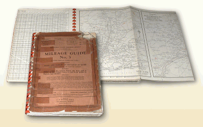
platforms.The #1 selling Motor Carriers' Road Atlas provides a printed
mapping resource to drivers and dispatchers nationwide.
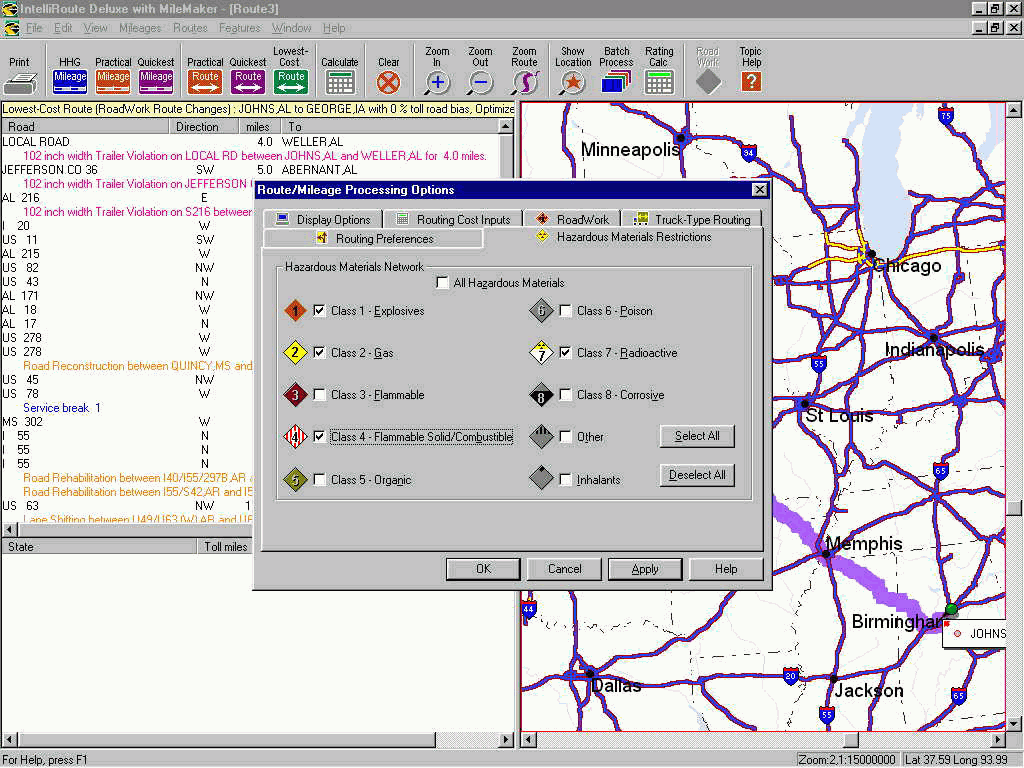
IntelliRoute software (click for larger image)
In the 1990s, Rand McNally introduced a variety of mapping software, including the award-winning TripMaker® travel planning software.In 1999, Rand McNally acquired Thomas Bros.Maps, bringing the two leading map publishers together. Today, we update and publish tens of thousands of map pages each year, deliver printed and matching digital versions of maps, and offer rancmcnally.com.