I wrote about Google's addition of satellite imagery to Google Maps earlier this week.What's interesting is watching the follow up.While many, many people say the equivalent of "Isn't this cool?" an equal number raise business and technology issues.Still others raise the privacy issue.After reading these reactions I find that we are not yet in a position to have a national or international discussion on this level of availability of imagery since the public's knowledge of the issues on many fronts is rather limited.
 |
Australian Financial Review writes in its headline that the new feature "may wipe rivals off the map." In particular, it cites the opinion of Greg Sterling, of the Kelsey Group that Google's satellite maps posed the biggest threat to MapQuest.That service, owned by Time Warner, still ranks as the most popular website for finding directions.MapQuest "defined" the online map service.It's the Kleenex of the industry.It's number one, but with many rivals, Google among them.Still, MapQuest is a "one trick pony," just a mapping site, though it's part of a bigger empire.Google really is competing in the portal/search/services/world domination arena.
A writer at Journalism.co.uk notes that the updated Google Maps is "Multimap ["online maps to everywhere"], Yell.com ["the UK's Local Search Engine"] and Google rolled into one.And yet another online tool that could shaft newspaper classified ads." That's well stated.Google is currently all about advertising dollars, not mapping.Further, Google is all about integration.Google is pulling together local search, mapping and directions, shuttle services (RideFinder) and other spatially linked information together.Google is making that integration seamless and simple to use.Ideally, Web Services and/or OGC specifications are supposed to enable this sort of picking and choosing of geospatial services to "plug together." The reality is that that ability is still, for the most part, in the hands of the developer community.For now, Google has made all of the decisions and done the integration work, providing a slick product.There are two ways to look at Google accomplishments in mapping thus far.Either, the company is indeed on the way to world domination or the company is showing what's possible and others will enter with an even better, perhaps more open, solution.
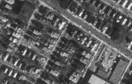
Softpedia is not that impressed with the new imagery offering: "Unfortunately, the images taken through satellite look kind of old or show residential areas still under construction, when in reality they have been finished for a long time." It seems everyone assumes real time satellite images are available and that they are inexpensive, such that Google could offer them for free.Clearly much of the world has forgotten the size of the contract the Department of Defense awarded to DigitalGlobe for exclusive use of images of Iraq in recent years.Or the world forgot that it took a few days to make the images of the tsunami stricken areas available for relief efforts.A suggestion: when explaining the nature of imagery to non-geospatial acquaintances, consider this analogy, which I believe I first heard from Gerry Kinn at Trimble: "Aerial imagery has a shelf life similar to bread.It's very tasty when fresh, but less and less interesting as it ages." Why would Google give away fresh bread for free?
 |
Pam Dixon, executive director of public interest research firm World Privacy Forum, San Diego noted that Amazon's A9 removed images of women's shelters, after being asked.She feels Google, as imagery becomes more detailed, must offer an "opt out" for business and consumers to be removed from the imagery database.Her remarks were covered in DMNews.com.I was not aware of the issue surrounding A9, but the fact that it was raised and the reaction of the company do set a precedent.Recall, too that once word got out that keying in one's phone number into Google would yield addresses and other (already public) information, that company provided tools to remove it.
Why exactly are we removing the information from the Web? It's not that it's not available elsewhere (phone books, for example, unless the number is unlisted).The same might be said for the shelters in the A9 case.Locations of shelters and their pictures, I'm confident, could be found, if someone really wanted that information.No, the issue is simply the ease of access.That brings me back to the Rand report which accessed the risk of online geospatial information in aiding terrorist attacks.The conclusion was that the information is a vast majority of cases was available publicly, elsewhere.So, the issue becomes, "Do we make it easier for people to access the information?" That, interestingly, is a large part of Google's business mission.