City officials in Sherbrooke, Quebec are using GeoEye's
IKONOS imagery for urban planning, land use and urban infrastructure
inventories, but also to provide its residents better emergency
response from first-responders.
Every second is important for an emergency response vehicle on its way to a crisis. Delays - whether they're caused by traffic congestion or hard-to-find residences - can mean the difference between life and death. To provide its citizens the best emergency response possible, city officials in Sherbrooke, Quebec are using satellite imagery to ensure that emergency vehicles and personnel have up-to-date mapping information.
Sherbrooke, a city located not far from the United States-Canada border in southern Quebec, has 145,000 residents. The Canadian Centre for Topographic Information is located in Sherbrooke, and the University of Sherbrooke is well-known across North America for its geomatics program.
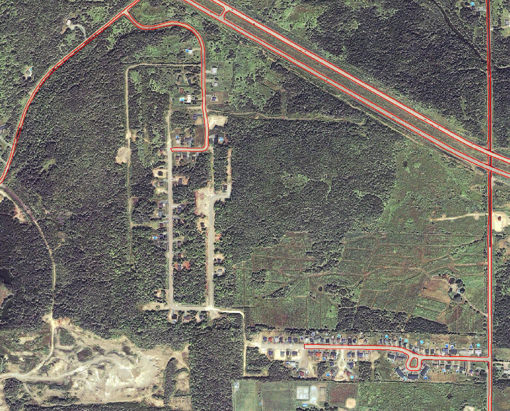
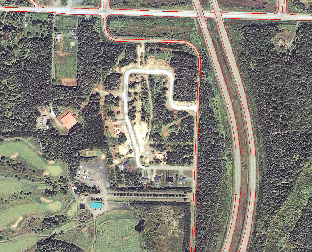
As in many forward-thinking towns across the world, detailed maps are important for Sherbrooke's civil security and urban planning. When new developments are being considered, the city often uses imagery in tandem with engineering plans and legal documents for mapping new streets and buildings. Imagery is used to confirm building locations and other visual elements on properties.
The city last updated its imagery with aerial photos in 2002. But due to budgetary constraints, commissioning another aerial imaging mission was out of the question. The municipality's large size - 376 square kilometers - made it an ideal candidate to use satellite imagery from GeoEye's IKONOS satellite. IKONOS was the world's first one-meter commercial remote sensing satellite, and has collected more than 275 million square kilometers of imagery available in GeoEye's digital archive. (Gï¿1⁄2oid is a reseller of the IKONOS data, and provided the data to the city.)
The cost of purchasing the necessary IKONOS imagery was small compared with the expense of creating maps from aerial imagery. For an area of Sherbrooke's size, satellite imagery is far more reasonable. The data was already available in the IKONOS archive, which helped with cost, but city officials questioned which of their applications could be supported with one-meter resolution data. They found that the data could be used for a variety of purposes.
"Imagery helps us mostly with urban planning, land use and urban infrastructure inventories, but it has also been useful to detect encroachments on public land and for civil security," said Michael Howard, the head of the city's geomatics department. A law in Quebec makes it possible for those who encroach on public land to take ownership of the land after a certain period of time, if there has been no complaint. Recently updated imagery helps the city monitor such encroachments.
Sherbrooke officials also use IKONOS imagery to update maps in developing areas. A rapidly developing sector can become almost unrecognizable after a period of several years, so regularly acquiring satellite imagery is part of the process to update and monitor these developments. The one-meter resolution provides enough detail to allow for building and feature recognition, Howard says.
More than 260 square kilometers of high quality IKONOS imagery was
available in GeoEye's archive as city officials began the project. In
order to use the data, they had to be orthorectified, which was done by
Gï¿1⁄2oid. Elevation data and data for ground control points (GCPs)
were provided by the city of Sherbrooke. Raster digital elevation data
were extracted from available elevation data. About 20 well dispersed
GCPs were collected per image. Another 20 were collected as independent
points from a different set of data to validate and measure precision
of the image. The images also had to be color balanced, which was
challenging since the archive data and the new acquisition data were
not collected during the same season.
City officials verified the imagery and overlaid it with existing mapping layers for building recognition, confirming the accuracy of the new imagery by comparing it with the existing database. "Buildings do not have to be located with centimeter precision right now," Howard said. "For this application, it is important to have buildings and other elements identified, and orthorectification is providing us with a sufficient precision." Convinced that the archived data was a good fit with their existing database, Sherbrooke officials tasked the IKONOS satellite to collect areas not covered by the archived imagery.
City and local officials are increasingly turning to satellite imagery and the applications it can support. While these applications have been available for several years, more and more forward-thinking officials in the last few years have made the decision to use satellite imagery.
Demand is growing as commercial satellite resolution improves and as city officials realize that one-meter imagery is sufficient to carry out many of the necessary planning and zoning applications. Gï¿1⁄2oid had three times the demand from municipalities in 2006 compared with the previous year.
Sherbrooke officials plan to continue collecting aerial images every five years, as some applications require a higher resolution than commercial satellites are able to provide. Between aerial photo collections, the city will task satellite acquisitions and merge the data to create a comprehensive and updated source of crucial information. Sherbrooke plans to have satellite collection every two years or so, but this could change to a yearly collection.
Every second is important for an emergency response vehicle on its way to a crisis. Delays - whether they're caused by traffic congestion or hard-to-find residences - can mean the difference between life and death. To provide its citizens the best emergency response possible, city officials in Sherbrooke, Quebec are using satellite imagery to ensure that emergency vehicles and personnel have up-to-date mapping information.
Sherbrooke, a city located not far from the United States-Canada border in southern Quebec, has 145,000 residents. The Canadian Centre for Topographic Information is located in Sherbrooke, and the University of Sherbrooke is well-known across North America for its geomatics program.
As in many forward-thinking towns across the world, detailed maps are important for Sherbrooke's civil security and urban planning. When new developments are being considered, the city often uses imagery in tandem with engineering plans and legal documents for mapping new streets and buildings. Imagery is used to confirm building locations and other visual elements on properties.
The city last updated its imagery with aerial photos in 2002. But due to budgetary constraints, commissioning another aerial imaging mission was out of the question. The municipality's large size - 376 square kilometers - made it an ideal candidate to use satellite imagery from GeoEye's IKONOS satellite. IKONOS was the world's first one-meter commercial remote sensing satellite, and has collected more than 275 million square kilometers of imagery available in GeoEye's digital archive. (Gï¿1⁄2oid is a reseller of the IKONOS data, and provided the data to the city.)
The cost of purchasing the necessary IKONOS imagery was small compared with the expense of creating maps from aerial imagery. For an area of Sherbrooke's size, satellite imagery is far more reasonable. The data was already available in the IKONOS archive, which helped with cost, but city officials questioned which of their applications could be supported with one-meter resolution data. They found that the data could be used for a variety of purposes.
"Imagery helps us mostly with urban planning, land use and urban infrastructure inventories, but it has also been useful to detect encroachments on public land and for civil security," said Michael Howard, the head of the city's geomatics department. A law in Quebec makes it possible for those who encroach on public land to take ownership of the land after a certain period of time, if there has been no complaint. Recently updated imagery helps the city monitor such encroachments.
Sherbrooke officials also use IKONOS imagery to update maps in developing areas. A rapidly developing sector can become almost unrecognizable after a period of several years, so regularly acquiring satellite imagery is part of the process to update and monitor these developments. The one-meter resolution provides enough detail to allow for building and feature recognition, Howard says.
 |
 |
City officials verified the imagery and overlaid it with existing mapping layers for building recognition, confirming the accuracy of the new imagery by comparing it with the existing database. "Buildings do not have to be located with centimeter precision right now," Howard said. "For this application, it is important to have buildings and other elements identified, and orthorectification is providing us with a sufficient precision." Convinced that the archived data was a good fit with their existing database, Sherbrooke officials tasked the IKONOS satellite to collect areas not covered by the archived imagery.
City and local officials are increasingly turning to satellite imagery and the applications it can support. While these applications have been available for several years, more and more forward-thinking officials in the last few years have made the decision to use satellite imagery.
Demand is growing as commercial satellite resolution improves and as city officials realize that one-meter imagery is sufficient to carry out many of the necessary planning and zoning applications. Gï¿1⁄2oid had three times the demand from municipalities in 2006 compared with the previous year.
Sherbrooke officials plan to continue collecting aerial images every five years, as some applications require a higher resolution than commercial satellites are able to provide. Between aerial photo collections, the city will task satellite acquisitions and merge the data to create a comprehensive and updated source of crucial information. Sherbrooke plans to have satellite collection every two years or so, but this could change to a yearly collection.
From Our Homepage
Saying Farewell to an Amazing Journey
Communicating with Maps
Is There a GIS Career Ladder?
What does it mean to be geospatially smart? Series
Ways Real Estate and Property Developers Utilize Melissa GeoData for Data-Driven Decisions
Unlocking Value From Daily Satellite Imagery and Insights
Maximizing the Value of Your Address Data with Geo Addressing
How Indoor Mapping Enhances the Security of Smart Buildings
Look Ahead: AI, Location Intelligence and Efficiency
Collaboration Takes on Sea Level Rise & Dynamic Technology Environments
Brownies for Brownfields
Has Everything Been Mapped Already?
How Is Data Literacy Changing in an Artificial Intelligence Landscape
Portfolios for GIS Professionals: More Than Just Maps
How to Create a Distance Matrix in QGIS - A Step-by-Step Guide
7 Ideas for Bringing GIS into the K-12 Classroom
The Geography of Movement