Last week I collected Four GPS derived points for our Franchise Territory and placed them into an Excel file.This time I'll put them in several different mapping programs and see about getting the territory into the Palm.Several things happened since last time, which made this project more interesting.My daughter Katie found the Palm emulator so I can run this app on my PC.Since I can screen capture the entire Palm, the images from the Palm look much better than trying to photograph them.
If you don't have a Palm or Handspring Visor, go get the emulator at http://www.palmos.com/dev/tools/emulator/ and you can try using the Palm on your own with your PC.
A second neat addition to this project that Katie found was a map of Middle Kingdom for the Palm.Why this was important is that it displays the attributes of a number of points in the map where some Hobbit adventure occurred.I'll show you this at the end of this column.
Back to getting our territory into the Palm:
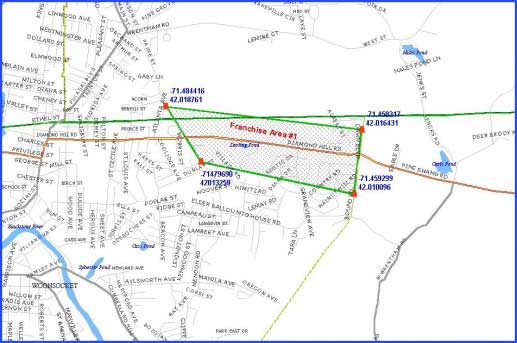
I started with reading the points into Maptitude 4.5 because I could easily create a new Franchise territory feature.I could write the new feature out in several formats that could be read by the other programs.The territory looks like this when the point are connected.
I exported the territory out to a ArcView shape file so it could be read by Business Map and exported to the Palm.The results looked like this in Business Map;
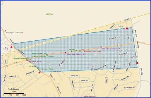
Notice that the points don't match the territory very well.This is after several tries at transforming the file.So I finally created a new territory (feature) in ArcView and that fixed the projection problem - AV & BM use the same projection so now everything matched up and looks like this.Obviously, what I should have done in the first place.
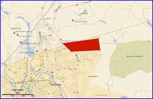
This map exported to the Palm from Business Map looks like this (points exaggerated in size so you can see them).
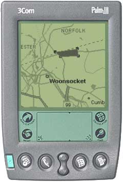
We now have our territory on the Palm, but it was a lot less easy than I had hoped.It would be nice to also have the attributes of our territory available so we would at least know who the Franchisee was.You can do this on a CE powered device and I'll do that next time.But, if you have a better way to do this on the Palm, I would be interested in hearing about it.
In the search for attributes, Katie found this map from the Lord of the Rings.The map is copyrighted by New Line Productions Inc.(http://www.lordoftherings.net)
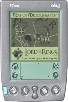
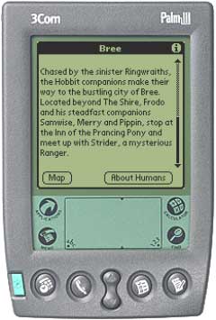
The neat thing about this map is that while it has attributes the compass works too.If
you click on one of the ![]() s, you get what happened at that part of the Middle Earth Map.For example, if you click on the point just to the right of Bree, this is what you see.
s, you get what happened at that part of the Middle Earth Map.For example, if you click on the point just to the right of Bree, this is what you see.
The point is, that technically we can have attributes and maps on our Palm or Visor, but they don't seem be available yet in one package or one that is as useful as it might be.Maybe like the map of Middle Earth, it just takes a little more wizardry.
Next time we'll put the GPS points into MapPoint 2002 and ArcPad and see what we can do with the IPAQ and Jornada.